The 614cast
Wednesday’s tl;dr
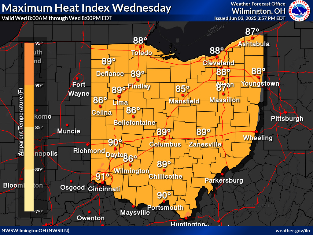
🌡️ Mostly sunny with a smidge of humidity, high in the upper 80s.
Forecast highlights
🌶️ Kinda hot, but it won’t last
Tuesday was the first 80-degree day in Columbus since May 16. We’ll easily do it again on Wednesday thanks to abundant sunshine and a southwest wind around 10–20 mph, sometimes gusting higher.
You might notice a bit more mugginess in the air on Tuesday as dew points get to the lower 60s. That’s not super sticky, though, so the heat index will hug pretty close to the actual temperature.
🌧️ Occasionally wet
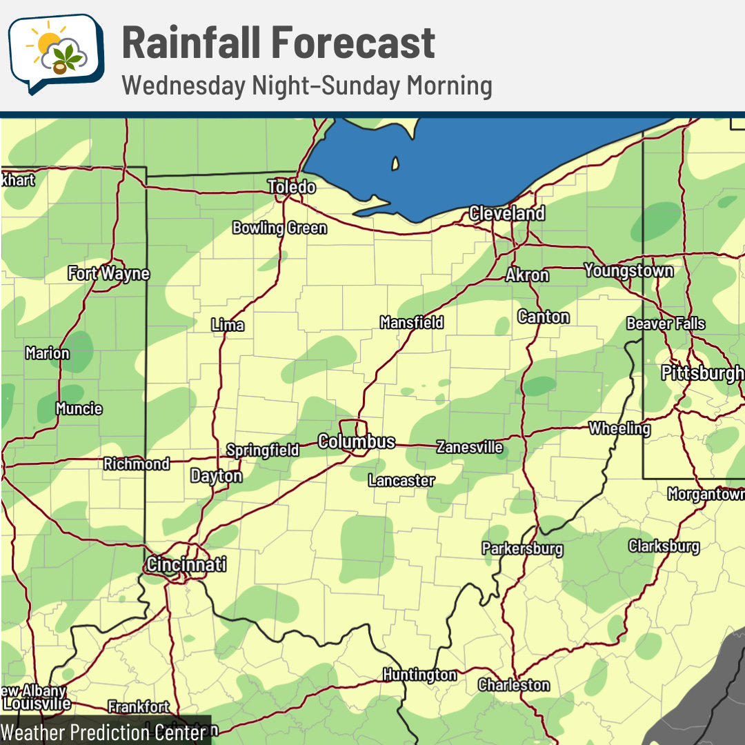
A weather system currently bringing rain and storms to the Midwest and Plains will head our way later this week, slowly trudging through Thursday and Friday. Our rain chances look to increase Thursday morning, then peak during the afternoon and evening. They’ll drop off a bit Thursday night, then increase again for the daytime Friday.
Areas in yellow-green in the map below are where at least a half-inch of rain is expected. The slightly darker green is where there’s a better shot at over an inch.
Severe weather remains unlikely here. The Storm Prediction Center is still including northwestern Ohio in its marginal risk (level 1 of 5) of gusty storms late Wednesday evening/night. Locally, we can plan on occasional run-of-the-mill thunderstorms to accompany the showers.
🔥 Canadian wildfires
After a brief break, central Ohio had slightly milky skies on Tuesday as wildfire smoke from the Canadian wildfires moved back overhead.
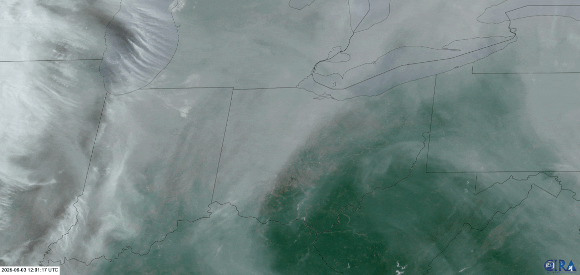
While the smoke remained high aloft here, areas closer to the wildfires were under air quality alerts as the smoke was thicker and closer to the ground.
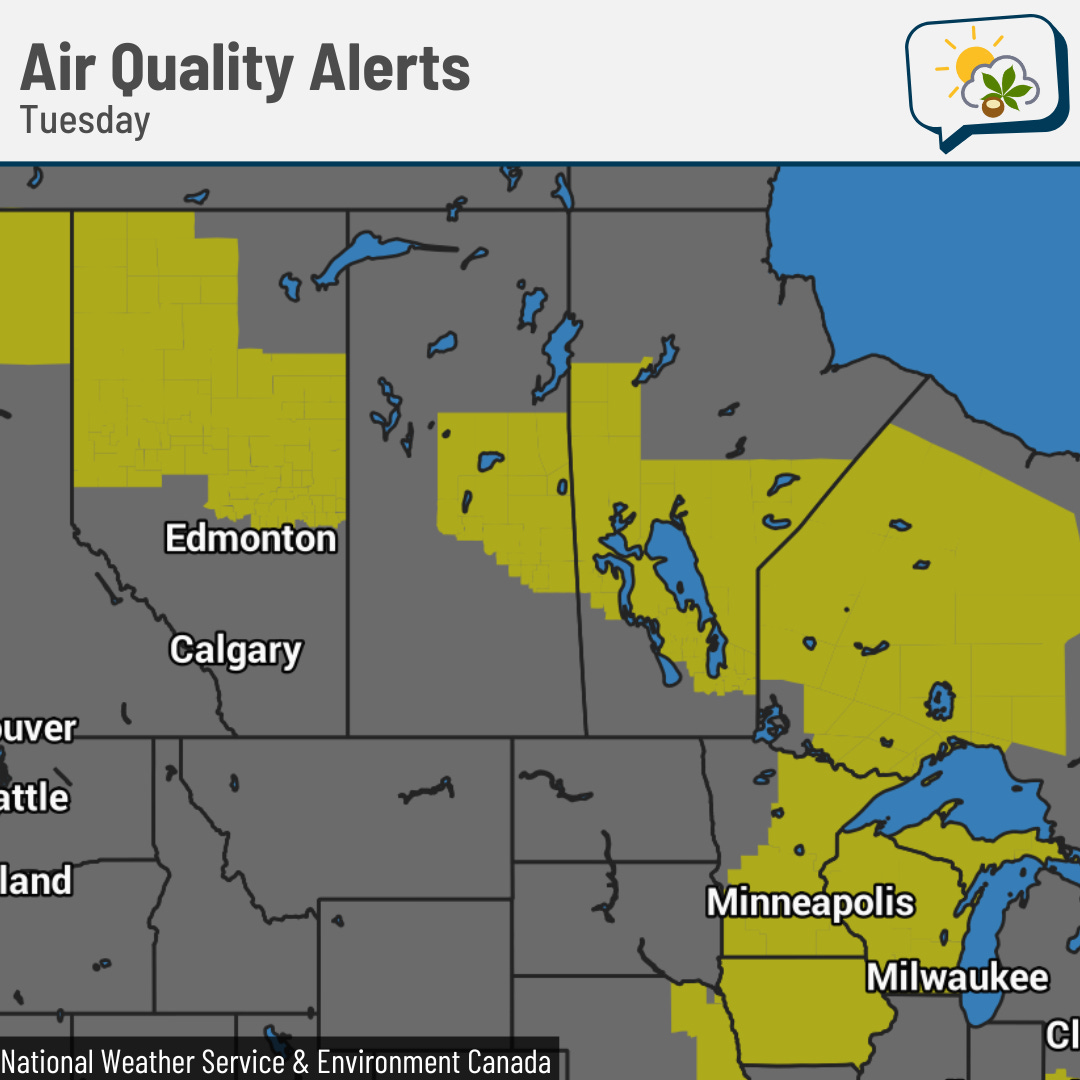
A small portion of the 25,000+ people in Canada’s Prairie provinces who were told to evacuate are being allowed to return home. Other communities are still very much on the knife edge.
Fire danger remained in the “extreme” category on Tuesday over a large area of Canada, which was not welcome news there.
