The 614cast
Thursday’s tl;dr
🌦️ Occasional scattered showers and storms, high in the lower 80s.
Forecast highlights
☔ Periods of rain, but not a washout
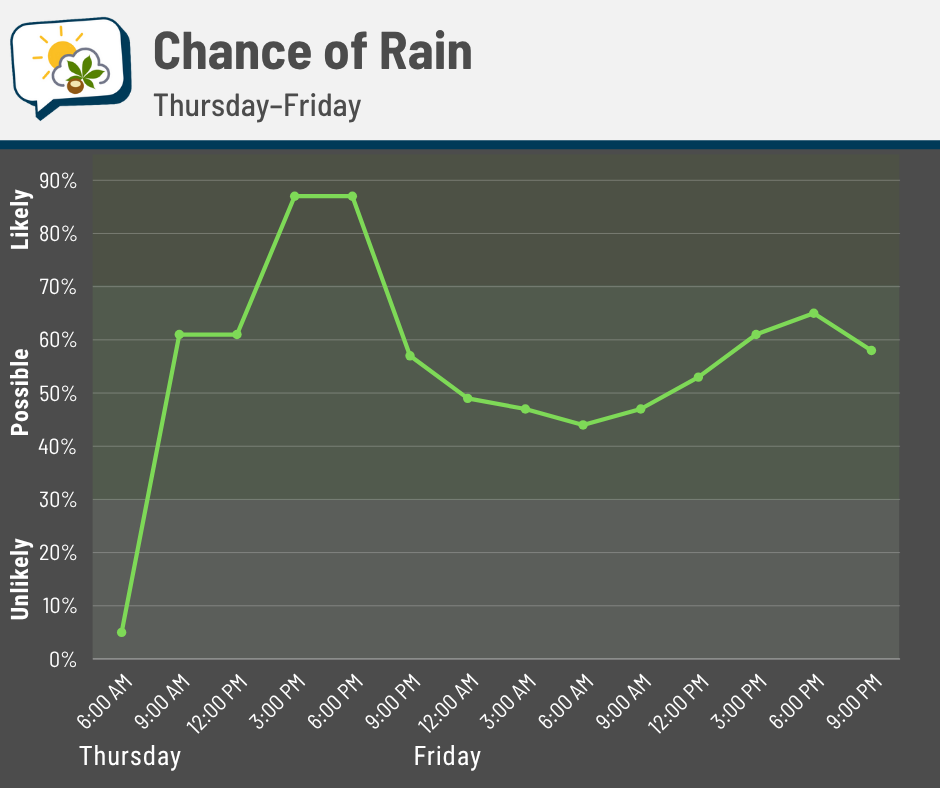
That slow-moving system to our west is almost here. You can see our rain chances pick up by midday Thursday and remain elevated during the afternoon and evening. It’s important to note that the activity will be scattered, so while there’s a higher likelihood of rain then, it’s one of those play-it-by-ear situations for exactly when your particular neighborhood will have rain.
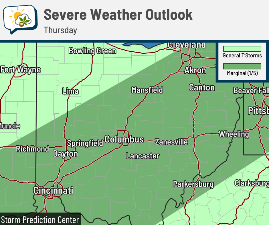
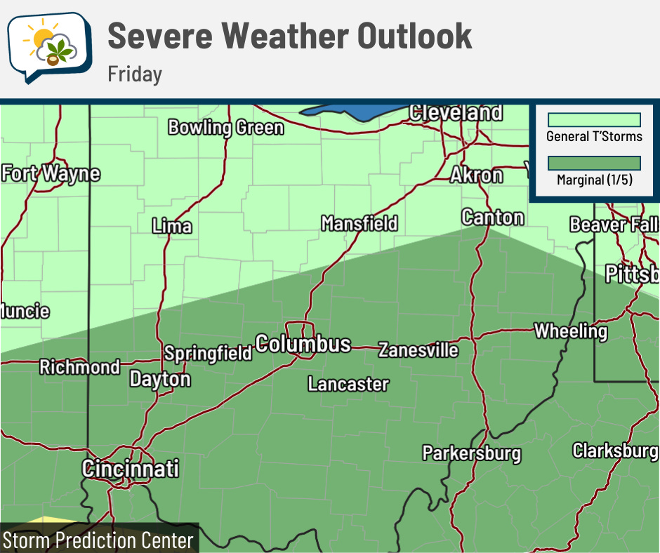
The severe threat’s still pretty low. The Storm Prediction Center now includes central Ohio in its marginal (level 1/5) risk of severe storms both Thursday and Friday. In the off-chance something gets rambunctious enough, it’d produce gusty winds. By and large, we’ll have garden variety thunderstorms — you’ll still need to be indoors until they pass, since lightning can easily cause injury.
Total rainfall amounts could still top an inch in spots, but I expect there to be quite a bit of variability because of the scattered nature of the rain/storms.
💤 Pretty normal for early June
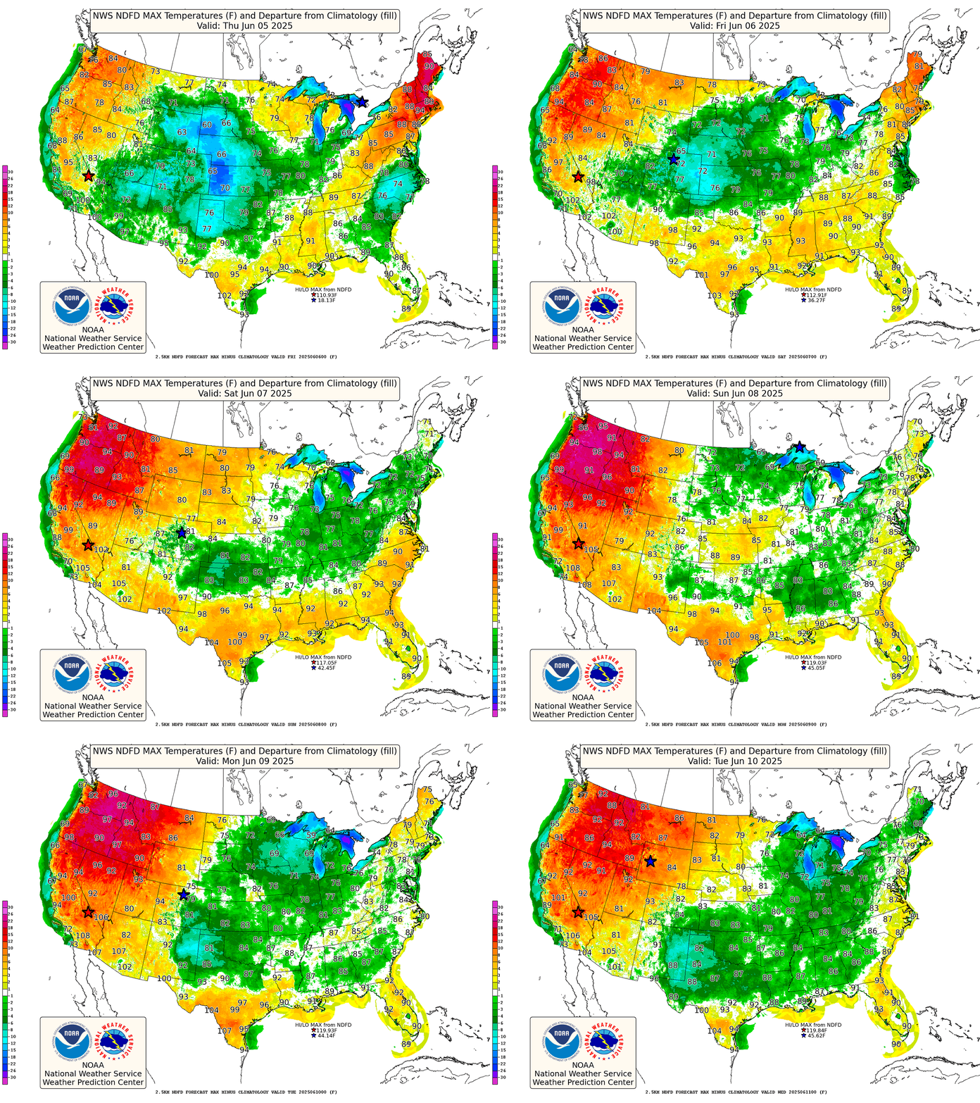
After a long stretch of below-average temperatures for the second half of May, followed by a couple of warmer days this week… highs over the next several days will actually be pretty ho-hum, run-of-the-mill stuff.
Highs won’t stray far from about 80 degrees, which is about our average high this time of year. Meanwhile, a good part of the West will be 15+ degrees above average, putting some cities in record-warmth territory.
📖 Weather Word Wednesday
Why not have a “Weather Word Wednesday,” since alliteration adds allure, aids attention, and amplifies appeal?
I’ll either use a term that’s related to recent weather happenings or pick a random term from the American Meteorological Society Glossary of Meteorology each week. I’ll admit that I’m going to curate from that source, since sometimes the random result can be a little too esoteric.
Anyway, without further ado, the first one up is:
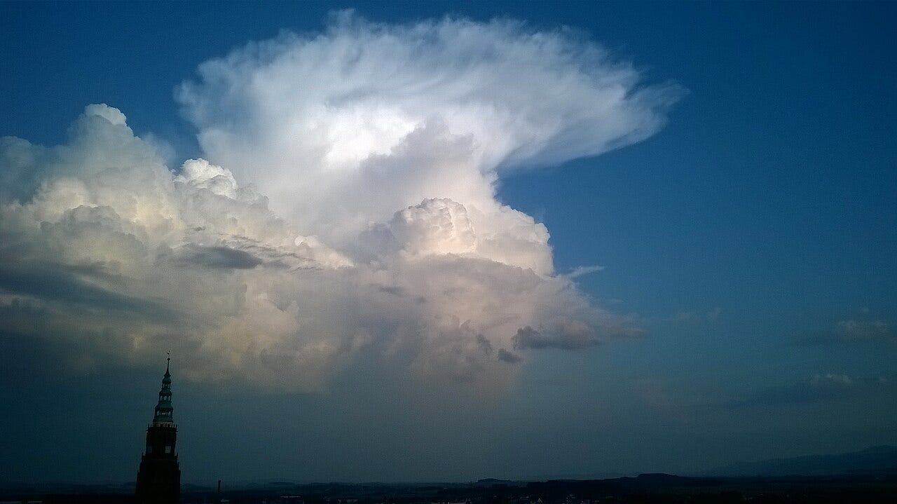
Cumulonimbus capillatus
Cumulonimbus capillatus is a form of cumulonimbus cloud that has dense cirrus clouds above it. As a result, the top of the cloud appears to have a mess of thick hair.


