Not everybody got in on downpours this past weekend, but those who won’t feel the need to water their garden for a while. A small chunk of eastern Franklin County even had a flash flood warning Saturday evening. You can see just how localized the heavier stuff was:

The 614cast
Monday tl;dr
🌦️ Spotty afternoon showers/storms, humid, high in the lower 80s.

Forecast highlights
☔ Intermittent rain could be locally heavy
Pinning down the details of this week’s rain is still a headache, but here’s how things look at this point.
Isolated showers/storms develop this afternoon and evening, lasting off-and-on into tonight. That continues into tomorrow, although the most widespread rain should be in southern Ohio. Chances taper tomorrow night into Wednesday morning before picking up again Wednesday afternoon and evening. Scattered activity sticks around until the cold front passes sometime Thursday.
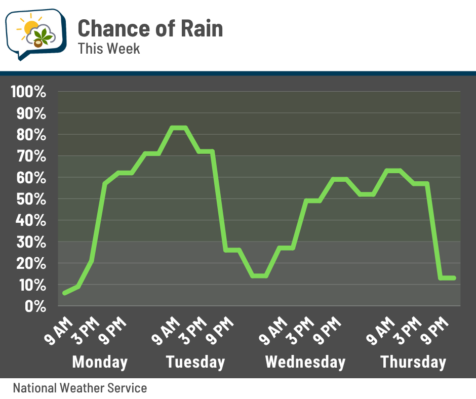
As we saw this weekend, any of this could produce locally heavy rain. There’s plenty of moisture around — not just near the ground, but through a good chunk of air above us, too. That means efficient rainfall producers.
Here’s a model blend of rainfall from the National Weather Service today through Thursday. It’s 6-hour amounts ending at the timestamp in the upper-right corner (so the first frame is rainfall from 8 a.m. to 2 p.m. Monday, then 2 p.m. to 8 p.m. Monday, and so on). This gives a broad sense of the when and where of the rain.
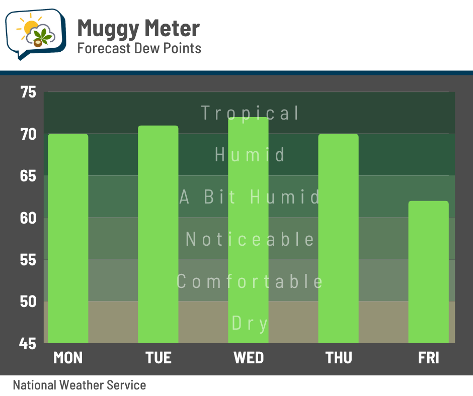
🦨 Stinky armpit weather
Kiiiinda feel like I’m on repeat here, but hey — this is one of the main stories this week. The humidity is going to be up there all the way through Thursday. Dew points should top out near 70, so be ready to sweat if you’ll be doing stuff outside. A cold front kicks through the region by Thursday evening, temporarily knocking back the mugginess.
📊 Today’s almanac
Normal low/high: 62 / 83
Record low/high: 43 (1969) / 96 (1957)
Sunrise/set: 6:02 a.m. / 9:03 p.m.
🥵 When do we have our muggiest weather?
We’ve dealt with the humidity the past few days (although not the heat, thankfully)… and that got me wondering: when do we typically have our muggiest weather?
Here’s a graph of the average highest daily dew point at CMH since 1945. In mid-June, having a dew point in the mid-60s is completely normal. We’re not quite to our climatological peak, though. That happens in mid to late July.
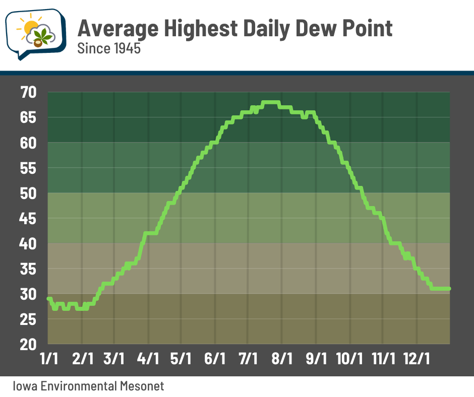
Since these are the average numbers, that means the daily values can go higher. It’s possible for dew points to push beyond 75, which feels absolutely miserable.
See more of the sticky-weather stats here. The default graph on that page displays the complete maximum dew point climatology, as well as the daily frequency of getting a dew point of at least 65 degrees.
🌭 Bonus weather weenie content
-
Alaska heat (Bluesky)
-
Rivers may fuel explosive strengthening of major hurricanes (The Weather Network)
-
Condor A320 operates 32-hour journey to nowhere, with five landings (One Mile at a Time)