The 614cast
Wednesday tl;dr
⚡ Partly cloudy with isolated showers/storms; more near or after sunset. High in the mid-80s.

Forecast highlights
⛈️ Tonight’s storms could be strong
The Storm Prediction Center bumped up our severe weather chances with the storms that come through late this evening into the overnight hours. There are still questions on the exact timing, but I expect things to happen here closer to sunset or after.
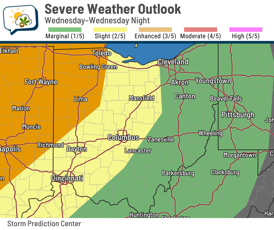
Gusty winds are still the main hazard, assuming things hold together enough. There’s an outside chance of hail or a brief tornado, but ingredients aren’t overly favorable for those here.
More broadly, we shouldn’t see much happening in central Ohio this morning and most of the afternoon. Isolated storms could pop up late today before the main line gets here, but our most likely storm timing comes roughly between about 8 p.m. and midnight.
A bit of shower activity could still linger into tomorrow, but most of the “oomph” to produce much will be passing to our east by midday. Whatever might hang around shouldn’t amount to much more than a nuisance.
🔥 Steamy weather ahead
This classic gif is how we’ll all feel next week.

We might hit 90 already on Saturday, but we should have no problem getting there Sunday through at least Tuesday and possibly a day or two longer. I expect to see a heat advisory get issued, perhaps as early as Sunday.
The NWS HeatRisk forecast (tap/click to make bigger) puts us in the “extreme” category on Monday, the furthest day out as of the time I write this.
Here’s what “extreme” means:
This level of rare and/or long-duration extreme heat with little to no overnight relief affects anyone without effective cooling and/or adequate hydration. Impacts likely in most health systems, heat-sensitive industries and infrastructure.
While the upcoming heat isn’t particularly rare, it will last for at least a few days, which means the issues compound. When it doesn’t cool down much at night, there’s just not a good chance to get relief.
HeatRisk takes into consideration:
-
How unusual the heat is for the time of year
-
Duration of the heat, including both daytime and nighttime temperatures
-
If those temperatures pose an elevated risk of heat-related impacts based on CDC data
Find out more nitty-gritty details about HeatRisk here.
📊 Today’s almanac
Normal low/high: 63 / 83
Record low/high: 47 (1986) / 99 (1944)
Sunrise/set: 6:03 a.m. / 9:03 p.m.
📖 Weather Word Wednesday
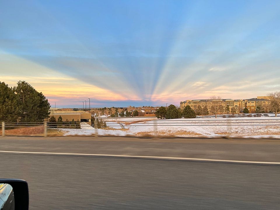
Anticrepuscular rays
If you’ve ever seen the sunbeams that shine through cloud breaks and stretch across the sky, most often seen at sunrise or sunset, you’ve seen crepuscular rays.
Anticrepuscular rays are similar, but appear opposite the sun.
🌭 Bonus weather weenie content
-
Tornado with a double rainbow (Bluesky)