The 614cast
Monday tl;dr
🌦️ Partly cloudy with “popcorn” storms again, high in the middle to upper 80s.

Forecast highlight
⚡ One more day of pop-up storms
Scattered storms have blossomed every afternoon and evening the past several days, and today will be no exception. Some spotty activity is possible in the morning, but the greater coverage will come in the PM.
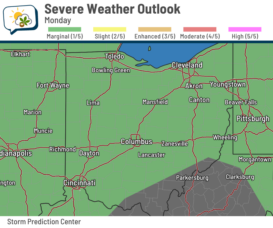
There’s an outside chance that a couple of them could produce gusty winds, so the Storm Prediction Center has us in a marginal risk (level 1/5) of severe storms. Storms won’t be overly organized, so the gusts would be from any storm that happens to be able to dump enough cool air from aloft with its heavy rain.
A rain chance lingers into Tuesday, but if we have anything, it should mostly be in the morning.
🌡️ Staying seasonably warm, but turning less humid
A cold front slides through Ohio early Tuesday… it won’t really knock back our temperatures, but you’ll notice a bit of change in the humidity.
Check out the dew point forecast below. Darker greens are higher dew points (muggier), while lighter greens are lower dew points. The streamlines are the winds, and you’ll see they swing around from the northwest on Tuesday, squashing the muggier air to our south.
Highs will be in the middle to upper 80s each day this week. Sure, that’s a little warm for the end of June into early July, but it sure beats the 90s.

📊 Today’s almanac
Normal low/high: 65 / 85
Record low/high: 47 (1988) / 99 (1901)
Sunrise/set: 6:06 a.m. / 9:04 p.m.
🔥 90-degree stats
Columbus had a run of seven straight 90-degree days last week, peaking at 94 on Tuesday. Afternoon storms managed to keep us just outside of record territory.
Since that heat wave is behind us, here are some 90-degree stats to tide you over until the next one…
-
Last streak of 7+ days: August 24–30, 2024
-
Longest streak: 14 days, from July 3–16, 1881
-
Most in a year: 49 days, in 1955 and 1936
-
Fewest in a year: 1 day, in 1992 and 1979
-
Earliest: April 25, 1915
-
Latest: October 15, 1897
🌭 Bonus weather weenie content
-
Department of Defense suddenly and unexpectedly terminates crucial hurricane forecast tool (Eye on the Tropics)
-
Scientists believe they detected a pulse from a long-dead satellite (Fox Weather)
-
Two Minnesota weather observers had a friendly competition during the epic 1996 cold wave; the second of them passed on June 21 (Northern News Now)