The 614cast
Thursday tl;dr
☀️ Lots of sunshine again with a very slight chance of a shower, high in the upper 80s.

Forecast highlights
🏊 Tropical-feeling weather continues its break
If you’re not like me, you’ll enjoy being at the pool anytime over the next four days. If you are like me, you’ll put on SPF 5,000 sunscreen (and wish you were somewhere else).

Highs reach the upper 80s today and touch or sneak just past 90 over the long holiday weekend. Because the mugginess isn’t ridiculous, though, the top heat index each afternoon will be relatively tolerable. It’ll max out in the mid-90s Saturday and Sunday.
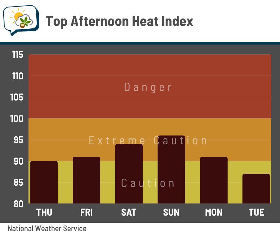
Even though those numbers are completely typical for early July, you’ll still need to be mindful of basic heat safety if you’re out. I know from experience it takes just one warm summer day in the sun without drinking enough water to make for a very miserable time (and haven’t made that mistake in the 20 years since).
🌧️ Mostly dry through early next week
A weak disturbance passing through today brings an ever-so-slight chance of a shower. It’s barely anything, but enough guidance suggests something could pop that it’s worth mentioning.
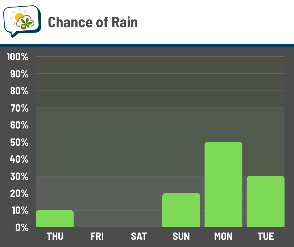
Rain chances remain virtually nil until later Sunday. Monday and maybe Tuesday are when we get the next bout of rain as a cold front pushes across Ohio. The potential for organized severe storms looks quite low at this time.
📊 Today’s almanac
Normal low/high: 65 / 85
Record low/high: 50 (1924) / 101 (1911)
Sunrise/set: 6:08 a.m. / 9:04 p.m.
⚡ Passing the peak of severe weather season
Severe weather can happen any time of year — but it certainly favors late spring and early summer here. Now that we’ve entered July, we’re wrapping up our primary severe weather season.
This climatology from the Storm Prediction Center shows how the odds of severe thunderstorms (hail 1” or larger, wind gust of 58 mph or stronger, and/or tornado) change from June through July.
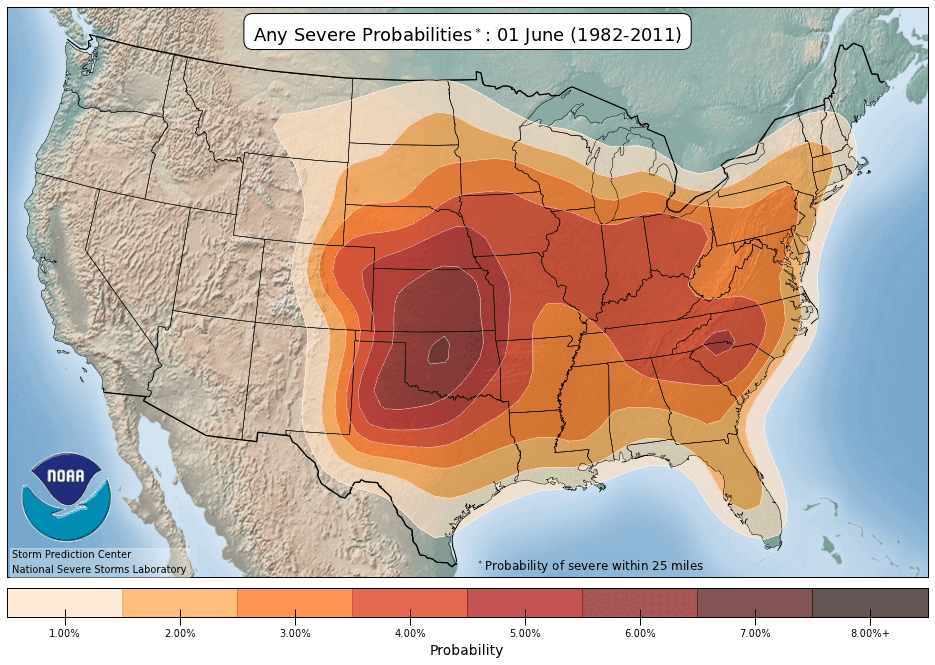
You can also see how the number of severe thunderstorm warnings issued in Ohio changes by week. The highest frequency is in the last week of June, gradually tapering off thereafter.

Tornado warnings peak earlier, maxing out the last week of May.

🌭 Bonus weather weenie content
-
Heat domes and flooding have nearly tripled since the ’50s (Penn Today)
-
NOAA proposes permanently closing premier hurricane research institute (Eye on the Tropics)