📺 Programming note: This newsletter will be on hiatus again next week. See you on the 14th!
The 614cast
Friday tl;dr
😎 Mostly sunny, high near 90.

Forecast highlights
🎆 Warm holiday weekend
First things first: No rain worries during fireworks.

The afternoon will be warm and somewhat humid (but not oppressive) with highs near 90. Temperatures slip through the 80s during the evening, with a 10 p.m. temperature near 80. Winds will be light from the south, so fireworks smoke may not clear very well.
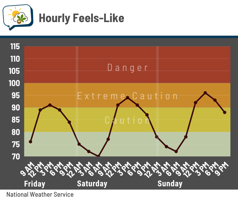
Heat indices will peak in the lower to middle 90s over the long weekend.
💧 Rain chance early next week
It looks like we’ll get through the weekend without dealing with rain — except maybe Sunday evening, but those chances look low right now. The better chance comes on Monday as a weather system pushes through the region. The European forecast model, which hasn’t waffled around, focuses the rain on Monday, followed by light/scattered showers possibly again on Tuesday.
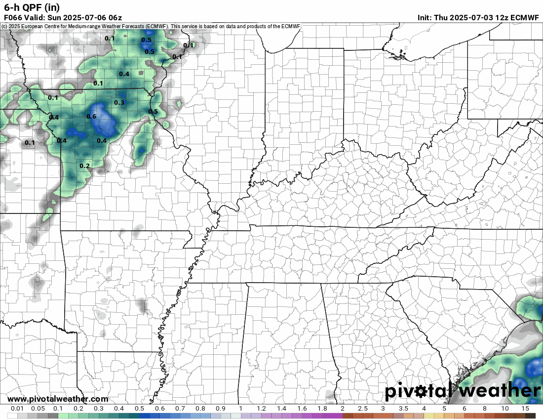
This same one brings a bit of a weather pattern change that knocks our highs back to more seasonable mid-80s and possibly allows for rain chances to pass through every few days. That’s a ways out, but a trend to watch.
📊 Today’s almanac
Normal low/high: 65 / 85
Record low/high: 47 (1968) / 104 (1911)
Sunrise/set: 6:08 a.m. / 9:03 p.m.
🎇 Independence Day weather history
-
Warmest high: 104 (1911)
-
Coolest high: 69 (1922, 1882)
-
Coolest low: 47 (1968)
-
Wettest: 1.38” (1984)
-
Years with at least 1/4” of rain: 22
-
Years with a high of at least 90: 38
-
Last year: 73 / 86 / trace of rain
🌭 Bonus weather weenie content
-
Trump’s science guidelines could amplify climate skeptics (Climatewire)
-
July Fourth’s stormy and weird weather: Hurricanes, derechos, tornadoes, even record cold (The Weather Channel)