The 614cast
Thursday tl;dr
⛅ Partly cloudy, showers/storms possible in the afternoon. High in the middle to upper 80s.

Forecast highlights
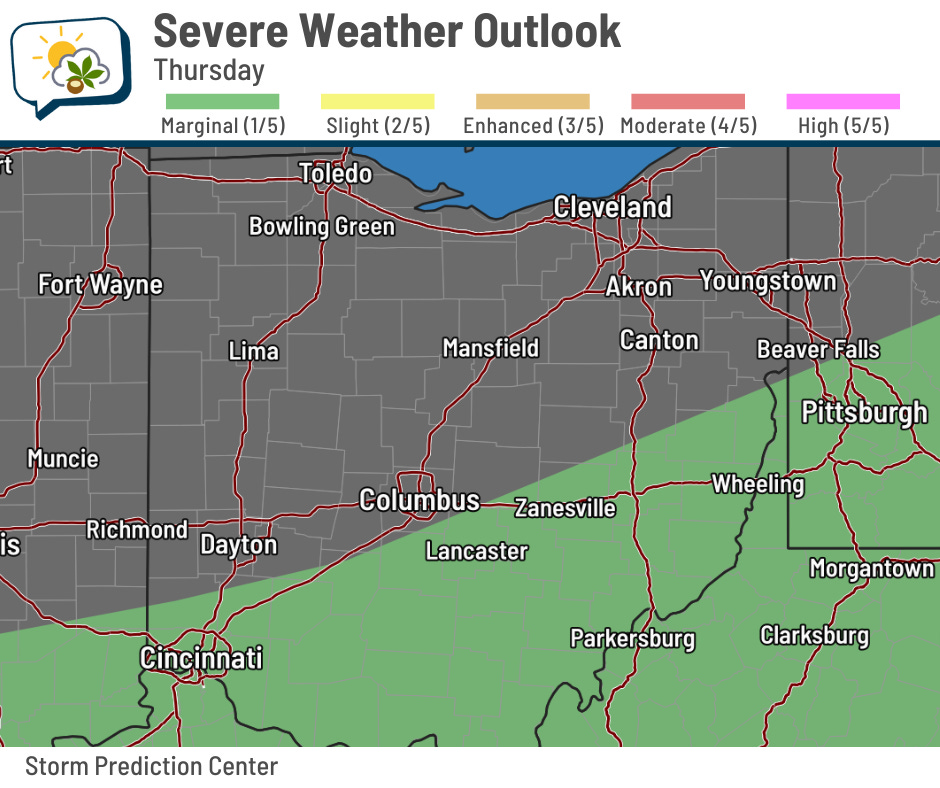
☔ Still a storm chance with locally heavy rain
It appears the majority of the storm activity the next couple of days, especially tomorrow, will favor southern Ohio. That said, we could still have some around this afternoon and evening. Some guidance suggests the I-70 corridor might right about where stuff fires up this afternoon, although I wouldn’t be surprised if it hedges a bit farther south.
Whatever happens has the potential for local downpours yet again. The low-end threat of strong wind gusts should be primarily south of our area.
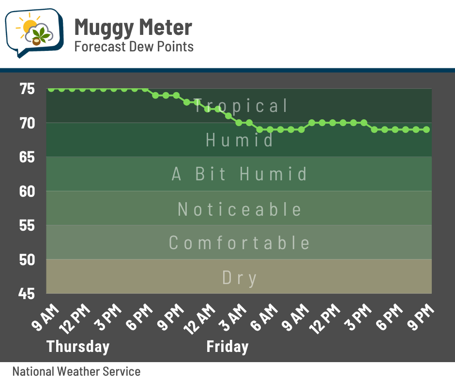
The cold front that temporarily pushes away most of the storminess also brings in slightly less gross air Friday morning. It’s not much, but at this point, we’ll take what we can get.
🔁 On repeat: Warm, wet pattern expected to stay put
While there are signs we’ll have seasonable highs in the mid-80s Friday through Monday — and perhaps more tolerable mugginess on Monday! — the warm and unsettled weather pattern ought to pick right back up next week.
Check out the Climate Prediction Center’s temperature outlook for next week:
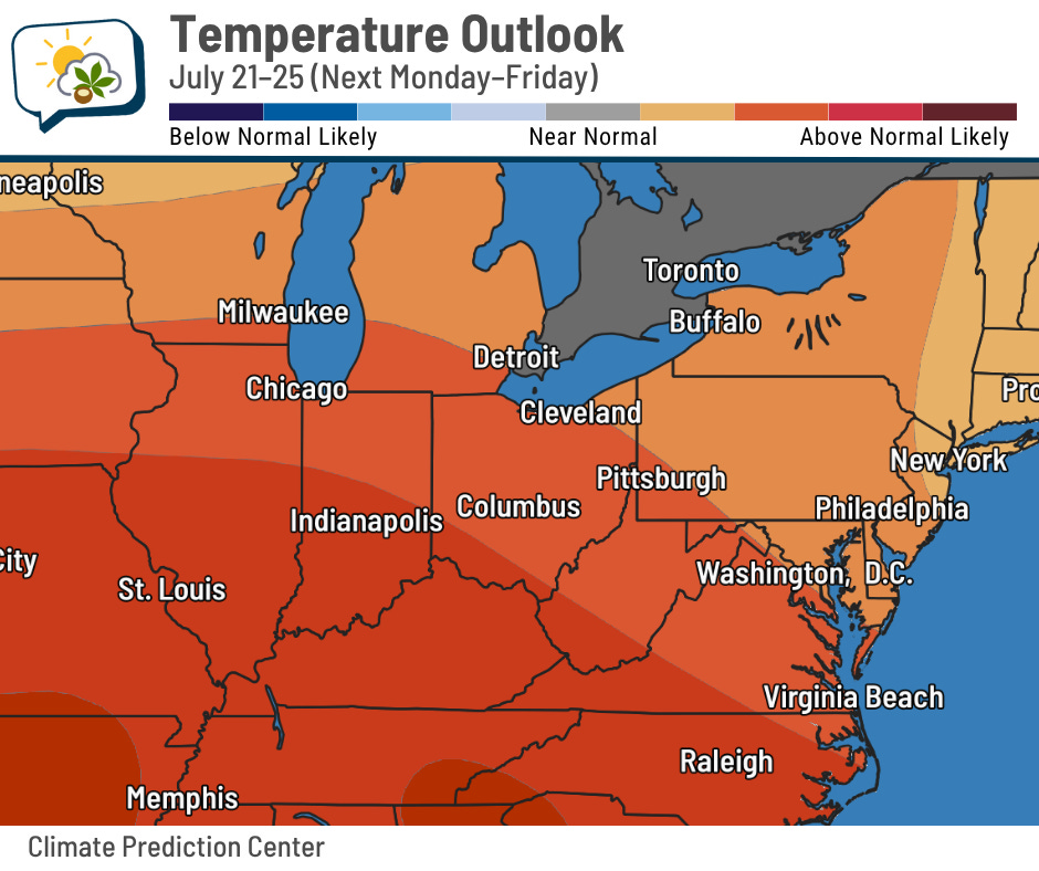
Ohio is certainly favored to have above-average highs (average is mid-80s). We’ll probably see highs go back near or above 90 most of next week, along with heat indices eventually pushing 100.
Here’s the rainfall outlook:
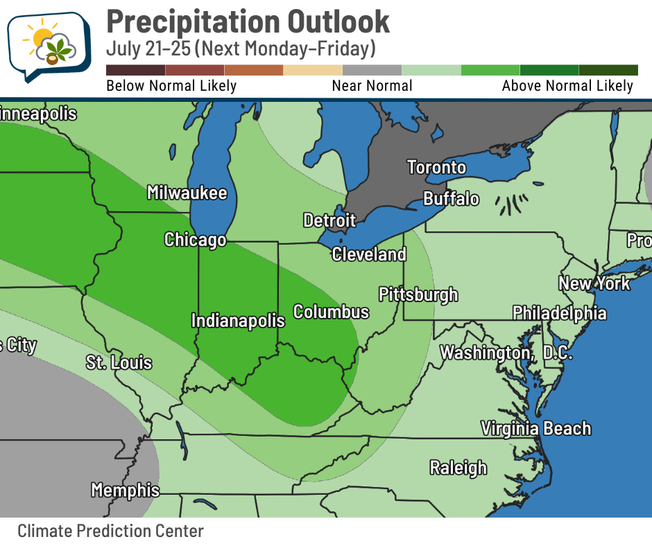
Again, a good share of Ohio is favored to have above-average rainfall. This one, though, isn’t necessarily a slam-dunk. We’re on the edge of a ridge of high pressure, which is an area that storm complexes tend to follow. Precisely where they go is in the details, and that’s just not knowable this far in advance… but the general pattern looks to support us being in or near the zone where occasional bouts of storms will happen.
📊 Today’s almanac
Normal low/high: 66 / 86
Record low/high: 52 (1896) / 100 (1887)
Sunrise/set: 6:17 a.m. / 8:58 p.m.
📝 Checking in on the summer so far
I’ve shared some tidbits recently about how warm and humid it’s been this summer. And now that we’re halfway through climatological summer (June 1–August 31), I thought I’d run down some of the numbers. Everything is through July 15, including rankings.
-
Average temperature: 76.2°, 3.1° above normal (tied for 5th warmest)
-
Average high: 85.5°, 2.2° above normal (22nd warmest)
-
Average low: 66.8°, 4.0° above normal (2nd warmest)
-
Rainfall: 8.06”, 1.41” above normal (25th wettest)
-
Warmest high: 95° on June 24
-
Coolest low: 44° on June 1 and 2
-
Warmest heat index: 100° on June 24
-
Number of 90-degree highs: 13
-
Number of 70-degree lows: 20 (most)
-
Hours with a dew point of 70°+: 313 (3rd most)
Data are from NOAA Regional Climate Centers and the Iowa Environmental Mesonet.
🌭 Bonus weather weenie content
-
Congressional committees reject deep NOAA cuts proposed by Trump administration (Eye on the Tropics)
-
It’s been a stormy and steamy summer across the U.S. so far in 2025 (DAMWeather)