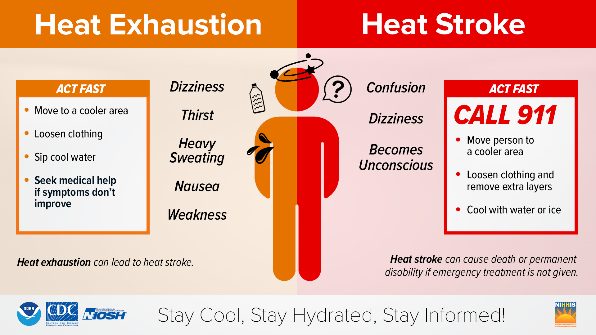
⚠️ A Heat Advisory runs from midday through this evening for an elevated risk of heat-related illness.
The 614cast
Today’s tl;dr
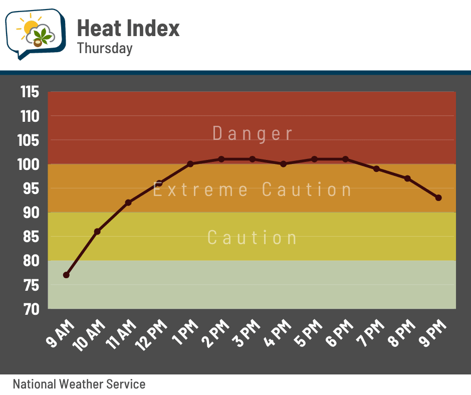
🌤️ Mostly sunny and more humid, high in the lower 90s with a heat index maxing out near 100.
Forecast highlights
💦 Warm, humid weather is here again
The soupy air has taken a bit longer to return, not that I’m complaining. But it’s back today and comes with highs in the lower 90s, which is five-ish degrees warmer than we had yesterday. That’ll push heat indices up near 100 this afternoon through early evening. A gentle breeze around 10 mph might help a little bit, but not much.
While the dew points won’t be any better Friday into the weekend, actual temperatures will be a few degrees lower, keeping afternoon heat indices in the 90s. That’ll probably be the case the first half of next week, too, before cooler and drier air pushes in.
⛈️ Downpours could accompany upcoming rain
After a little string of dry days (a rarity this summer), the plants wouldn’t mind a little drink of water. We’re still on track for periods of rain and storms mainly Friday and Saturday, followed by lower chances on Sunday.
It’s not just here at the ground that we have gobs of moisture. There’s plenty of it aloft, too. Below is an animation of “precipitable water,” which is the amount of water you’d get if all the moisture above a given spot were to condense and fall as rain. (It’s also a term some meteorologist absolutely chose without actually saying it aloud, because it’s a tongue-twister.) Blue-purple is quite a bit of moisture, and the pink-purple is a lot.
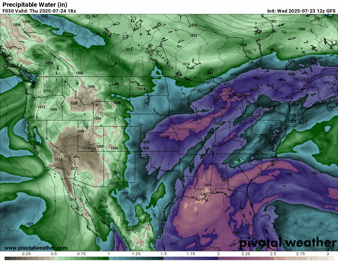
It’s not a rainfall forecast per se, since there are a bunch of factors that determine that. But anything over 2” (the pink-purple on this map) is a sign that, if storms form, they could be very efficient rain producers.
Notice that the big moisture gets scoured out of Ohio toward the end of the loop… that’s part of why I see Sunday’s rain chance trending downward compared to yesterday.
📊 Today’s almanac
Normal low/high: 66 / 85
Record low/high: 53 (1985) / 102 (1934)
Sunrise/set: 6:23 a.m. / 8:52 p.m.
🐦 The early bird gets the worm
Check out this radar loop from Louisville, Kentucky yesterday morning.
Uhhh… what? Was there an explosion?
Nope, it was just birds. (Assuming birds are real, that is. 🤣)
These radar signatures are called “roost rings.” Some types of birds tend to congregate in large numbers at nesting sites. Just before sunrise, they take off, flying in all directions to find bugs for breakfast. That’s why we see an expanding donut shape.
Why does the ring disappear, though? We’re looking at the lowest angle of the radar beam, and the birds will eventually fly above or below that beam, disappearing from view.
The closest radar to Columbus, located near Wilmington, also had roost rings yesterday morning. They just weren’t as pronounced this time. The National Weather Service office in Wilmington has a nice write-up on local roost rings and which birds mostly likely cause them.
🌭 Bonus weather weenie content
-
Alum Creek dam proposed 3 years before 1959 flooding that led officials to reconsider project (Columbus Dispatch)
-
Will we solve the climate problem? (People I [Mostly] Admire podcast)