Woof, so much for my thought that Sunday would be relatively quiet with the bulk of storms staying south. Yes, the majority of the heavy rain in the area fell on Saturday, but yesterday didn’t go as planned. Anyway, here’s how much rain we got over the past few days:
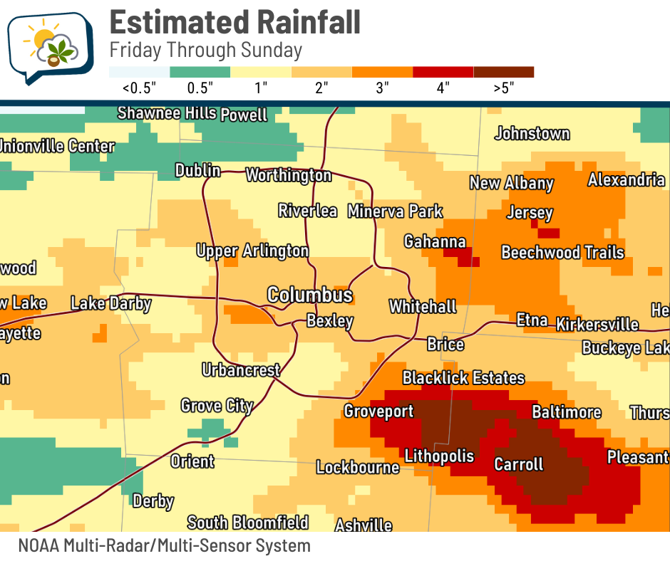
Far southeastern Franklin County into Fairfield County had amounts over four inches, causing flash flooding and road closures.
The 614cast
Today’s tl;dr
⛅ Areas of fog early, then partly cloudy with isolated showers/storms. High near 90.

Forecast highlights
🌂 Rain backs off for a couple of days
After several rounds of storms, we’ll have a lull in the action to start the new workweek. Yes, isolated showers/storms are possible today (and to a lesser extent tomorrow), but the coverage and amounts will be quite a bit lower than they have been the past few days.
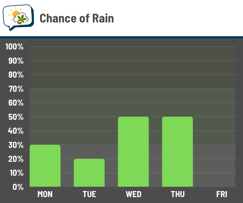
As a cold front approaches in the middle of the week, our opportunity for rain goes back up. Locally heavy rain will be possible again on Wednesday.
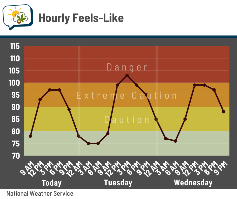
🥵 Still warm and humid… for now
We’ll end up near 90 this afternoon and maybe a few degrees above that tomorrow and Wednesday. And stop me if you’ve heard this one before, but it’s still muggy! That’ll shove the heat index well into the 90s the next three days, probably pushing 100 tomorrow.
Here’s your reminder of heat-related illness symptoms and what to do:

🥳 Relief is still coming!
I’ll write more about this tomorrow, but the cold front that slides through later this week brings a very welcome change in the weather pattern. It’ll knock back the heat and humidity not just for a couple of days, but likely into early next week.
📊 Today’s almanac
Normal low/high: 65 / 85
Record low/high: 50 (1962) / 100 (1952)
Sunrise/set: 6:27 a.m. / 8:49 p.m.
🌵 A far cry from last summer
Here’s what the Drought Monitor looked like in Ohio around this time last summer.

Drought conditions were expanding and worsening by the week as we struggled to get appreciable rain.
This summer has been a different story… mostly. Here’s the rainfall departure since the start of June:

The southern half of Ohio (plus up around Lake Erie) have been relatively wet this summer. Columbus is officially a couple inches above average for rainfall. Some places south of the city have gotten at least four inches more than what’s normal through this point of summer.
But I was surprised to see relative dryness covering much of the state roughly north of I-70. While a fair amount of that zone is within an inch of normal — no biggie — some areas are a few inches short of average.
Fortunately, the most recent Drought Monitor shows there’s been limited impact in the state so far, except for a sliver in the far northwest.

We’ll see how things evolve there over the next few weeks. But for the Columbus area, we do not need to worry about drought becoming a problem like we were at this time last year.
🌭 Bonus weather weenie content
-
Tampa hits 100 degrees for the first time in recorded history (Forbes)
-
Volunteers repair damaged parts of Appalachian Trail by hand almost a year after Helene (Associated Press)