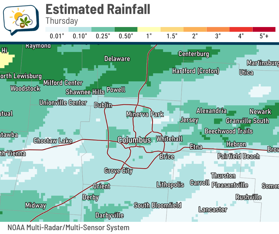
🏃➡️ Catch up: Much of the metro picked up around a quarter-inch or less of rain yesterday, although parts of Delaware County logged over a half-inch.
The 614cast
Today’s tl;dr
🌤️ Mostly sunny and pleasant. Breezy at times with a high in the upper 70s to around 80.

Forecast highlights
👍 Feeling good
The last time Columbus had a low below 60 was June 11. As of yesterday, that was 50 straight days, tied for 7th longest streak above 60. This morning will be a photo finish for dipping below that mark… if the streak doesn’t end today, I expect it to end tomorrow, putting us in 6th place.
All this to say, we finally have more pleasant weather, and we certainly have earned it.

If you spent any time outside yesterday, you almost certainly noticed it was less humid. It’ll be even better today, lasting through the weekend. Add in a northeast breeze in this weather feels especially wonderful.
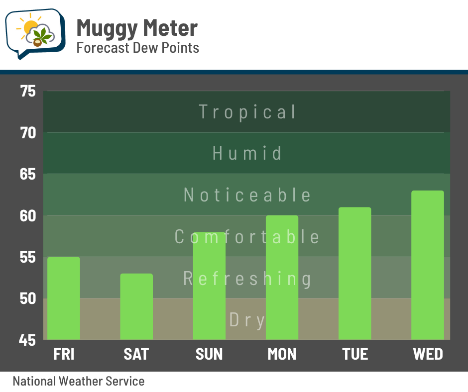
Even through the first half of next week, rising dew points only make it to the lower 60s. That’s still lower than what we had yesterday afternoon!
And temperatures will be quite fine, as well.
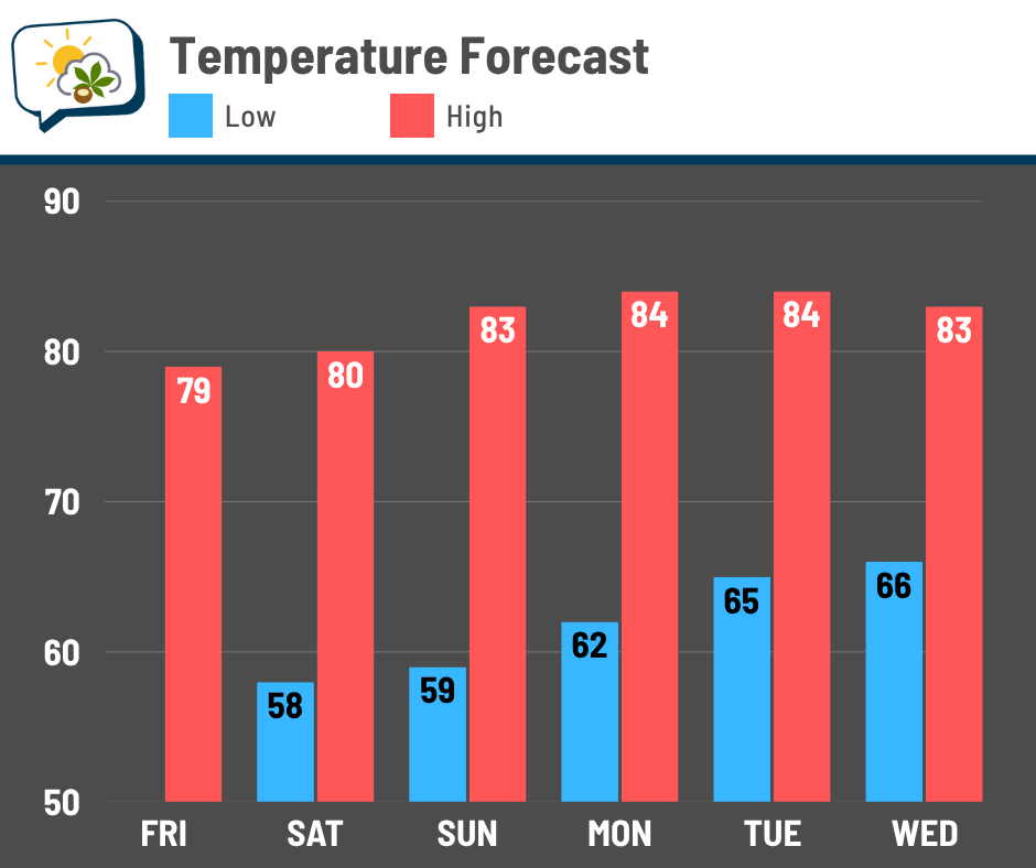
We ought to dip into the upper 50s during the mornings this weekend before going back to the 60s next week. Highs will be a bit below average the next couple of days before creeping up again, but these numbers are totally seasonable for the beginning of August.
The warmth that looked like it would nudge into the Ohio Valley the middle of next week now is trending to the end of next week. The core of the heat should be well to our west, though.
💧 Dry pattern sets in
The reason for this pleasant weather pattern is an area of Canadian high pressure settling into the Great Lakes and then the Northeast. That’s keeping not just the heat and humidity at bay, but also any weather systems.
The Weather Prediction Center’s rainfall outlook keeps much of Ohio with limited rain through (at least) next Tuesday.
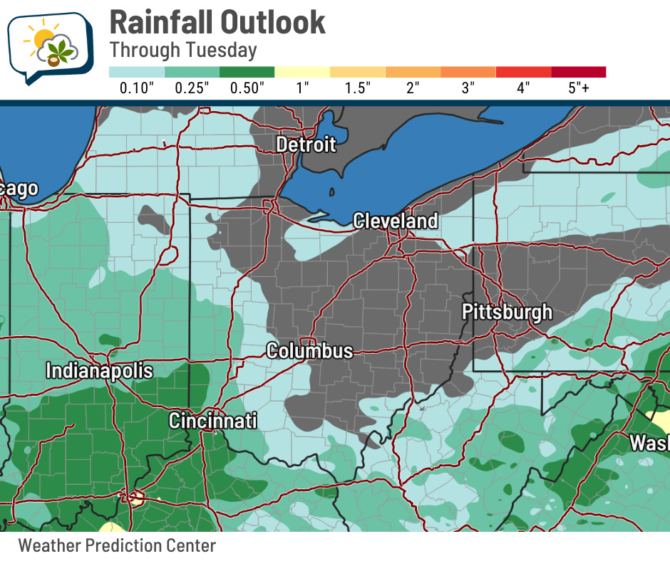
There are signs of a couple of disturbances trying to bring showers to the area Tuesday or thereafter. Until then, we are dry… and the high pressure might still have enough control to limit the amount of moisture that returns early next week.
📊 Today’s almanac
Normal low/high: 65 / 85
Record low/high: 48 (1952) / 97 (1955)
Sunrise/set: 6:30 a.m. / 8:45 p.m.
🕶️ August outlook
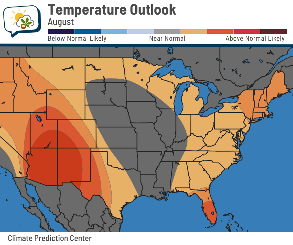
NOAA’s Climate Prediction Center issued its final outlook for August yesterday. Here in Ohio, they say the odds lean a bit toward having a warmer-than-average month. It’s not a super strong signal like there is in the southwestern U.S.
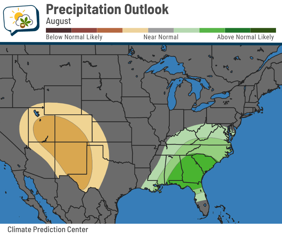
On the precipitation side, only far southern Ohio has odds that slightly lean toward above-normal rainfall. Locally, we have virtually equal chances of going either direction (or being near normal).
If you’re really into breaking down the odds, here’s how they shake out for Columbus itself.
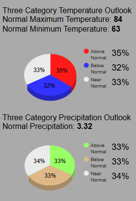
As you can see, the odds for above-normal temperatures barely edge out the others.
🌭 Bonus weather weenie content
-
WMO certifies megaflash lightning record in USA (World Meteorological Organization)
-
Animation of July 29 tsunami propagation (NOAA/Bluesky)