🤓 Nerd stats: Columbus just had three days in the 70s from Thursday to Saturday — the first such streak since June 7–10. And the three lows cooler than 60 were the first since the very beginning of June, a full two months ago.
The 614cast
Today’s tl;dr
🌤️ Mostly sunny, high in the lower 80s.

Forecast highlights
🌻 Seasonably summer-feeling
We won’t be constantly sweating this week like we were for… I guess almost all of last month?
The delightfully dry weather of the past few days basically sticks around for the next few. Dew points come up a little, but it’s not until later in the week that they’ll actually be a bit more noticeable.
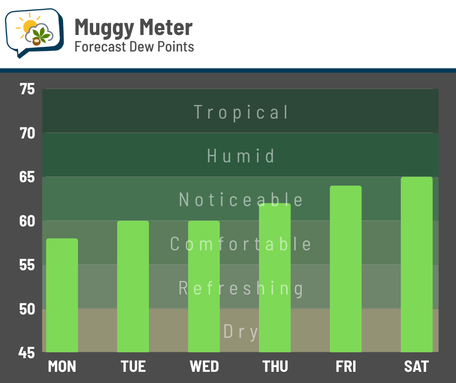
Those are still be a far cry from the tropical 70s dew points we endured many days last month.
Highs will also be in the lower to eventually middle 80s this week, which is right about normal.
☀️ Overall dry week
High clouds this afternoon may be mixed with high-up Canadian wildfire smoke as it drifts across the state. It’ll remain far aloft and not affect air quality.
Without much moisture return, the weak disturbances crossing the region in the coming days won’t do much. We have a low-end chance of showers Tuesday and Wednesday, but I don’t expect much locally, if we get anything at all.
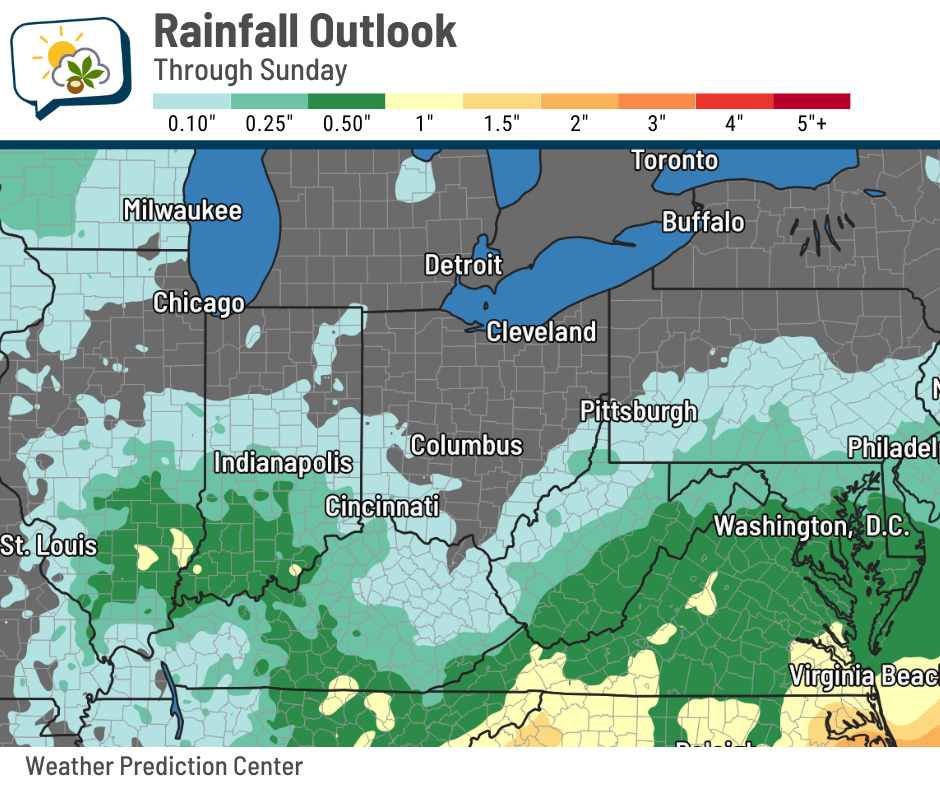
Indeed, you can see the bulk of the rain should bypass us over the next week. While it won’t be blazingly hot during this dry spell, the plants will still need watering.

📊 Today’s almanac
Normal low/high: 65 / 85
Record low/high: 49 (1950) / 99 (1955)
Sunrise/set: 6:33 a.m. / 8:41 p.m.
🏊 July in review
Last month was warmer than average.

Yeah, definitely not breaking news there.
Here are the basics for the month:
-
Average high: 86.9 (1.5° above normal)
-
Average low: 69.6 (4.2° above normal) — 4th warmest on record
-
Average temperature: 78.3 (2.9° above normal) — tie for 16th warmest
-
Rainfall: 4.66” (0.01” below normal)
The superlatives:
-
Warmest high: 93 on the 14th and 30th
-
Coolest high: 76 on the 18th
-
Warmest low: 75 on the 16th
-
Coolest low: 62 on the 22nd and 23rd — 4th warmest July minimum on record
-
Highest heat index: 100 on the 26th
-
Highest dew point: 77 on the 27th
-
Lowest dew point: 59 on the 22nd
-
Greatest 24-hour rainfall: 1.59” from the 26th to 27th
And a few other numbers…
-
Days of 90+ highs: 10
-
Days of 70+ lows: 18 — 3rd most on record
-
Days with 0.01”+ rainfall: 14 — tie for 4th most
-
Days with 0.25”+ rainfall: 9 — tie for 3rd most
🌭 Bonus weather weenie content
Today, I’d like to highlight a three-part series by Houston meteorologist Elyse Smith:
-
A first look at the next generation of weather radar technology (ABC13 Houston)
-
How history shaped the next generation weather radar being developed in Tornado Alley (ABC13 Houston)
-
The timeline and future of phased array radar technology (ABC13 Houston)