The 614cast
Today’s tl;dr
🌤️ Partly to mostly sunny with a slight chance of a shower, high in the middle 80s.

Forecast highlights
😴 This week is a snooze-fest
We have a small chance of an isolated shower today, and that’s about the most exciting thing happening.
As I noted yesterday, the weak disturbance pushing through just doesn’t have much “oomph” or moisture… the weather pattern is dominated by a large ridge of high pressure.
With that in mind, let’s dip our toes into some weather nerdiness today, shall we?
The map below is an “ensemble” forecast — basically, a bunch of forecasts put together into an average. “Two heads are better than one,” as the saying goes… but in this case, it’s about 50 heads.
We’re looking at the situation halfway up the atmosphere, about 3.6 miles above sea level. Here, we can see broad “ridges” and “troughs.” In the Northern Hemisphere, ridges are where the air curves northward, while troughs are dips southward.
Ridges are anchored by high pressure; literally, the air is heavier there, so the air sinks. Troughs are associated with lower pressure; the air is lighter and rises. High pressure and ridges often come with dry weather, while low pressure and troughs typically bring unsettled weather.
You see a bunch of orange and red on the animated map, which indicates the ridging is stronger than average for this time of year. Over the next week, a ridge will be pretty much parked over the Southwest, causing them to roast under extreme heat (even by their standards).
However, it’s pretty sprawling, which is keeping active weather at bay here in the Ohio Valley. Another developing ridge near the Southeast is also in play, helping our temperatures and humidity rise into the weekend.
There are signs that the general ridging pattern should break down next week, although there’s disagreement on when and to what extent.
For now, highs in the mid-80s look common throughout the workweek, perhaps nudging to the upper 80s this weekend. Again, those warmer temperatures will be accompanied by a return to somewhat muggier air.
📊 Today’s almanac
Normal low/high: 65 / 85
Record low/high: 46 (1951) / 103 (1918)
Sunrise/set: 6:34 a.m. / 8:40 p.m.
🌀 Is hurricane season off to a slow start?
Tropical Storm Dexter formed Monday night in the open water between North Carolina and Bermuda. It’s headed northeast and is forecast to become post-tropical later this week.

If you know that tropical systems are named alphabetically but haven’t followed the tropics closely, you might be wondering how we’re at “D.” What about the first three? And don’t we usually have more storms by now?
Andrea, Barry, and Chantal were short-lived systems in late June through early July. Chantal was the strongest of the three, peaking at 60 mph estimated sustained winds and making landfall in South Carolina early July 6.
Here are the average formation dates for the first five tropical storms, from NOAA’s National Hurricane Center.
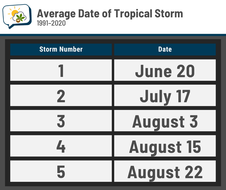
We’re running a little ahead of schedule, actually. Of course, there’s a lot of year-to-year variability. In the record-breakingly hyperactive 2020 hurricane season, we already had nine named storms under our belt at this point!
The number of storms typically ramps up in August, peaking in September.
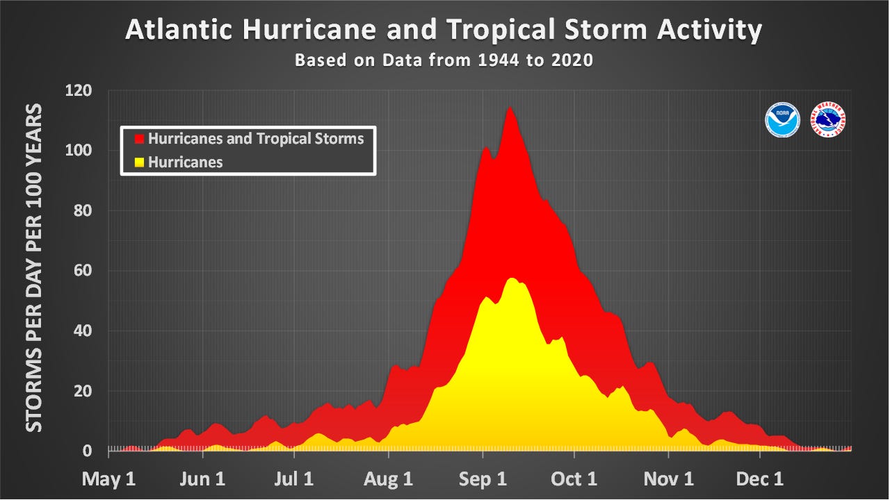
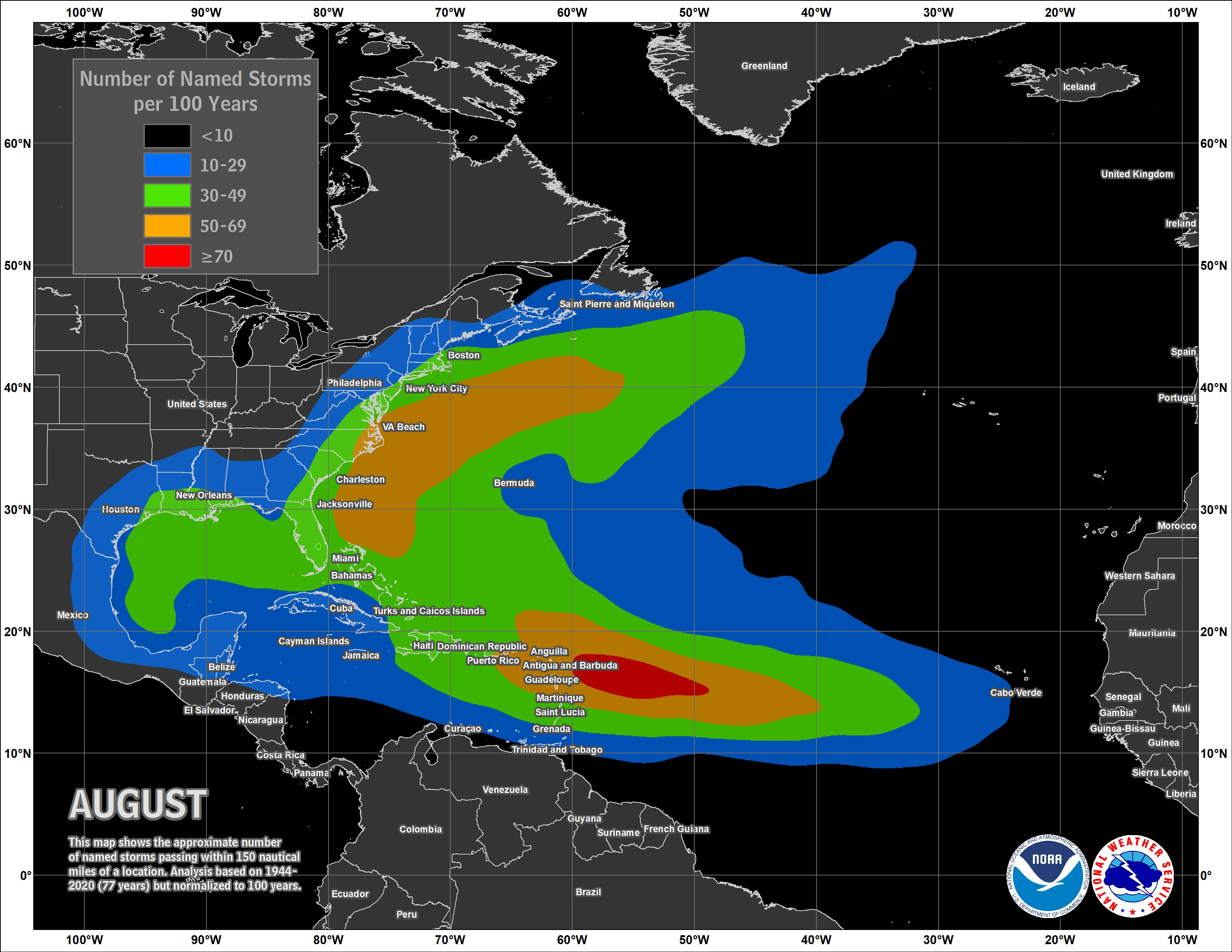
In the first couple months of the season, storms typically form in the Gulf of Mexico or off the East Coast. In August, though, they’re increasingly born farther out in the Atlantic.
🌭 For the weather weenies
-
Cruz introduces weather radio modernization bill with a new focus on flood communications (The Texas Tribune)
-
A fish falls from the sky and sparks a brush fire in British Columbia (The New York Times)
-
Bipartisan support picks up for a natural disaster review board (NBC News)