The 614cast
Today’s tl;dr
🌦️ Partly to mostly sunny, high near 90. Maybe an isolated shower/storm.

Forecast highlights
☔ It might actually rain soon?
Okay, so the odds today aren’t great, but a stray shower or storm could develop later on. The better chance comes tonight into Wednesday as a disturbance moves through the region.
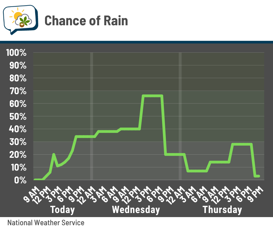
Chances dwindle again on Thursday, aside from an isolated pop-up possibly getting going in the afternoon.
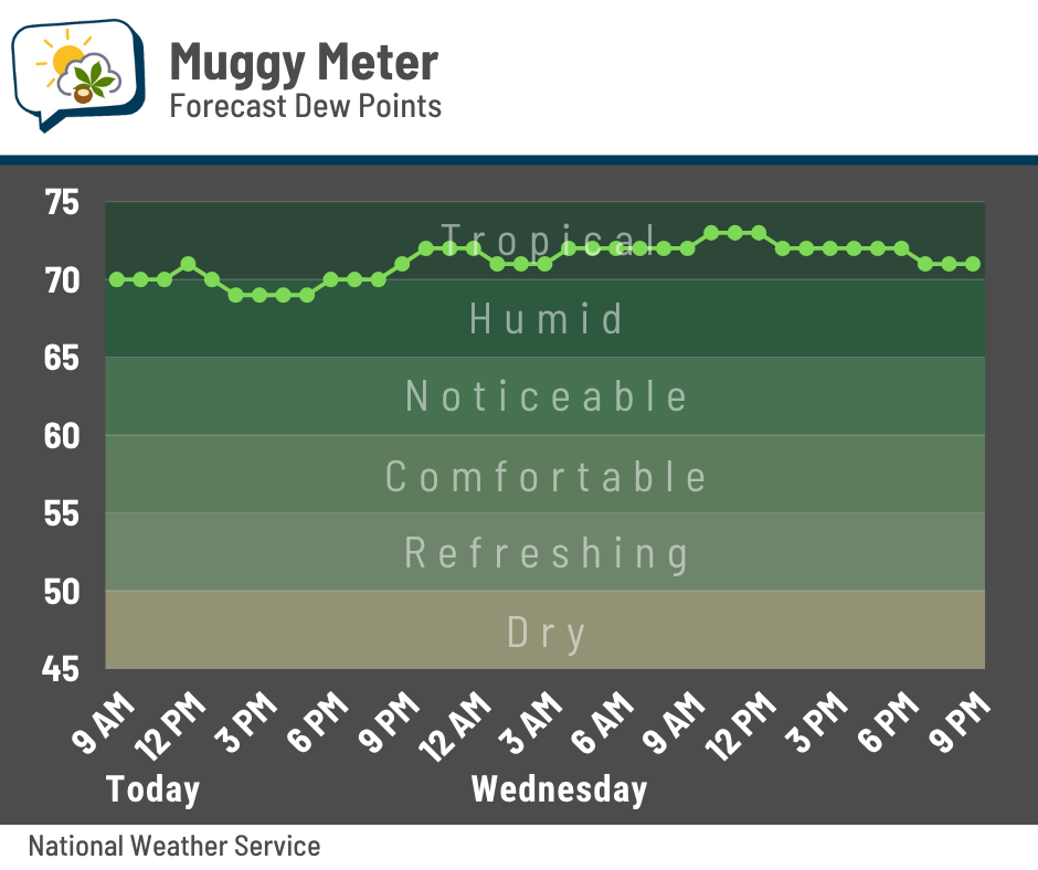
Moisture will increase somewhat ahead of this cold front, which means dew points will probably hover somewhere in the neighborhood of 70 the next couple of days. That’s the muggiest we’ve been since the end of July.
With more humid air in place and not much wind aloft, anything that develops will be slow-moving and could produce localized downpours. Outside of those, I anticipate amounts will be pretty low. To be honest, I wouldn’t be shocked if some places don’t get anything.
Drier air swings back in already on Thursday with dew points dipping back to the mid-60s for the rest of the week.
🏖️ Staying summery
Today tops out around 90 again, followed by highs reeling back a few degrees Wednesday through Friday. That’s behind the cold front when the ridge of high pressure relaxes a bit… at least temporarily.
Notice how it builds back up as it slides west this weekend into next week.
That’ll send highs back close to 90 for a few days. We’ll see how long that lasts… some forecast guidance shows readings falling back to the lower 80s around the middle of next week. Fingers crossed.
📊 Today’s almanac
Normal low/high: 65 / 85
Record low/high: 45 (1967) / 97 (1881)
Sunrise/set: 6:41 a.m. / 8:32 p.m.
🌵 Unusually dry start to August
Hey everyone…
… LOOK AT THIS CLIMOGRAPH
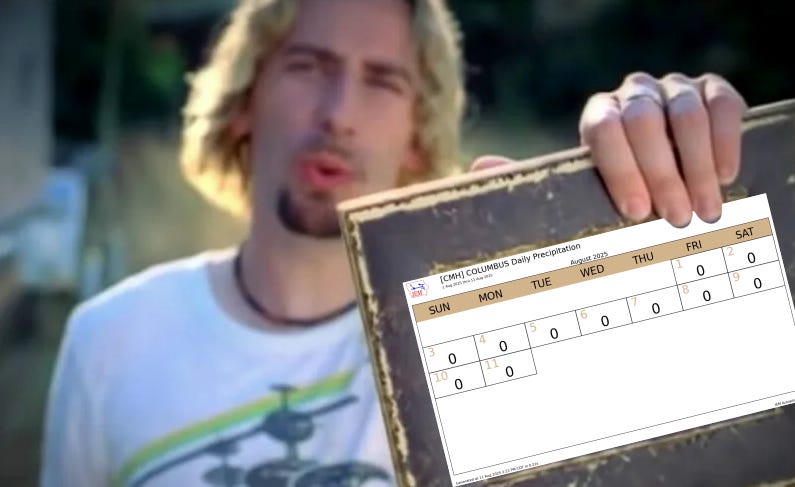
Officially, Columbus has had zero rain so far this month. Zip. Zilch. Nada. Not even a trace. (Some neighborhoods, including my own, can’t make that claim, but it does apply to many in the metro and the all-important airport rain gauge.)
First off, this is a huge change from last month, when we had the fourth-most July days with measurable rain on record. But it’s not just a relative change!
It’s the first time on record that the first 11 days of August have had nary a raindrop.
1944 and 1900 had a trace of rain, so it’s technically the third time with no measurable rain during this period. But as far as registering goose eggs? 2025 stands alone.
Even if you look at dry streaks in August as a whole, this is noteworthy:
-
13 days: August 18–30, 1953
-
12 days: August 20–31, 1969 (lasted through September 1)
-
11 days: August 16–26, 1981; August 19–29, 1948
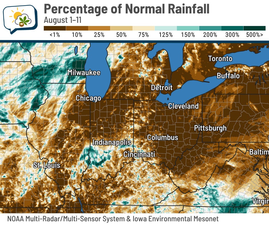
Much of the region has been parched so far this month, too. The darkest brown is up to 1% of normal rainfall, which is basically nothing. One noteworthy exception is eastern Iowa and southern Wisconsin; the Milwaukee metro had significant flash flooding over the weekend.
This is the longest zero-rain streak since a 12-day run in early October of last year.
🌭 For the weather weenies
-
Tropical Storm Erin updates (NOAA National Hurricane Center)