I’m back! We spent a few days back in Iowa and Illinois, visiting old friends and colleagues and getting a little time with family.

We also brought back two dozen ears of sweet corn because Ohio’s just isn’t as good (sorry not sorry, although Roberts’ Farm Market is a very satisfactory substitute) and a couple of treats from Hy-Vee, the grocery store chain whose bakery and meat sections are excellent. Okay, enough reminiscing and such.
The 614cast
Today’s tl;dr
🌦️ Partly cloudy with isolated showers/storms later today, high near 90.

Forecast highlights
⚡ A chance of rain, albeit not a great one
A couple of fronts passing through the region will be the focus for isolated showers and storms later today and tomorrow.
Coverage looks pretty limited, though… but if you have evening plans, keep an eye on the radar, just in case.
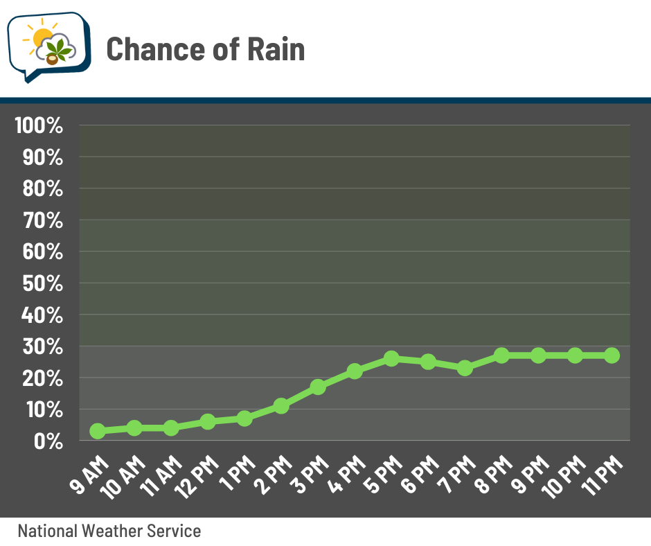
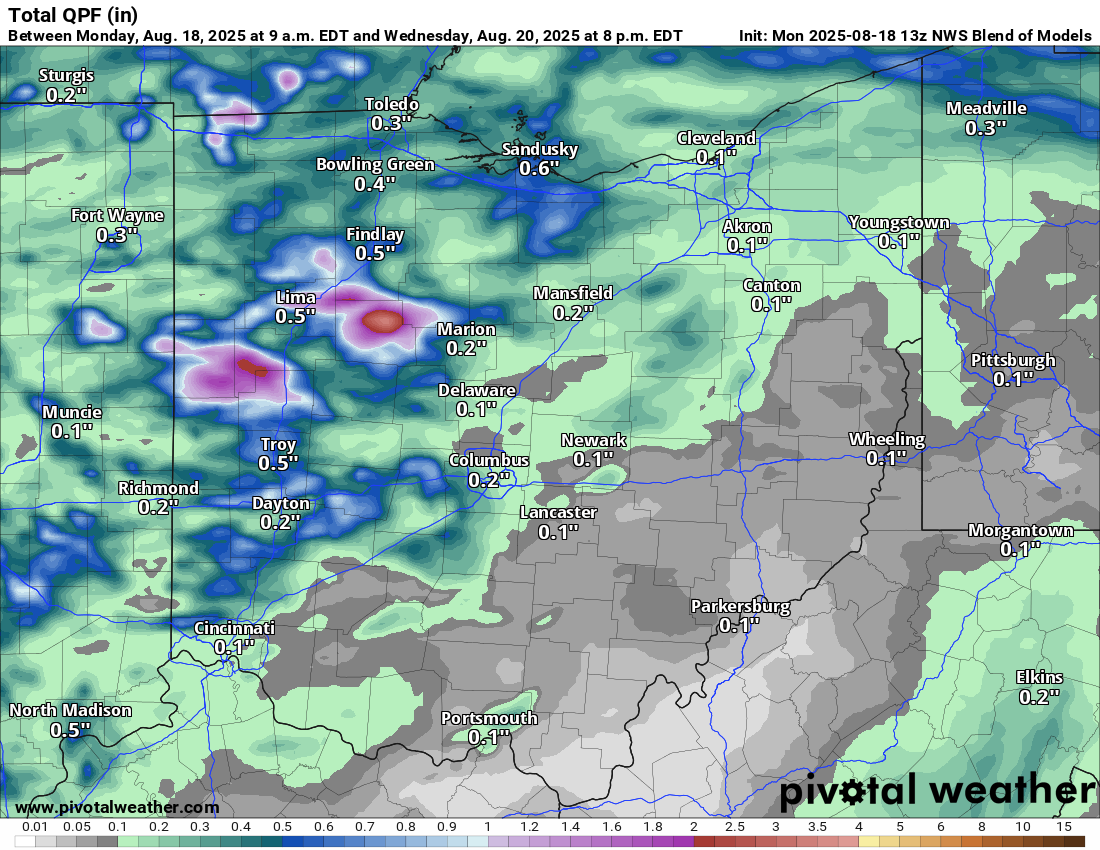
We don’t have a ton of deep moisture in place. While a brief localized downpour is possible, the ingredients aren’t as robust as they have been at other times this summer for getting a big dump of rain. Areas to our west and north have a better shot at a decent rain, a theme that the Blend of Models captures well.
Part of the reason is timing… activity should be happening in the afternoon to our west/north, but arrive here later on when the amount of energy for storms is waning.
You’ll see that notion captured in the Storm Prediction Center’s outlook for today, as of yesterday afternoon. (This is the most recent outlook.)
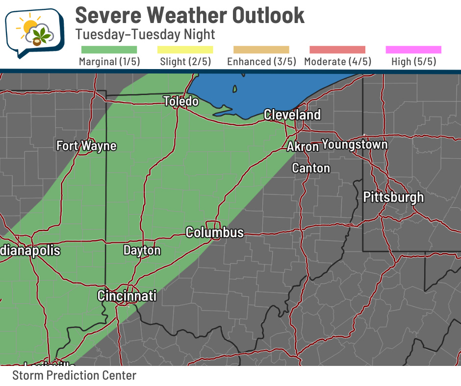
Areas roughly along and northwest of I-71 were put in a marginal (level 1/5) risk of severe storms producing gusty winds. As things press farther east, they’ll lose the bit of oomph they might have… “might” being a key word.
🌞 Warm and a bit humid this week
Above-normal temperatures will be the rule the rest of the week, with highs generally in the upper 80s. Today’s high should be the warmest of the bunch, touching 90.
We’ll also have some humidity in the air, certainly enough to notice but not enough to cause insta-sweat.
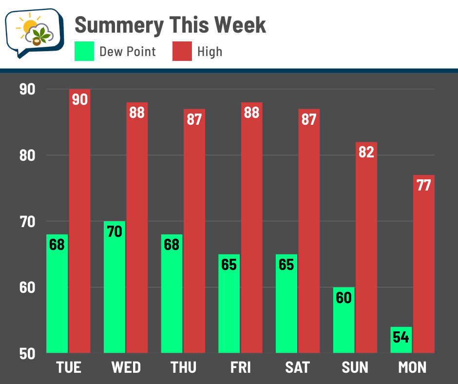

Look what happens at the start of next week. Guidance is really suggesting we’ll see lower temperatures and considerably drier air move in. The upper-level pattern would lend itself to normal to below-normal temperatures and a lack of mugginess.
Next week is the final week of August, so it’ll be getting progressively harder for hot, humid weather to take over for more than a few days at a time. I’ll pull that thread in a newsletter later this week.
📊 Today’s almanac
Normal low/high: 64 / 84
Record low/high: 49 (1977) / 101 (1936)
Sunrise/set: 6:47 a.m. / 8:22 p.m.
⬇️ Normal temperatures have begun their descent
Astute readers may have noticed our normal high and low are now 84 and 64, respectively, after sitting at 85 and 65 for quite a while. They peaked at 86 and 66, parked there from July 10–21. They’ve obviously been slow to fall since then, but that will change soon.
After fluctuating by just a couple of degrees over a couple of months, they’ll slip to 82 and 62 over just the next 12 days. And then we lose another 10 degrees through the end of September!
Here’s a graph of the normal temperature curves from August through December.
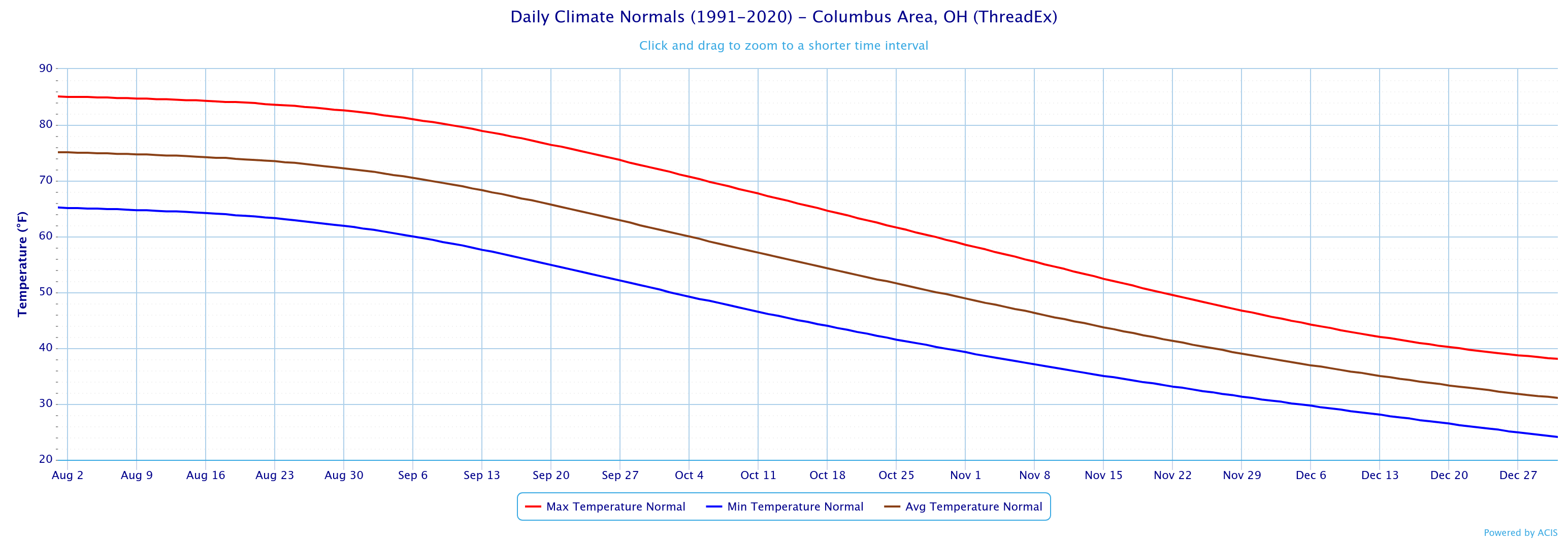
You can see the slow decline at first, followed by an acceleration into fall before leveling out again during the winter.
🌭 For the weather weenies
-
Temperature palindromes (Sketchplanations)
-
Rodanthe, N.C. homes stand in rising surf as Hurricane Erin approaches (WRAL)