The 614cast
Today’s tl;dr
⛅ Partly cloudy, high in the mid-80s.

Forecast highlights
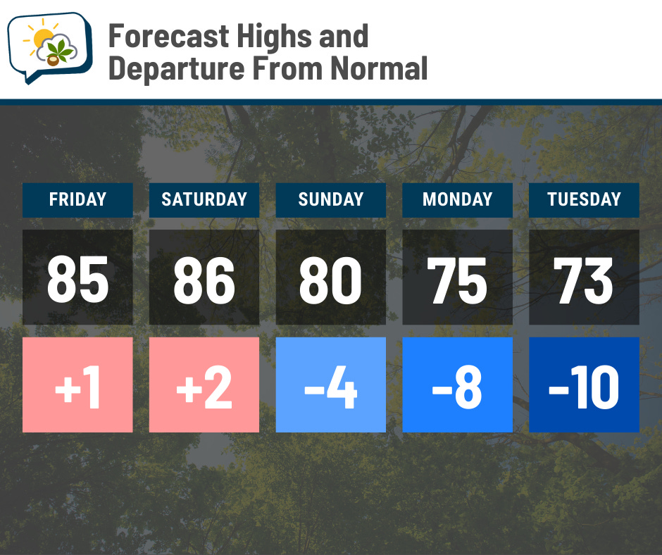
🌻 Two summer days before a fall preview
After a couple of cloudy days, we’ll see more sunshine today. I expect the afternoon to have quite a few puffy fair-weather clouds pop up, but they won’t be the low, gray clouds we just had.
Highs reach the mid-80s the next two days, which is about where we ought to be. A cold front passing through Saturday night will begin to usher in cooler air on Sunday. The Canadian airmass really takes hold in the following days, keeping highs a fair bit below average.
There’ll still be some humidity in the air the next couple of days, too, but of the usual summertime variety. Sunday still starts off with a smidge of mugginess… but during the afternoon, drier air finally shoves in.
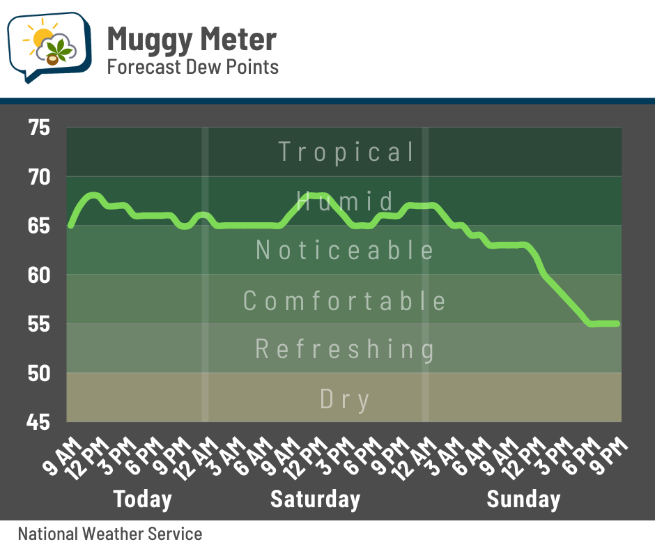
Low dew points stick around throughout next week.

📊 Today’s almanac
Normal low/high: 63 / 84
Record low/high: 46 (1982) / 98 (1936)
Sunrise/set: 6:50 a.m. / 8:18 p.m.
🌧️ Drought Monitor update
The latest Drought Monitor was published yesterday morning. The “abnormally dry” category — which is just below true drought threshold — was expanded and added from the previous week.
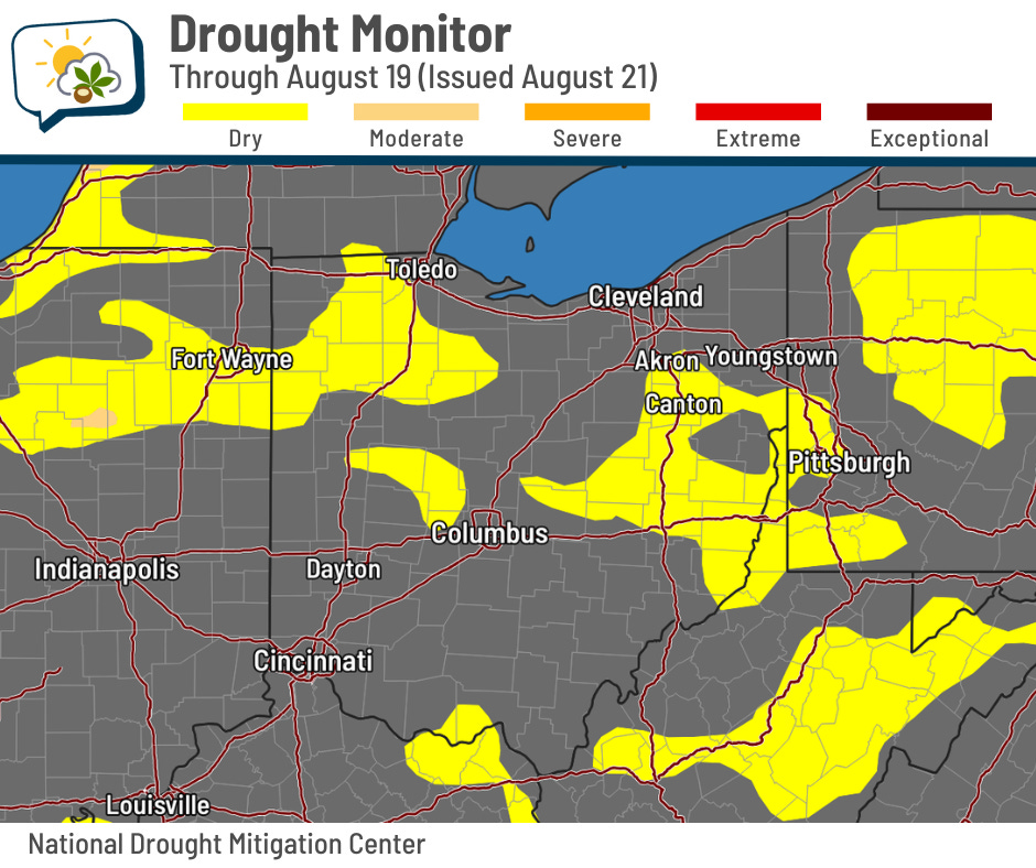
One of the expanded areas is that chunk just northwest of Columbus, which is now poking into Madison County.
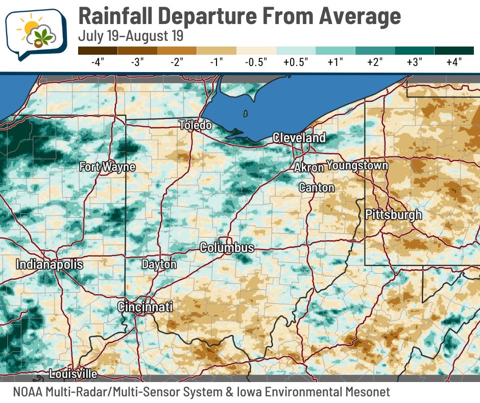
These line up fairly closely with the areas experiencing below-average rainfall over the past month.
With dry weather the past few days and no meaningful rain before Tuesday (the data cutoff for the weekly Drought Monitor update), I wouldn’t be at all shocked if we see more yellow on the map next week.
🌭 For the weather weenies
-
Sea turtle nests in North Carolina washed away by Hurricane Erin (ABC News)
-
At the US Open, tennis stars shine under dark sky-friendly outdoor lights (Associated Press)
-
Katrina to Erin: The most extreme hurricanes in history (BBC)