The 614cast
Today’s tl;dr
🌤️ Mostly sunny, breezy at times in the afternoon. Pleasantly cool with a high in the lower 70s.

Forecast highlights
🌂 Two types of dry this week
First type of dry: It’s not raining.
Okay, there actually are a couple of tiny rain chances this week. (The chances are tiny, not the rain. Raindrops will be the normal size.)
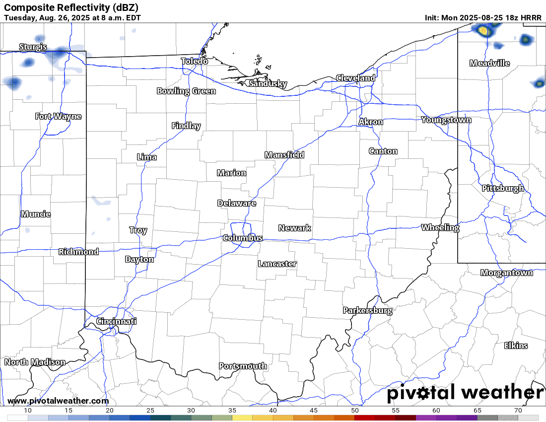
A handful of showers popped up in northern Ohio yesterday with the relatively unstable air caused by the very cool air aloft. We should see that scenario again this afternoon, and a couple might get as far south as the I-70 corridor. I’d put our odds at about 10%.
A disturbance carving across the Great Lakes on Thursday, in association with a cold front, brings another low-end chance of an isolated shower. Once again, odds strongly favor being dry. In fact, here’s the Weather Prediction Center’s rainfall outlook through Saturday:
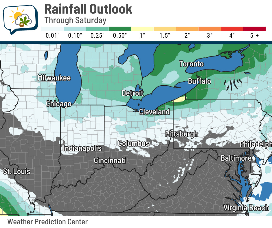
There’ll actually be some lake-effect showers and storms up near Lake Erie, along with possible waterspouts. But for central Ohio, shower activity will be much more sparse.
Second type of dry: the lack of humidity. It’s not just cool air we have in this Canadian airmass — it’s dry air, too. Check out the dew point forecast through the rest of the week. It sure is nice!
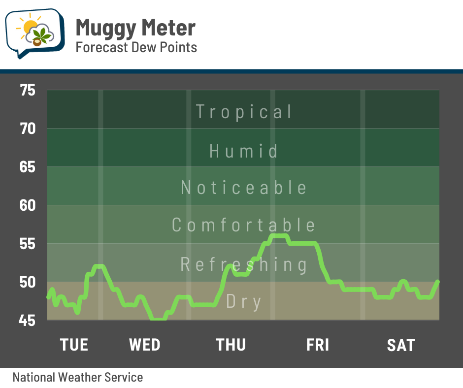
That little rise in dew points Thursday afternoon is what could foster a spotty light shower.
🧊 Crisp mornings
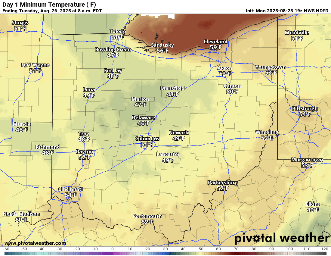
We’re starting our day not far from 50, and we’ll do that again the next couple of mornings.
While Columbus proper might not quite drop into the 40s, it’ll be darn close if it doesn’t. Outlying areas far enough from the urban heat island should make it there, though. Upper 40s and even some mid-40s aren’t out of the question a ways from the Outerbelt.
“Layer-up” weather is certainly in place this week, as a hoodie or jacket will be nice to have first thing in the morning, but won’t be necessary once the sun’s been up for a few hours.
📊 Today’s almanac
Normal low/high: 63 / 83
Record low/high: 48 (1958) / 98 (1948)
Sunrise/set: 6:54 a.m. / 8:12 p.m.
🕺 Talking 70s
Hat tip to the fine folks at the Iowa Environmental Mesonet (actually, “the fine folk” singular… it’s a one-man deal over there) for the inspiration for today’s nugget.
We ought to stay below 75 degrees today, which will feel even nicer than yesterday. While the frequency of a high below 75 on any particular day at the end of August hovers near just 15%, that’s certainly an increase from early in the month.
At that time, it’s only around 5%, give or take.
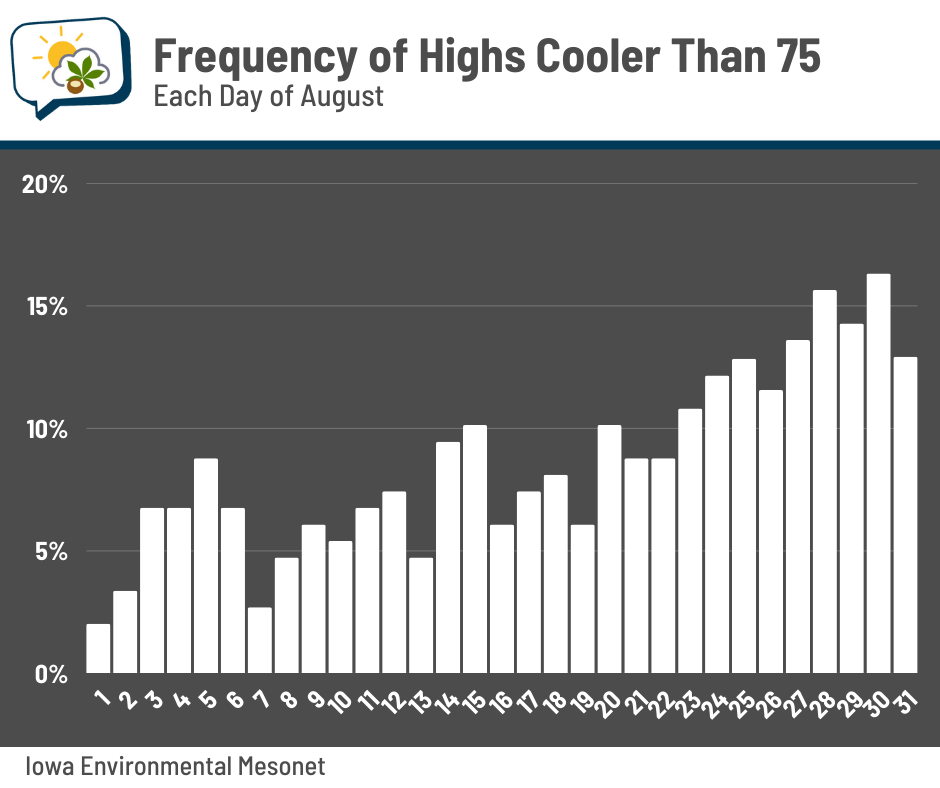
This should come as no surprise, since we’re getting further from the core of summer. The shortening days and early-season intrusions of Canadian air mean we start getting glimpses of fall.
🌭 For the weather weenies
-
The only river that flows into both the Atlantic and the Pacific (Half as Interesting/YouTube)