The 614cast
Today’s tl;dr
☀️ Sunny, high around 80.
Forecast highlights
🎢 Seasonable now, cooler later
We’re still around 80 the next few days, which is near where we ought to be to kick off September. (We actually had a six-day run of highs in the 70s that ended yesterday when we hit 80 on the nose.)
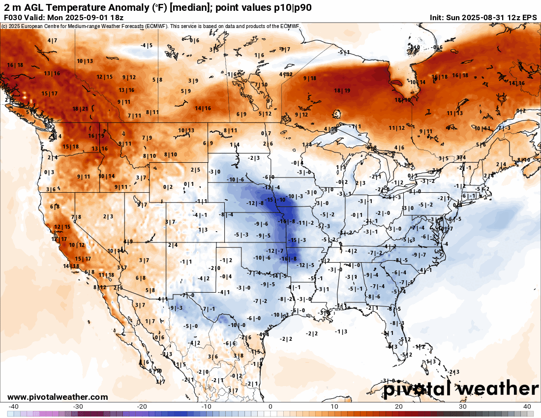
A cold front midweek will send our temperatures down once again as highs settle into the lower 70s. That’s some 10 degrees below average. You can see the expanse of the below-normal temperatures, colored blue, coming out of Canada later this week (don’t worry about the numbers on the map).
🤞 Promising rain chance
That same cold front also produces the best chance of a decent rain we’ve seen in a while. That said, there are no guarantees, but I’m cautiously optimistic that we’ll actually get more than a few hundredths.
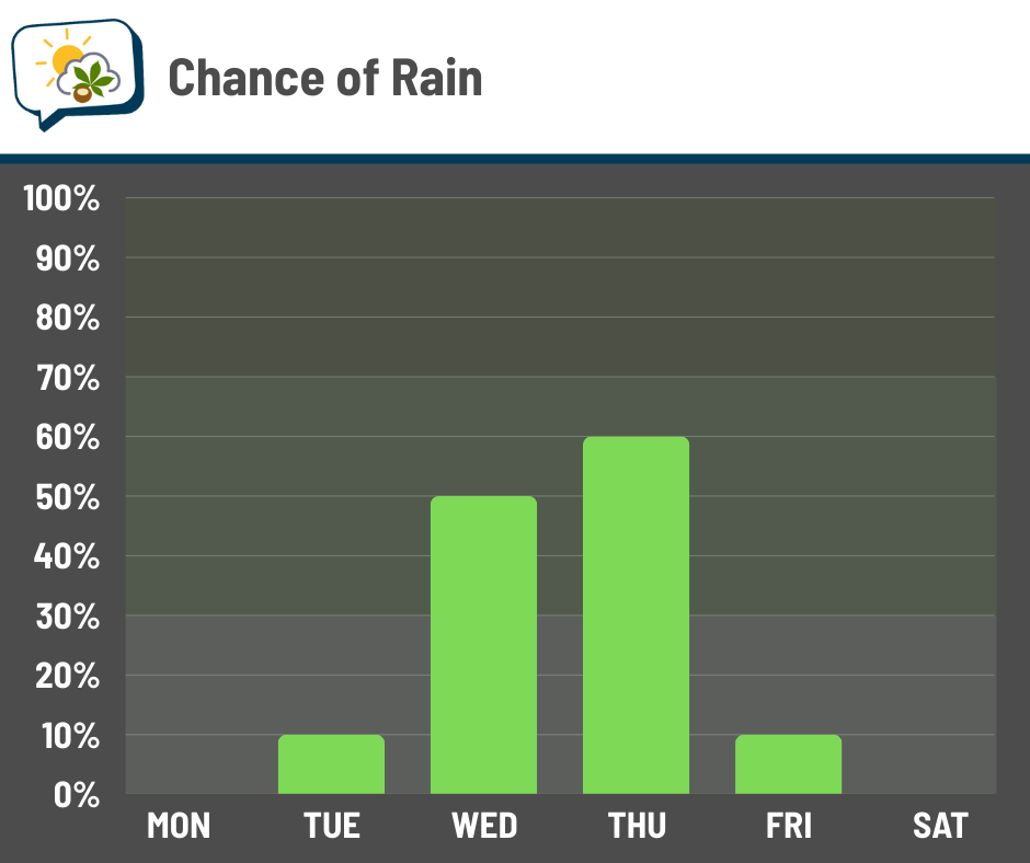
While there could be an isolated shower as early as late Tuesday, chances pick up later Wednesday and should be highest Thursday if the cold front passes through that day as currently expected.
A second cold front going into next weekend could produce showers, too, but I don’t have as much confidence in that yet. Rain chances might end up coming up then, depending on how things evolve.
📊 Today’s almanac
Normal low/high: 61 / 82
Record low/high: 42 (1967) / 99 (1953)
Sunrise/set: 7:00 a.m. / 8:02 p.m.
Yes, we’re done with pre-7 a.m. sunrises for a while… We get realllllly close on November 2 — 7:02 a.m. — when daylight saving time ends and clocks go back an hour. But officially, sunrise won’t go before 7 again until March 5, 2026.
🍂 First day of fall
Labor Day is the unofficial end of summer… and it just so happens to be the first day of climatological fall this year.
Climatological seasons don’t totally line up with the usual astronomical seasons that most people (read: normal people) use. The reason is that astronomical seasons’ dates shift around a little, and that’s not great for record-keeping purposes. So, we start the seasons on the first day of the relevant month. Coincidentally, temperate areas’ warmest and coolest 90-day periods often align better with climatological seasons than astronomical seasons.
Here’s how things evolve in Columbus as the season progresses:
-
September
-
Normal high and low drop from 82/61 to 72/51
-
Normal rainfall is 3.14”
-
Lose 1 hour, 15 minutes of daylight
-
-
October
-
Normal high and low drop from 72/51 to 59/40
-
Normal precipitation is 2.90”
-
Normal snowfall is 0.2”
-
Lose another 1 hour, 15 minutes of daylight
-
-
November
-
Normal high and low drop from 59/39 to 46/31
-
Normal precipitation is 2.79”
-
Normal snowfall is 1.2”
-
Lose 55 minutes of daylight
-
🌭 For the weather weenies
-
High heat imperils Canada’s all-time September heat record (The Weather Network)
-
Climate.gov will re-launch under new URL thanks to a secret team of web ninjas (CNN)