The 614cast
Today’s tl;dr
🌤️ Mostly sunny, breezy at times in the afternoon. High in the lower to middle 80s.

Forecast highlights
☔ Wet to start tomorrow
Rain won’t arrive until well after bedtime tonight, with the highest chances running from around daybreak through lunchtime. After that, the band of showers will peel away to the southeast with eventual clearing behind.
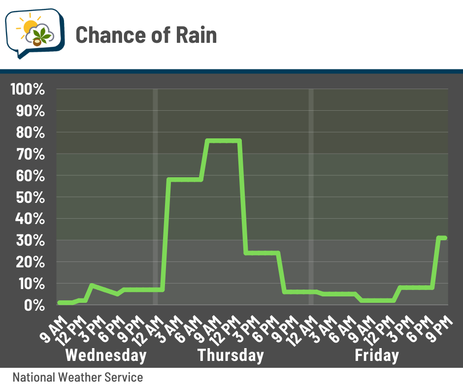
There’s a slight chance we could have a rumble of thunder as the activity departs.
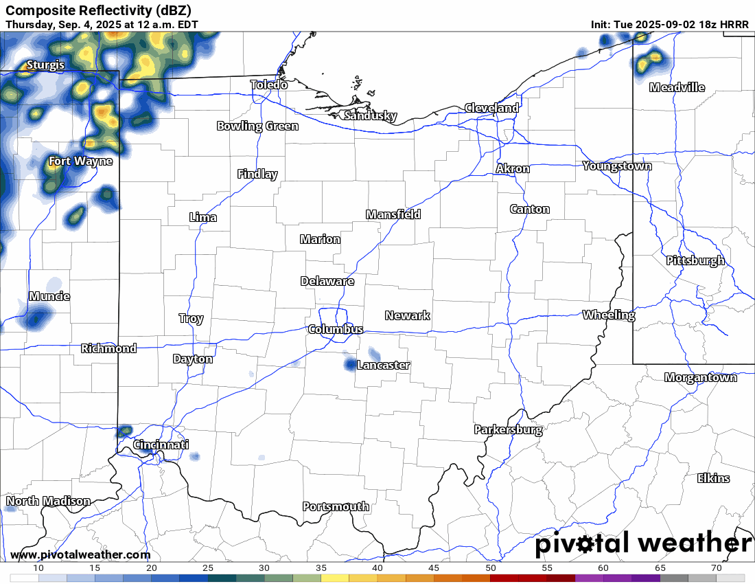
This is what one high-resolution model predicts radar will look like from midnight tonight through early tomorrow afternoon:
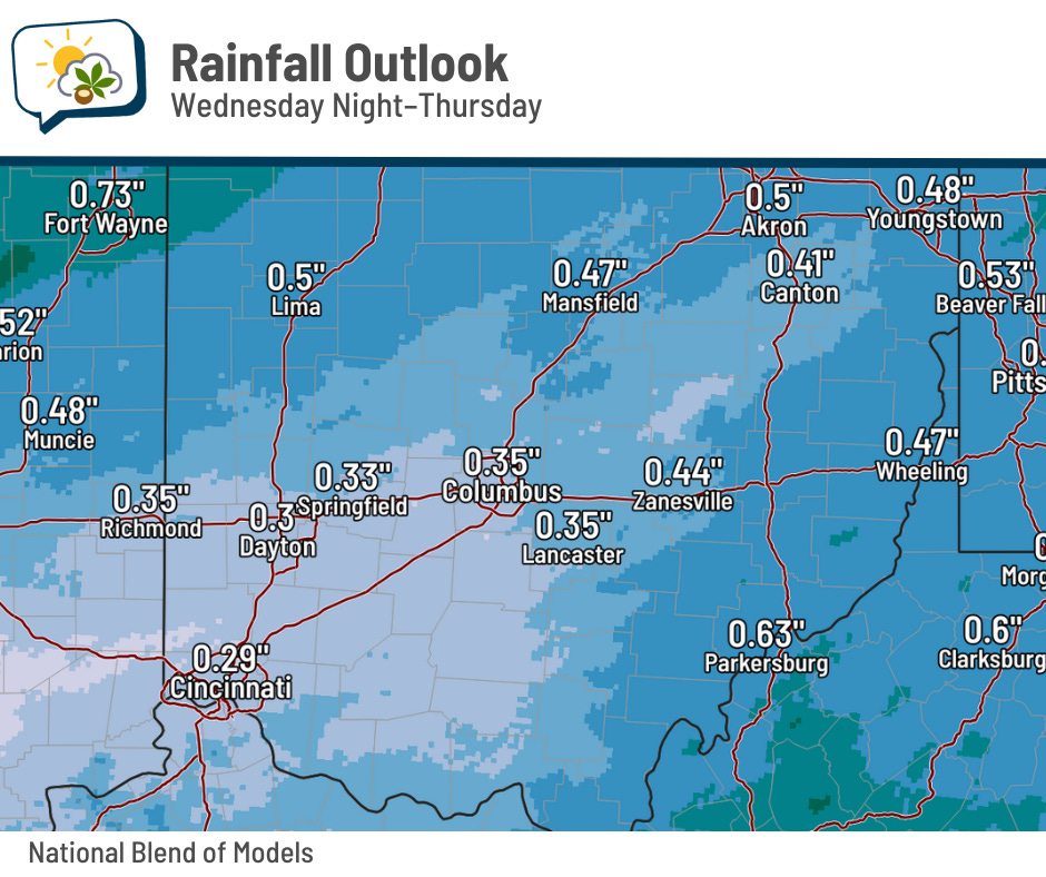
The National Blend of Models spits out an average of about a third of an inch of rain here in central Ohio. There’s pretty good agreement among various forecast guidance that we’ll get somewhere in that neighborhood, too.
😃 Back to coolish
Tomorrow’s actually looking like it’ll be the coolest day (near 70) ahead thanks to cloudiness for a good share of the day. Readings jump back to about 80 on Friday, then slip back to the lower 70s this weekend behind a second cold front.
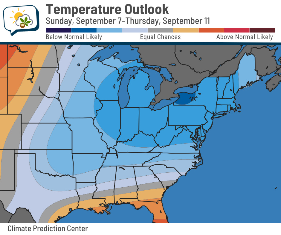
Below-normal temperatures roll right into next week. NOAA’s Climate Prediction Center shows that much of the eastern half of the country favors that pattern, with the highest odds in the Great Lakes region.
📊 Today’s almanac
Normal low/high: 61 / 82
Record low/high: 46 (1967) / 99 (1953)
Sunrise/set: 7:02 a.m. / 7:59 p.m.
Yep, we’ve hit another sun milestone… this time, a pre-8 p.m. sunset. If you can believe it, it’ll be at 7:15 at the end of this month! The next time our sunset is at 8 p.m. is April 5, 2026.
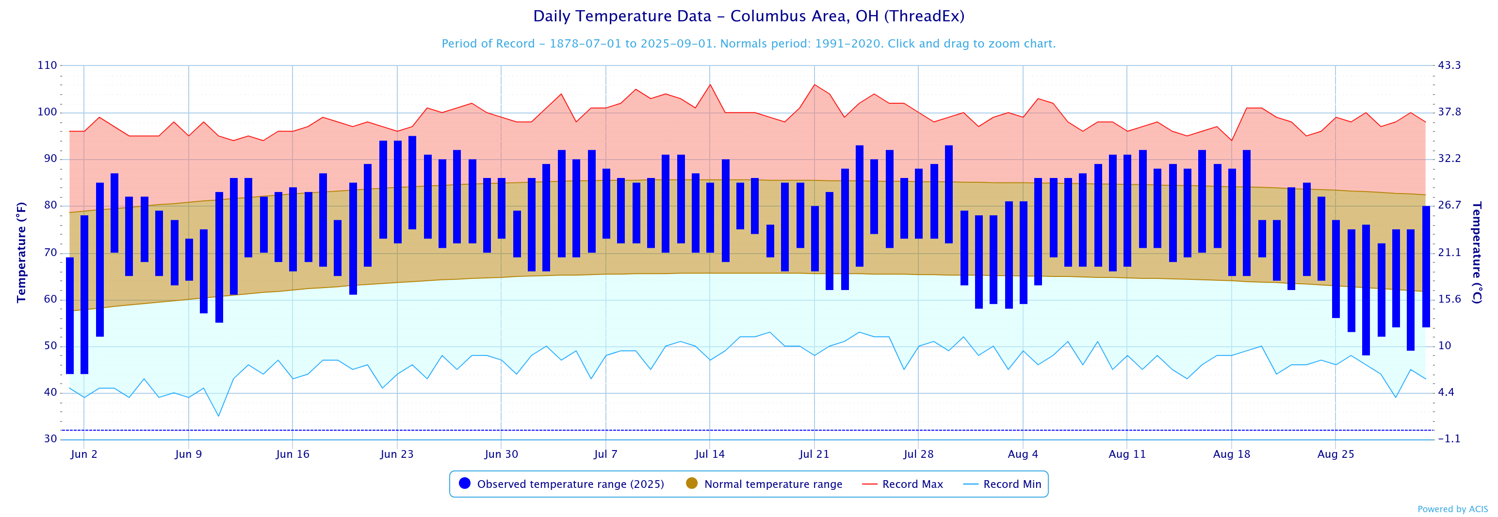
🩴 Summer statistics
Since we’ve wrapped up August, we can also take a look at how climatological summer (June–August) fared…
-
Average high: 84.9 (0.8° above normal)
-
Average low: 65.8 (2.2° above normal) — 8th warmest
-
Average temperature: 75.4 (1.6° above normal)
-
Rainfall: 11.46” (1.28” below normal)
The superlatives:
-
Warmest high: 95 on June 24
-
Coolest high: 69 on June 1
-
Warmest low: 75 on June 24 and July 16
-
Coolest low: 44 on June 2
-
Greatest 1-day rainfall: 1.11” on June 25
Bonus stats:
-
Days of 90+ highs: 22
-
Days of 70+ lows: 33 (2nd most)
The graph below shows the daily temperature range (dark blue), compared to normal (brown) and records (red and light blue).
🌭 For the weather weenies
-
USGS confirms small earthquake in Ohio (WSYX ABC 6)
-
Summer 2025 was hottest on record in UK, says Met Office (The Guardian)
-
Map of daylight lost during September (Brian Brettschneider/Bluesky)