It rained yesterday! The southern half of the metro got more than the northern half.
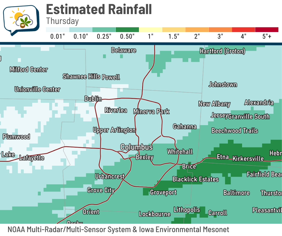
Here are a bunch of rainfall reports:
-
Canal Winchester: 0.37”
-
Bexley: 0.35”
-
Rickenbacker: 0.35”
-
Grove City: 0.27”
-
CMH: 0.26”
-
Gahanna: 0.26”
-
Worthington: 0.25”
-
Galena: 0.21”
-
Johnstown: 0.19”
-
Whetstone area: 0.18”
-
Upper Arlington: 0.15”
-
Alum Creek Lake: 0.14”
-
Hoover Reservoir: 0.13”
-
Powell: 0.13”
-
Dublin: 0.12”
-
Hilliard: 0.10”
-
Delaware: 0.07”
-
OSU Airport: 0.07”
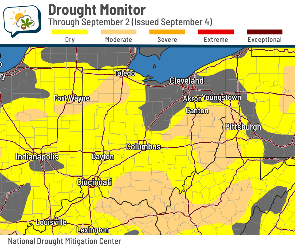
Meanwhile, this week’s Drought Monitor update shows much of the state is now in at least dry conditions (83% this week compared to 53% last week). Moderate drought also jumped from 2% of Ohio to 29%.
The 614cast
Today’s tl;dr
🌤️ Mostly sunny and breezy, high in the lower 80s.

Forecast highlights
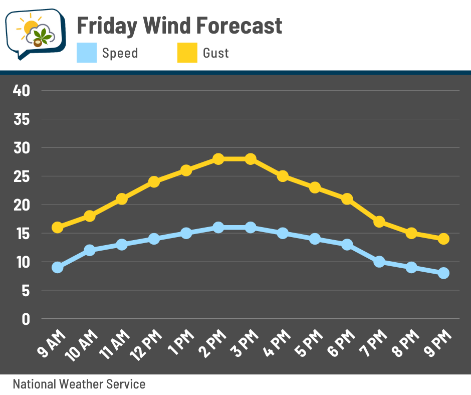
🌬️ Windy and warmer ahead of an autumn-y weekend
Winds gradually increase into the afternoon, when sustained winds should be around 15 mph with gusts of 20–30 mph. They’ll be from the southwest and eventually bend more to the west, so open north-south highways will have some crosswind.
These are warm winds, pushing highs a little past 80. Then a cold front passes through, dropping temperatures for the weekend. We’ll see highs near 70 both days, and Sunday morning’s low dips into the upper 40s. Outlying areas should fall to the mid-40s.
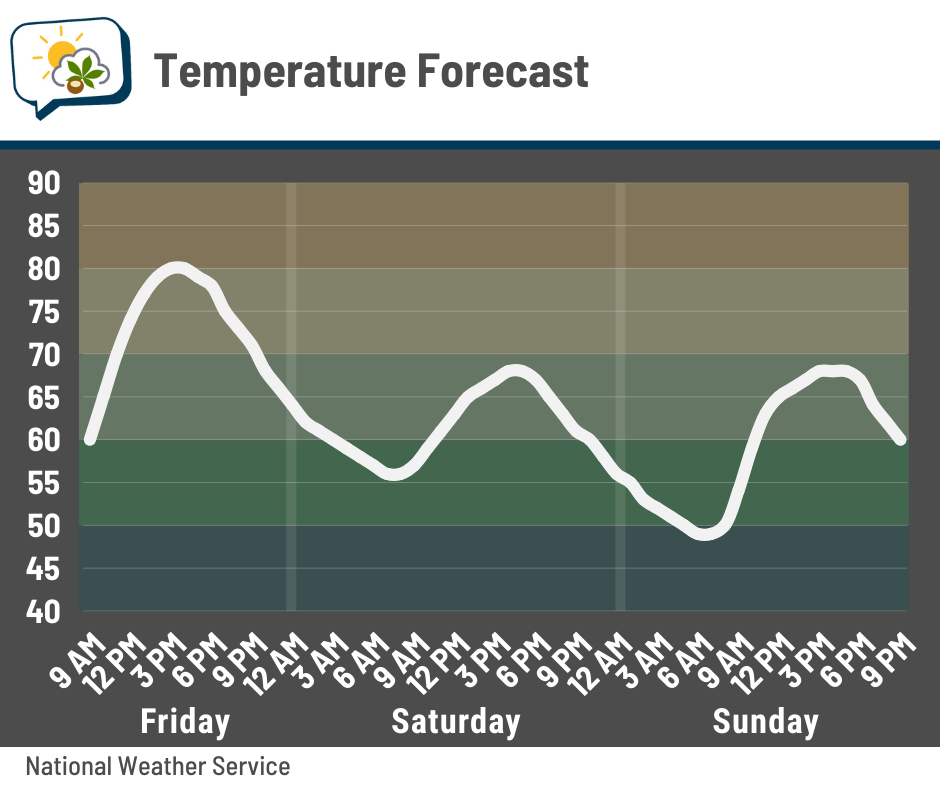
Next workweek starts with highs still in the 70s, but we should get back to around 80 on Wednesday.
🌧️ Another shot at rain
Areas to our southeast have a much better chance of showers and storms; a few could be strong in southeastern Ohio Friday evening into early Friday night.
Locally, we should have mostly occasional showers. Timing might be as early as Friday evening, but mostly Friday night into Saturday morning. Amounts should be lighter than today.
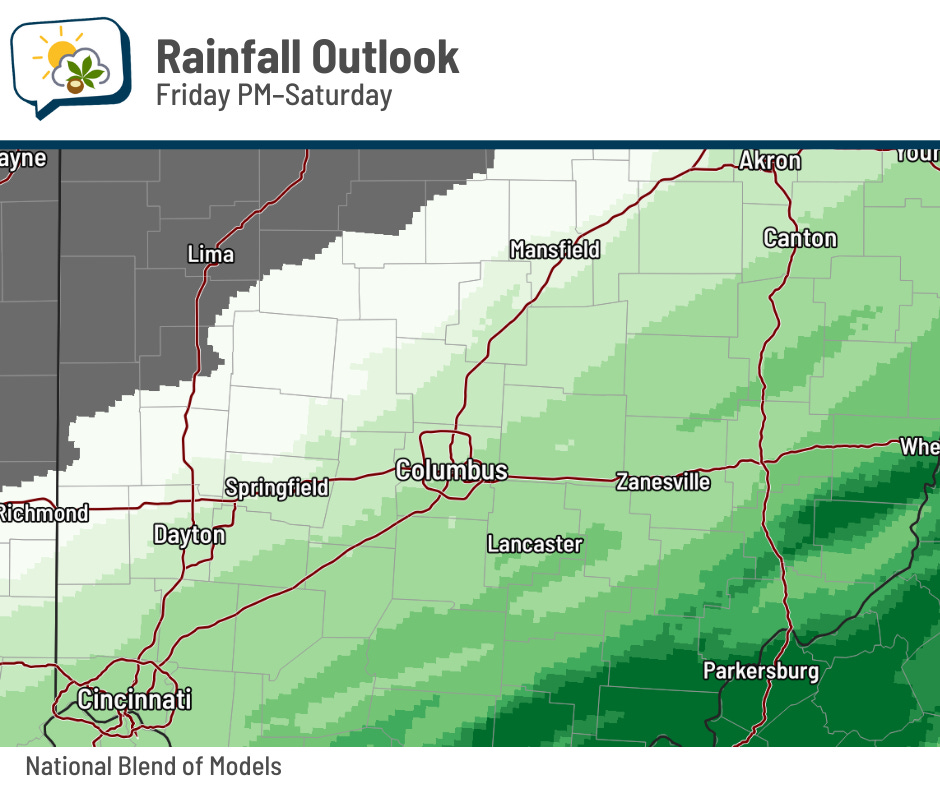
After that, dry conditions settle back in for several days.
📊 Today’s almanac
Normal low/high: 60 / 81
Record low/high: 45 (1950) / 99 (1954)
Sunrise/set: 7:03 a.m. / 7:56 p.m.
🌕 Full Corn Moon is this weekend
This weekend brings a full moon, known as the Full Corn Moon.
The moon will be fullest at 2:08 p.m. Sunday afternoon while it’s below our horizon, but it’ll appear full both Saturday night and Sunday night. The sky will be plenty clear either night, so you’ll have no trouble seeing it.
The September full moon is typically called the Harvest Moon, but that’s not the case this year. Why not? According to EarthSky, the full moon closest to the fall equinox is called the Harvest Moon. This year, that’ll be full moon on October 6.
Some Native American names for the September full moon include Gourd Moon, Leaves Turning Moon, and Someone Harvests Moon.
🌭 For the weather weenies
-
Tie no more: Canada’s all-time September heat record now belongs to one (The Weather Network)