The 614cast
Today’s tl;dr
☀️ Sunny, high in the upper 80s.

Forecast highlights
🤔 Not feeling like mid-September
Highs the past five days have been above normal (although last Wednesday was only by one degree, which barely counts). That theme continues this week and probably into early next week.
Here’s a map of the National Weather Service’s forecast highs this week and their departure from average.
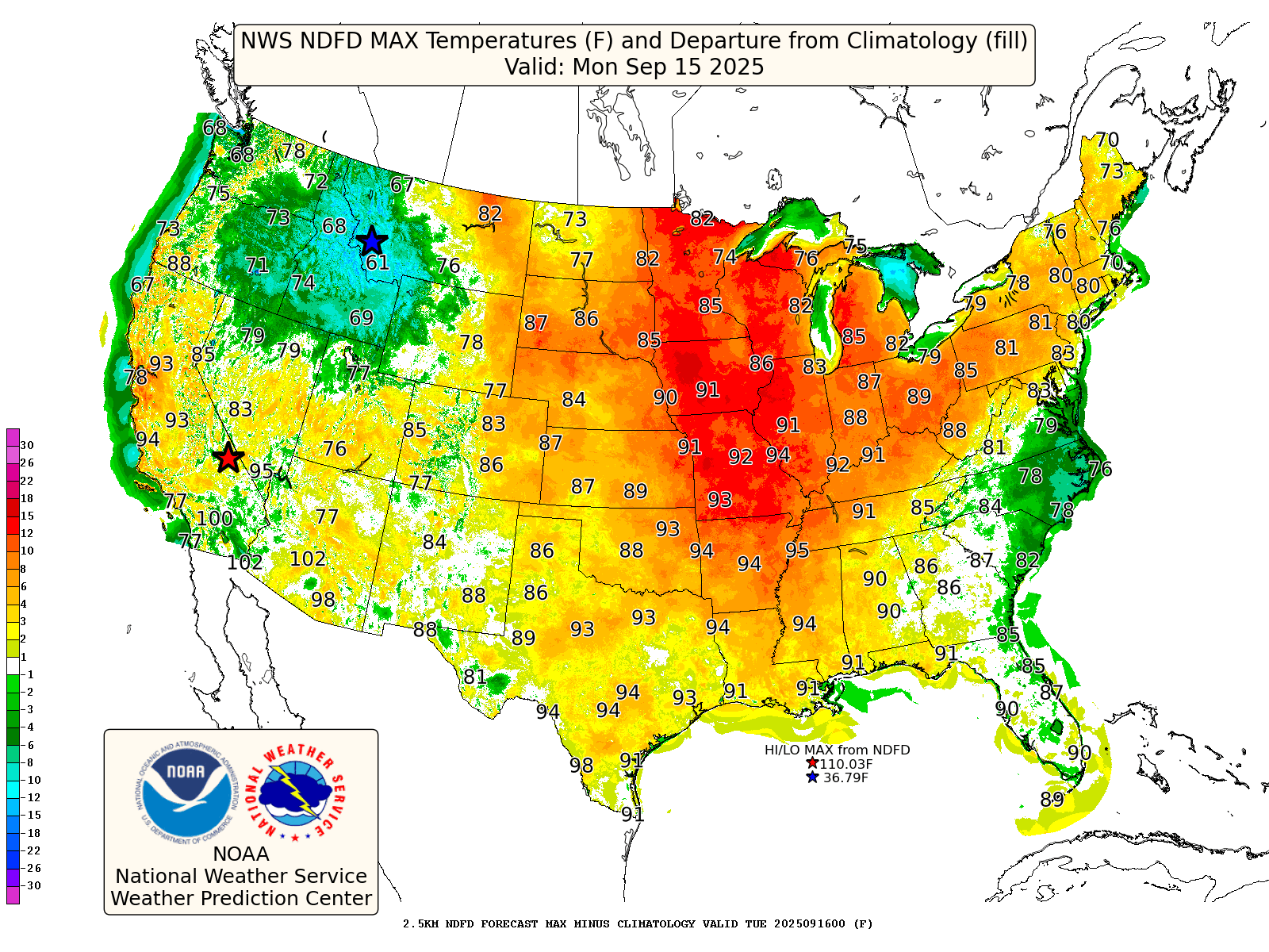
The deep oranges into reds indicate highs of about 10+ degrees above average. We’ll be near or above that threshold all week until Saturday. By that point, the expanse and strength of the warmth will relax a bit.
Each day this week will start off around 60, followed by afternoon highs in the middle to upper 80s.
📊 Today’s almanac
Normal low/high: 57 / 78
Record low/high: 40 (1923) / 97 (1939)
Sunrise/set: 7:13 a.m. / 7:40 p.m.
🔥 Late-season 90s
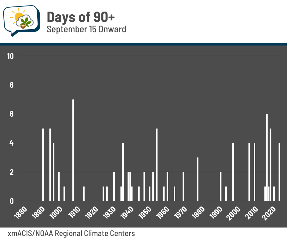
I think it’s going to be hard for us to officially reach the 90-degree mark this week, although it’s not impossible. But since we’re going to at least be close, I figured it’d be relevant to look back at 90s at this time of year.
Here’s the percent of years with a high of 90+ from September 15 onward around Ohio:

Locally, it happens in about a quarter of years. Not surprisingly, southern Ohio is closer to about a third to half of years.
Some years have a bumper crop of late-season heat. 1908 takes the cake with seven days of 90+ from today’s date. Two recent years — 2017 and 2019 — are toward the top with six and five days, respectively. Last year had four.
The latest 90-degree reading in Columbus was October 15, 1897.
The recent 30-year average for the last date is September 2.
We most recently hit 90 on August 19. If we don’t hit 90 again, it’ll be our earliest last date since August 17, 2009.
🌭 For the weather weenies
-
The balloon that wouldn’t come down (Everything is Amazing)
-
Rare tornado touches down near SW Colorado, damaging at least 3 homes (Denver7 KMGH)
-
North Dakota tornado reports on Sunday (WeatherMatrix/Bluesky)
