The 614cast
Today’s tl;dr
🌤️ Areas of fog early, then partly to mostly sunny with a high in the upper 70s.

Forecast highlights
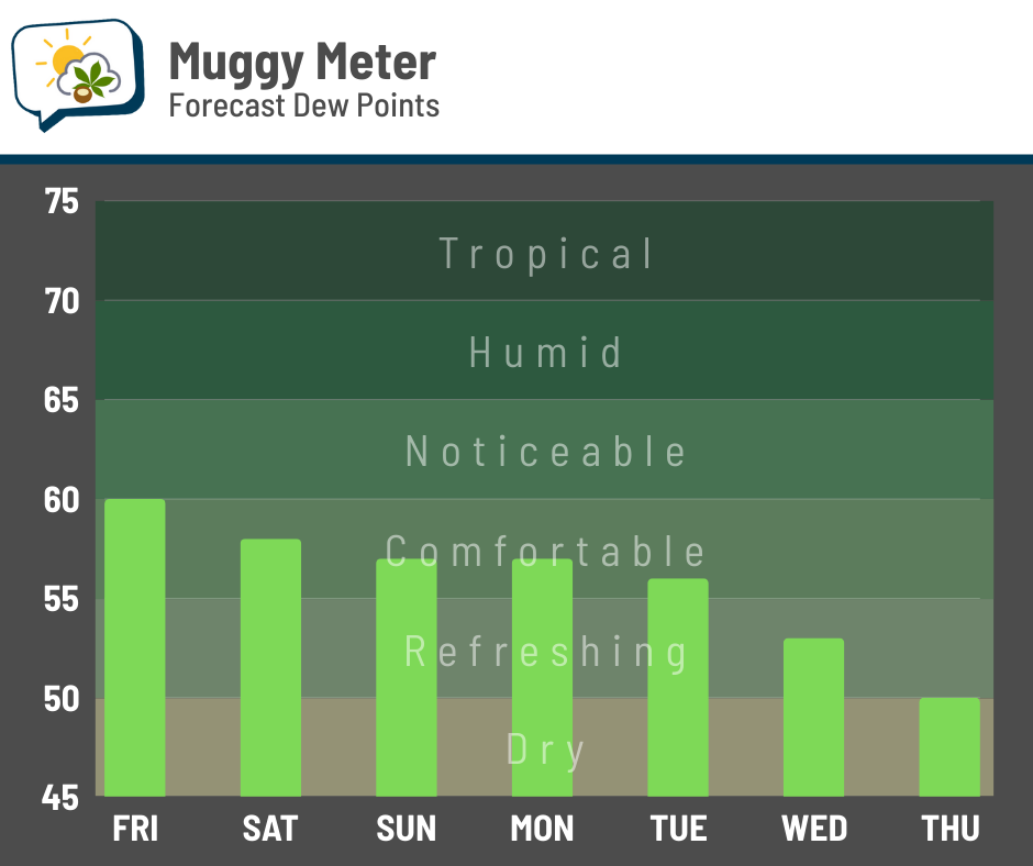
🙂 Relatively warm, but getting less humid
The seasonable air we had the last couple of days will be replaced by a bit of a warmup going into the weekend through early next week. We’ll see highs either side of 80 through Tuesday. Readings should fall back a bit after that, but remain above average.
We’ve had some mugginess around here this week, but that’ll diminish in the coming days.
Canadian high pressure will have some control of our weather later next week, pushing in even drier air.
🌂 Back to dry*
*Depending on what happens with a tropical system in the western Atlantic.
For the next few days, anyway, dry and brightening weather will be in charge.
A disturbance moving into the Bahamas today appears to have an increasing chance of reaching the Southeast U.S. coast Monday or Monday night. These are the track forecasts from a handful of models that ran early Thursday. An early look at the following run, as I was writing this, was reasonably comparable.
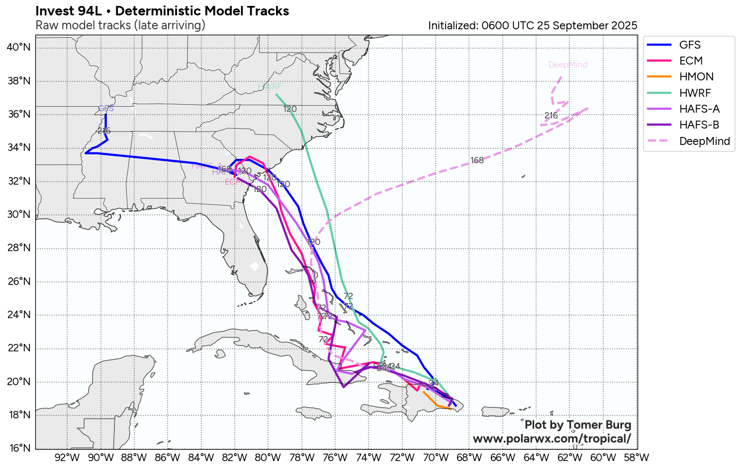
(It’s curious to see what Google’s DeepMind AI-based model has to say. Some of its forecast tracks pull it to the coast, while others have it swing out to sea.)
Anyway, if this system comes ashore in or near the Carolinas, we’ll have to see what happens with its remnants. I wouldn’t be surprised if it throws some high clouds our way Tuesday and Wednesday. But rain? That’s a trickier situation. It would 1) have to get far enough north, and 2) overcome the dry air being funneled in from a Canadian high pressure system.
This run of the European model does a good job showing how the rain on the periphery basically hits a brick wall as the system meanders after coming ashore.
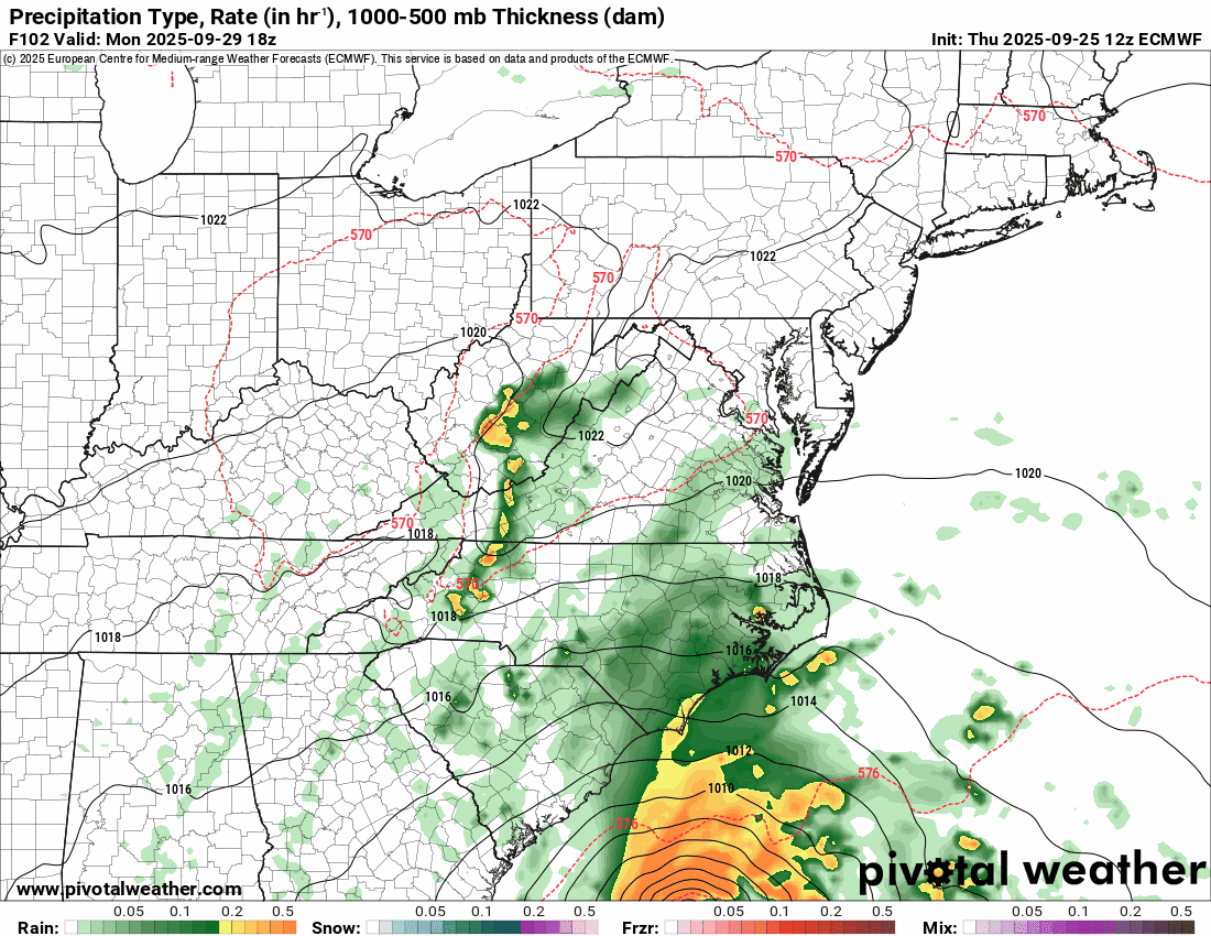
It’s a complicated setup, since there’s another disturbance over the Southeast that’s influencing where this thing goes… it’s a dance that is uncertain at this juncture. But for us locally, it appears it ought to stay far enough away to have only a limited effect on our weather… and, unfortunately, probably no rain.
📊 Today’s almanac
Normal low/high: 53 / 74
Record low/high: 35 (1950) / 92 (2017)
Sunrise/set: 7:23 a.m. / 7:21 p.m.
🦘 Fall temperature rebounds
The coolest temperature in Columbus so far this season was 46, back on the 7th and 8th. Since then, we’ve had no trouble getting 80-degree highs. However, this isn’t unusual; most years have at least one 80-degree high after falling to 46 for the first time. In fact, here are the warmest highs by year.
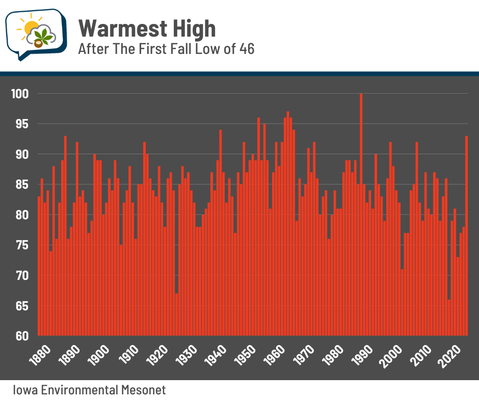
A handful of years (including last year) even make it to 90. We didn’t quite manage that with last week’s warmth.
On average, we get about seven days of 80-degree warmth after the first 46-degree low. We’ve had 13 so far this year, and should tack on a few more coming up.
But what about once we drop below 40? How warm does it usually get after that happens?
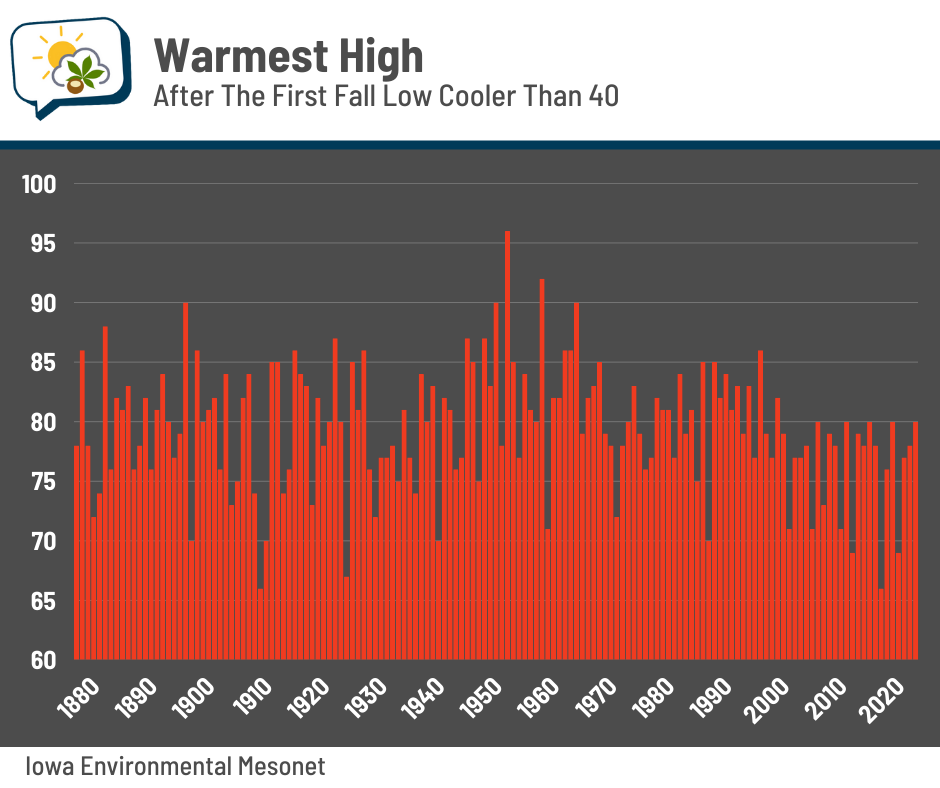
About half of the years still manage to hit 80 at least one more time.
🌭 For the weather weenies
-
Where ‘day-zero droughts’ could happen as soon as this decade (CNN)
-
How Voltpost is turning street lights into EV chargers (Axios)
-
Houston developed 65,000 flood-prone properties since Harvey. Who profits, and who pays the price? (Houston Chronicle)