The 614cast
Today’s tl;dr
☀️ Sunny, high near 80.

Forecast highlights
😎 Closer to average, but still warm
Well, the high probably won’t be double-digits above average today. That’s a small victory, I guess? And tomorrow morning will be the coolest it’s been in three weeks with a low around 50; Columbus fell to 49 on September 10.
This animation of temperature anomalies for the next week shows the expansive region of warmer-than-average temperatures.
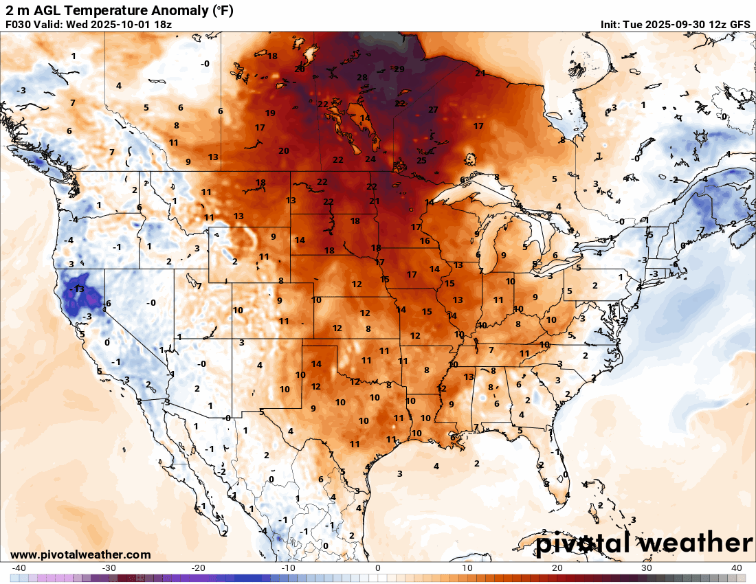
Near or new record highs are expected in parts of the Upper Midwest Friday and Saturday:
I’m seeing signs that the upper-level pattern may change in the second week of October, which would lower the thermostat some. That’s a ways off, though, so I’m not getting my hopes up for anything yet.
🪄 A rain chance appears
The aforementioned possible pattern change also means I see a speck of a chance of rain. But it’s not until next Tuesday.
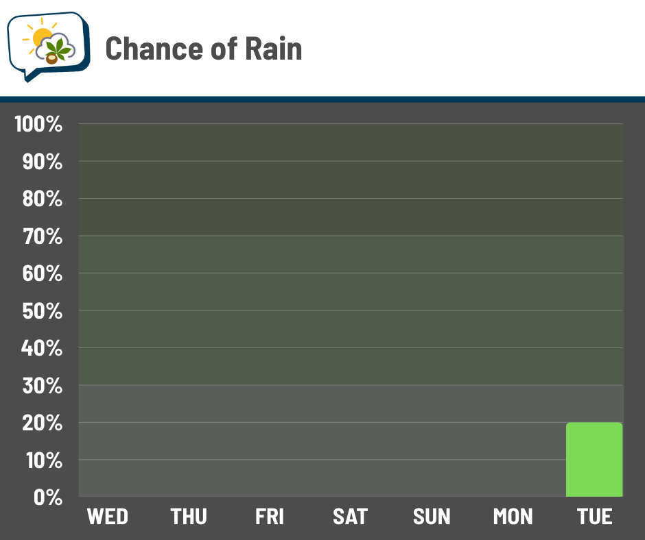
Now, if said pattern change happens, we might be able to get a weather system to shuttle through every few days. While rain wouldn’t be a for-sure with them, it at least would present opportunities — something we haven’t had over the past week and won’t have for most/all of the next week.
📊 Today’s almanac
Normal low/high: 51 / 72
Record low/high: 30 (1899) / 94 (2019)
Sunrise/set: 7:28 a.m. / 7:13 p.m.
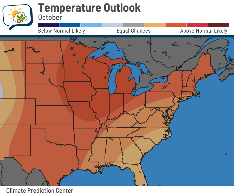
👁️ October outlook
NOAA’s Climate Prediction Center issued its updated October outlook yesterday. I wish it brought better news for those of us looking for ~*fall vibes*~.
Here’s the temperature outlook:
And the precipitation outlook:
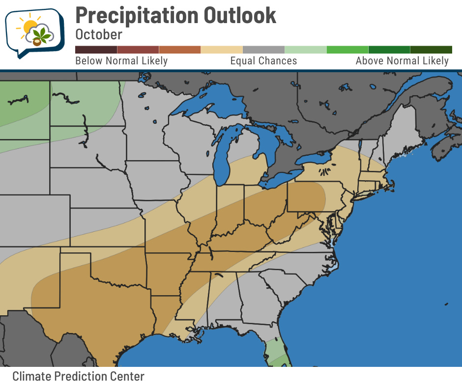
Same old, same old, right?
Columbus is marked as as 54% chance of being warmer than average, 33% chance of being near average, and 13% chance of being cooler than average. The normal high and low for the month as a whole are 66 and 45.
For precipitation, it’s a 44% chance of being drier than average, 33% chance of being near average, and 23% chance of being wetter than average. The normal precipitation is 2.90”.
The Climate Prediction Center’s technical discussion points out that the prevailing westerly winds are expected to be shifted north, allowing warmer temperatures to be more dominant. This also takes the active storm track away from the region enough to favor drier conditions.
🌭 For the weather weenies
-
A year after Helene, a group of raft guides embarks on a river clean-up mission (NPR)
-
Google DeepMind’s performance for Imelda’s path (Tomer Burg/Bluesky)
-
‘Wholesale destruction’: Government shutdown or not, critical science programs are at risk (Bulletin of the Atomic Scientists)