Virtually the entire metro got over an inch of rain yesterday, with CMH officially recording at least 1.70”. At “press time” for the newsletter last night, one more band of rain on the cold front had not yet come through. If you’d like to see final totals, check my Bluesky later today.
The 614cast
Today’s tl;dr
🌤️ Partly to mostly sunny, breezy at times. High in the upper 60s.

Forecast highlights
📆 Coolest since May
Today will be the coolest day since the very end of spring. Canadian high pressure is shoving the most fall-feeling air we’ve felt so far this season in behind last night’s cold front.
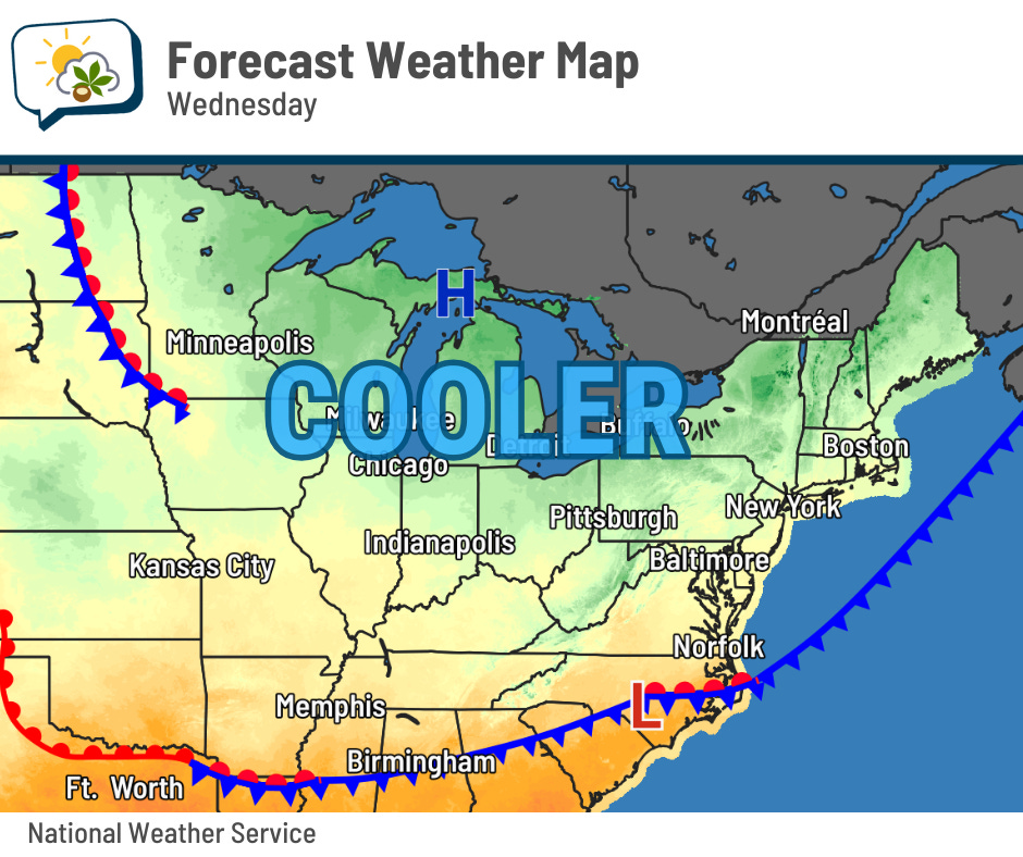
Today should feature a good amount of sunshine, but I do have to wonder if we’ll have some pesky clouds around in spots due to the combination of cooler air and residual moisture from the rain.
Regardless, today will feel fresh thanks to a north breeze sometimes gusting to 20 mph, on top of highs in the upper 60s.
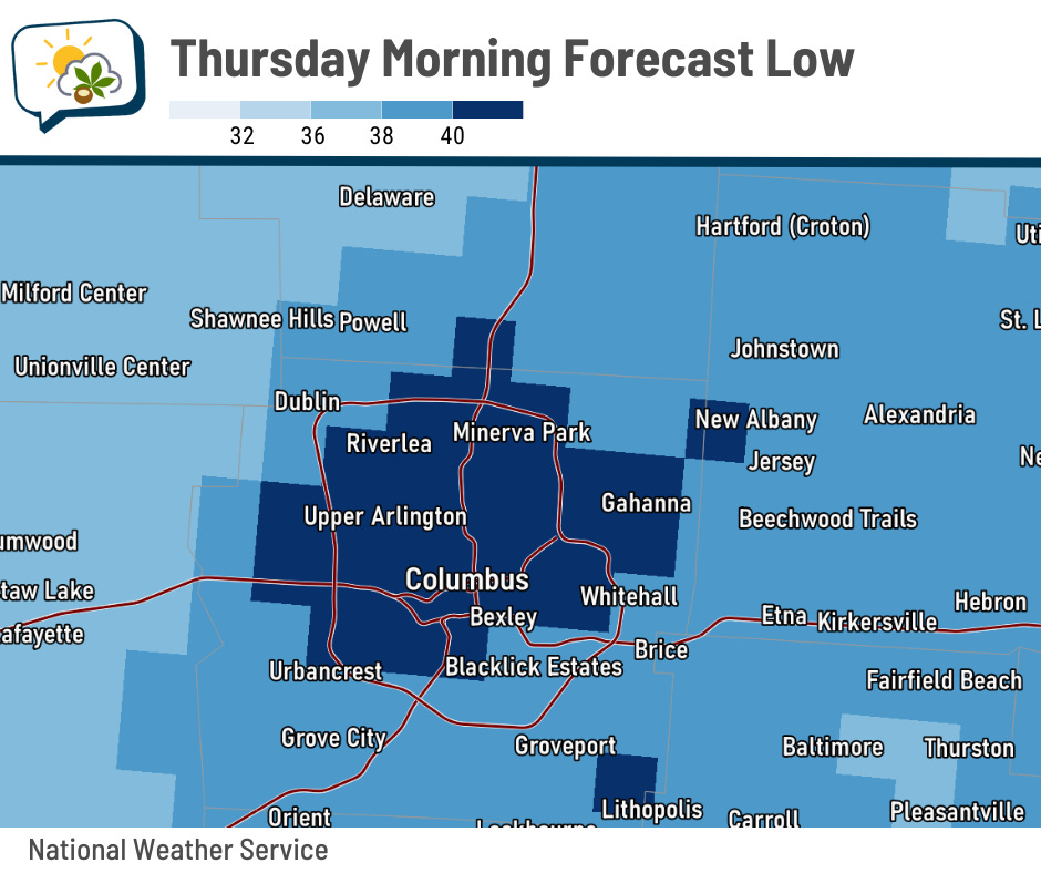
Winds slacken tonight, and with a clear sky, we have a recipe for a chilly night. Tomorrow morning should start off near 40 within and near the Outerbelt, but outlying areas dip into the 30s. Favored spots could even see patches of frost, mostly on rooftops.
With such a cool start, we’ll probably only manage the mid-60s tomorrow afternoon even with a lot of sunshine. Hoodie weather!
Friday morning looks to be similar… near 40 around Columbus proper while outlying spots drop into the 30s.
🙂 Back to mild, but not too warm
The temperature outlook map for next week looks awful if you are really anticipating this fall weather… but there’s a catch.
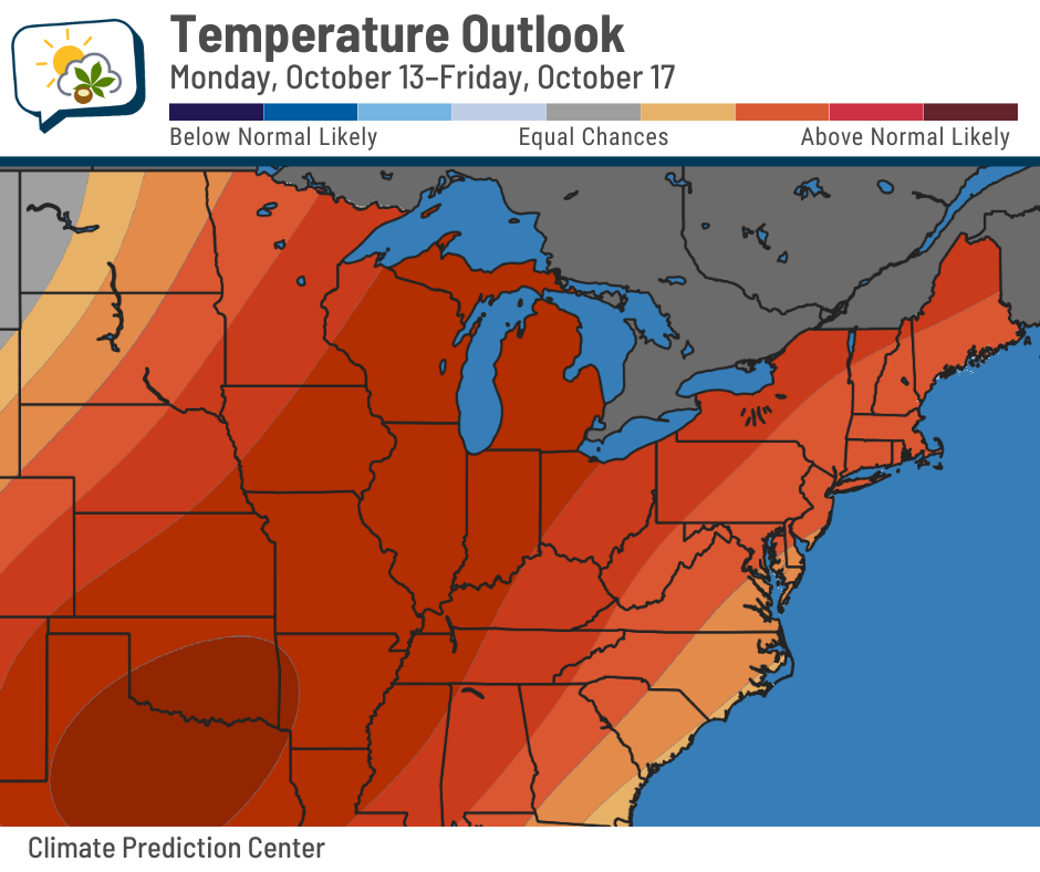
Yes, we have pretty high odds of above-average temperatures. But next week’s average high is in the mid-60s and average low is in the mid-40s. It doesn’t have to be especially warm to beat those numbers.
Highs return to the 70s next week, but we’re not looking at a run of 80s like we had to start the month.
📊 Today’s almanac
Normal low/high: 48 / 69
Record low/high: 29 (1889) / 90 (2007)
Sunrise/set: 7:35 a.m. / 7:02 p.m.
📉 When does Columbus drop below 40?
There’s a chance it could happen this week for the first time this season. If not, we’ll end up doing it fairly late, since there aren’t any other opportunities in the near future.
In half of years, Columbus has had a low cooler than 40 degrees by October 2.
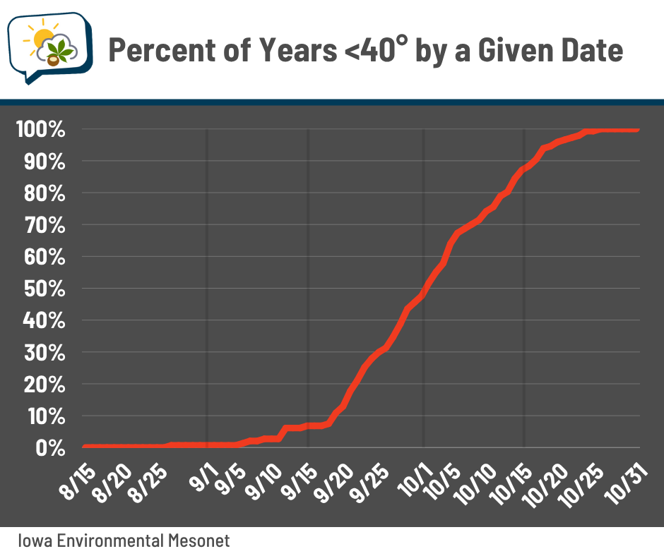
Interestingly, we haven’t done it before that date since 2012. Four of the ten latest years have happened since 2011.
The earliest date was August 29, 1965, and the latest was October 28, 1919.
Last year’s first sub-40 reading happened October 15.
🌭 For the weather weenies
-
Western University’s Canadian Severe Storms Laboratory assists NWS with rating historic EF5 tornado in U.S. (Northern Tornadoes Project)
-
Renewables overtake coal as world’s biggest source of electricity (BBC)