The weekly Drought Monitor update dropped yesterday morning — and one key thing to know is that their data cutoff time is 8 a.m. Tuesdays, which means a share of the rain that day was not included in this week’s update. That will be reflected next week.
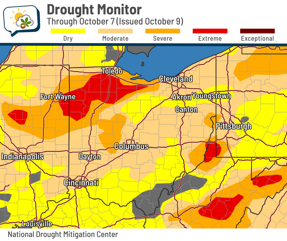
The immediate Columbus metro remains in moderate drought, but conditions worsened to “severe” just to the west. Here’s the change map from the previous week:
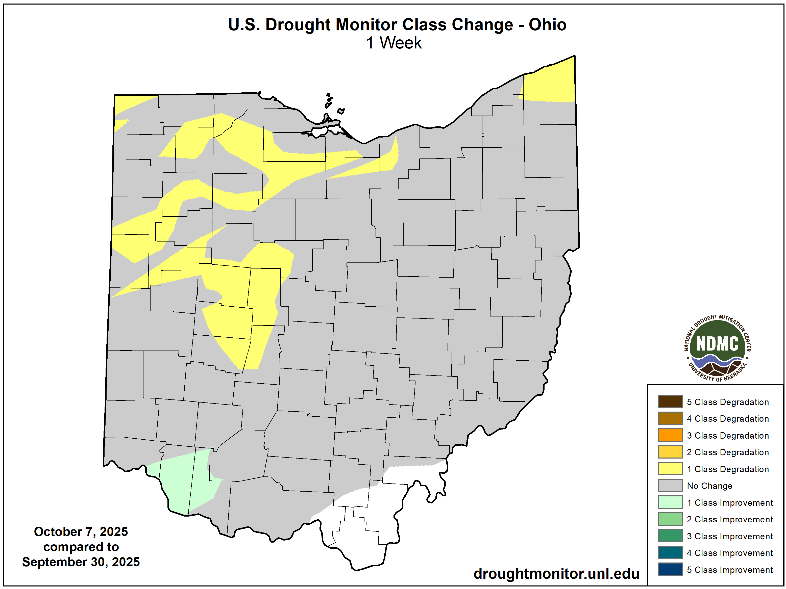
The amount of Ohio in at least moderate drought remained the same, near 73%. However, severe or worse drought increased from 18% of Ohio last week to 24% this week. Extreme drought makes up 9% of the state, up from 3%.
The 614cast
Today’s tl;dr
☀️ Mostly sunny, high in the upper 60s to near 70.

Forecast highlights
⬆️ A little warming trend
Central Ohio had its first frost advisory of the season this morning, which was the first one since May 10.
This cool Canadian airmass will begin moderating today, leading to highs edging close to 70. That’s several degrees warmer than yesterday.
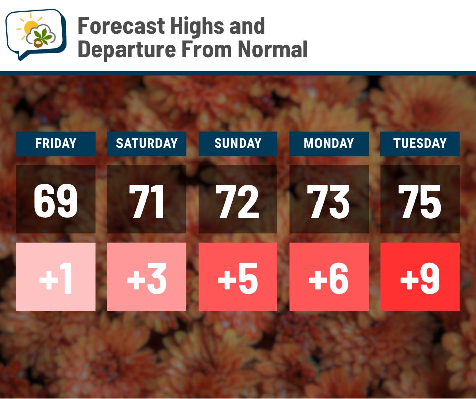
We should add in a degree or two each day through early next week, eventually peaking in the mid-70s on Tuesday. That’s nearly 10 degrees above normal, but still quite agreeable for the middle of October.
Morning lows will also be warmer, only falling to near 50 the next several mornings.
It looks like temperatures should come down again starting next Wednesday.
🤏 Weekend shower chance remains low, but isn’t zero
I’m still watching for a disturbance that’ll slide out of Canada and into our region this weekend. Some forecast guidance suggests that showers may develop more than originally expected, but northeastern Ohio is definitely favored compared to central Ohio.
Here are the odds of measurable rain this weekend from the National Blend of Models:
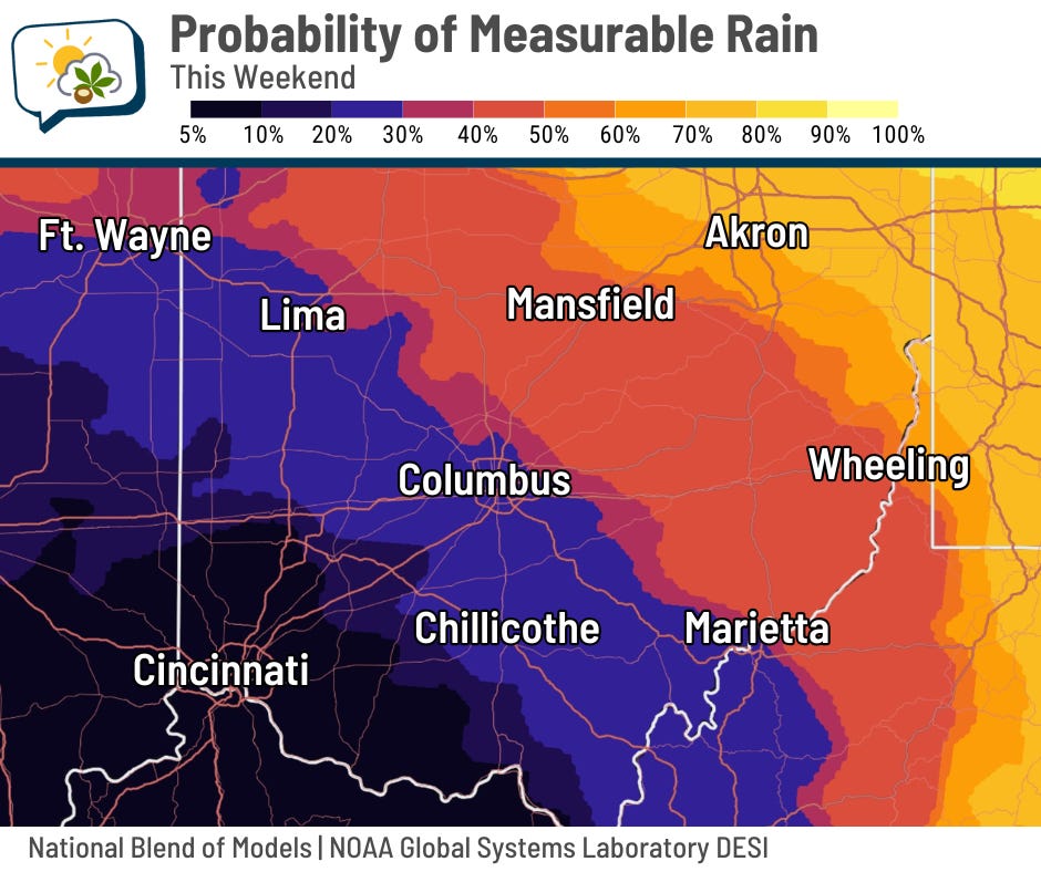
Much of the other data support this idea, and most of it actually would suggest even lower odds than this does. While the disturbance will almost certainly bring about more clouds than we’ve had to finish the workweek, those clouds will have a hard time actually producing any rain here. And if they do, amounts ought to be quite light.
📊 Today’s almanac
Normal low/high: 47 / 68
Record low/high: 29 (1925) / 87 (2010)
Sunrise/set: 7:37 a.m. / 6:59 p.m.
🍁 Fall foliage update
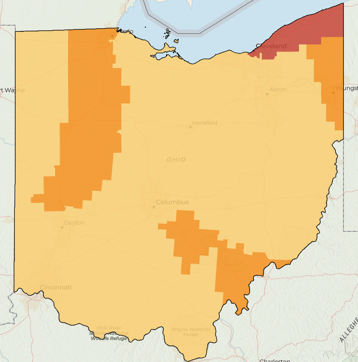
The Ohio Department of Natural Resources updated its fall foliage report yesterday.
It shows that most of the state is still changing (light orange), but some areas are approaching peak color (dark orange). That’s the case northwest of Columbus, as well as down toward the Hocking Hills and Athens. Colors in far northeast Ohio are currently at their peak (red).
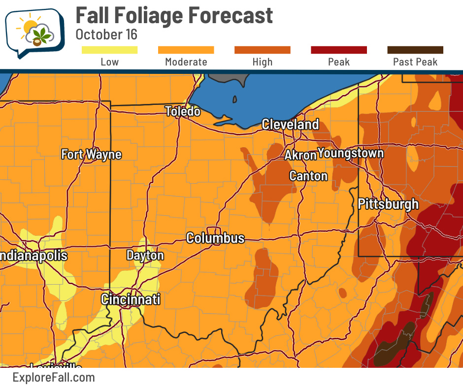
ExploreFall.com’s foliage forecast for the end of next week indicates that high levels of color will become more more common in parts of eastern Ohio. Their current color estimate differs from the Ohio DNR report, though, notably in northeast Ohio and western portions of the state. So, some aspects of their foliage model might be a little off.
Regardless, we are moving into the typical peak of foliage season over the next couple of weeks.
🌭 For the weather weenies
-
ODNR Division of Geological Survey invites Ohioans to celebrate Earth Science Week (Ohio Department of Natural Resources)
-
A nor’easter will target the East Coast this weekend with coastal flooding, heavy rain, winds (The Weather Channel)
-
What the Pacific ‘blob’ + La Niña means for winter in the U.S. (CNN)
-
1,000 Mars dust devils! European orbiters track Red Planet’s tiny tornadoes (Space.com)