The 614cast
Today’s tl;dr
🌤️ Areas of fog early, turning mostly sunny. High in the mid-70s.

Forecast highlights
😵💫 Topsy-turvy temperatures
The shoulder seasons of spring and fall can have some pretty decent variations in the weather over a short span, and the next week has some of those.
We’ll add another day in the mid-70s today before a cold front swings through early tomorrow, dropping highs back to seasonable 60s.
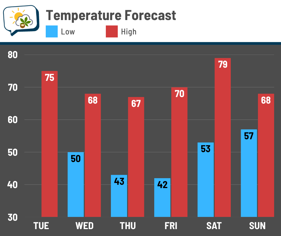
A mild airmass lurking to our west shoves into the region on Saturday, sending highs well into the 70s… and if cloudiness can hold off, we might even push 80. Yet no sooner does the temperature jump up than it drops right back again to start the new week.
🌧️ Weekend rain
I still have high confidence in rain this weekend. The timing is still in question (more on that in a moment), but for now, the thinking is late Saturday into Sunday.
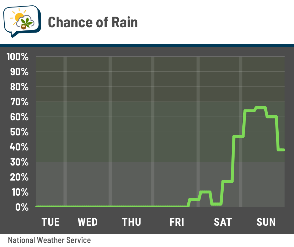
The two primary forecast models differ on when the bulk of the rain will fall. The Global Forecast System (GFS) model, which I’ll refer to as the American model, has a faster progression for the weekend system. It brings the rain in earlier on Saturday and has it out pretty early on Sunday. Meanwhile, the European model is slower.
You can see the differences in the image below, valid early Sunday afternoon. It shows the forecast rainfall for the six hours leading up to then (so roughly mid-morning to early afternoon Sunday). The American model has the rain largely off to our east already at that point. The European model, on the other hand, still has another batch of rain to our west yet to swing through.
The outcome is likely not going to be as cut-and-dried as either of these forecasts currently depicts. The saying “all models are wrong, but some models are useful” exists for a reason! But it helps illustrate the disagreement on timing this far out.
📊 Today’s almanac
Normal low/high: 45 / 66
Record low/high: 28 (1988) / 86 (2021)
Sunrise/set: 7:41 a.m. / 6:53 p.m.
😧 Crane flies!
If your neighborhood is anything like mine, it’s been invaded by crane flies. If you’re unfamiliar, they look like huge mosquitoes.
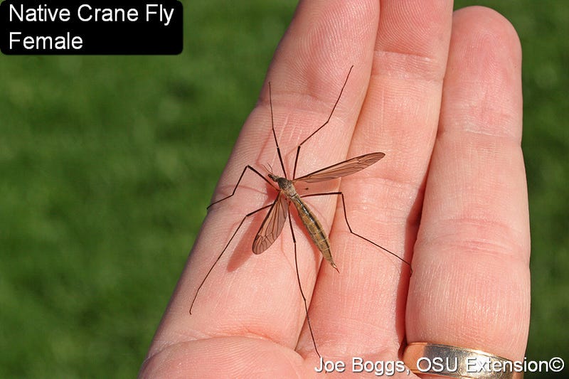
But unlike mosquitoes, they don’t have the mouthparts needed to puncture skin and drink blood, according to the OSU Extension. Even though they’re super annoying, they’re not harmful to people or animals.
The tough-skinned larvae are called leatherjackets and are sometimes seen after wet weather. I personally have not seen the larvae, but clearly there are plenty of them around to produce so many adults flitting about.
From OSU Extension:
Like the adults, the larvae occasionally appear en masse spilling onto driveways or sidewalks, especially after heavy rainfalls. Such a dramatic appearance in a landscape may signal that the lawn has a thatch problem since the larvae are particularly fond of decaying thatch. However, the native species found in Ohio cause no damage to the turfgrass.
Of course, if you have a thatch problem and they’re munching on that thatch, they’re at least a little helpful…
For more crane fly insights, head over here. (Note that it was published in October 2023, so some of the information pertains to that year.)
🌭 For the weather weenies
-
Historic coastal flooding strikes western Alaska (Balanced Weather)
-
Why less land has burned in much of the West this year (Washington Post)
-
Study shows smaller hail may be more damaging to roofs than once believed (Insurance Journal)