The 614cast
Today’s tl;dr
⛅ Patchy fog early, then partly sunny with a high in the upper 60s.

Forecast highlights
⬇️ Temperatures dip
Yesterday capped our four-day run of highs in the 70s. We should come up a just bit short today thanks to a cold front passing in the morning, allowing another bout of Canadian high pressure to slide in.
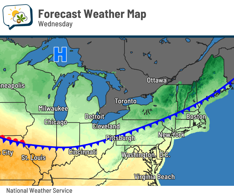
Outlying areas could have patchy frost again the next couple of nights, but mainly Friday morning.
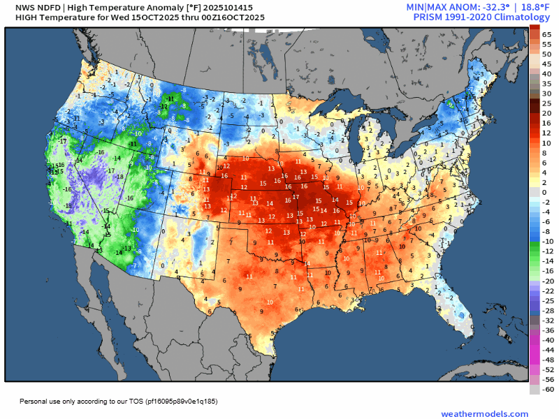
Upper 60s are still a smidge above average. And after spending few days fairly close to mid-October normals to round out the workweek, a surge of warmth that’s currently off to our west arrives on Saturday.
Highs approaching 80 will be 15-plus degrees above normal.
Temperatures drop again thereafter, although you’ll see that relatively mild weather again builds in parts of the Midwest and Plains again early next week.
🥴 Weekend whiplash
The temperature changes this weekend are part of the weather whiplash. Sunday will be some 10 to 15 degrees cooler than Saturday, and it’ll probably come with some wind. Nothing major, but noticeable.
That temperature contrast is courtesy another cold front that also drives the rain that’s coming — a change from the week-and-a-half of dry weather.
Forecast guidance still has timing differences, but I continue to believe the most likely period is Saturday evening to Sunday afternoon. I doubt it will be raining continuously that whole time, but that seems to me the time with the highest chances.
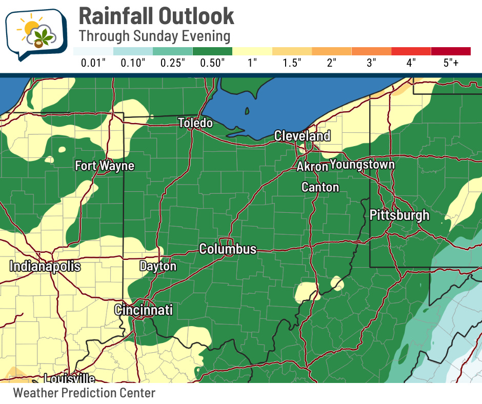
Rainfall amounts do not look as big as we had last Tuesday when widespread amounts of 1–2” fell. The current expectation is for totals to generally be less than an inch.
📊 Today’s almanac
Normal low/high: 45 / 66
Record low/high: 30 (1894) / 90 (1897) – latest 90 on record
Sunrise/set: 7:42 a.m. / 6:51 p.m.
🛰️ Summer to fall, from space
It’s been about a month since I shared an image showing the change in the landscape from August to September, as seen from satellite.
Let’s see how things have progressed into October. Each of these snapshots is about one month apart from the previous.
You can see the dark greens of the landscape in August allow the cities and towns to stand out. In September, we see greens fading to browns and tans as things begin to dry out (a little more than otherwise due to drought). Finally, the October image shows considerably less green in the agricultural areas of western Ohio. Eastern Ohio and its forested landscape still are hanging onto green… for now.
If you’re curious if fall foliage is visible on satellite… the answer is yes.
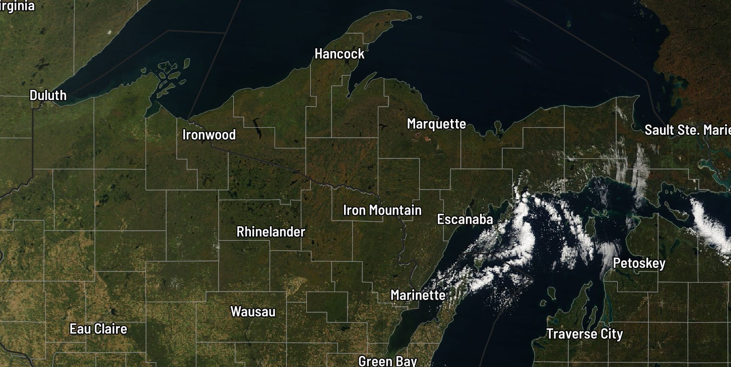
Here’s the view from the other day in the Northwoods of Wisconsin and the Upper Peninsula of Michigan. You can see splotches of deep orange, especially if you look north of Iron Mountain.
🌭 For the weather weenies
-
Typhoon leaves flooded Alaska villages facing a storm recovery far tougher than most Americans will ever experience (The Conversation)
-
Ryanair flight landed at Manchester airport during Storm Amy with six minutes of fuel left, flight log suggests (The Guardian)