It’s almost the weekend… and it’s going to be quite a changeable one. Let’s just say that Sunday will look and feel a lot different than Saturday.
The 614cast
Today’s tl;dr
🌤️ Morning sun, then increasing clouds in the afternoon. High in the upper 60s.

Forecast highlights
🪙 Weekend of change
Yes, I did use a coin emoji for “change.”
We’re on cruise control today, so let’s jump right into the weekend. Saturday’s going to be a warm one with highs near 80. The record high of 83 ought to be safe, but we’re still talking temperatures that are about 15 degrees above average.
The evening will also feel fairly humid as dew points rise to near 60. If you’re out and about, it will not feel like mid-October.
There’s still a low-end chance of a sprinkle or light shower early Saturday, but the bulk definitely waits until Saturday night into Sunday.
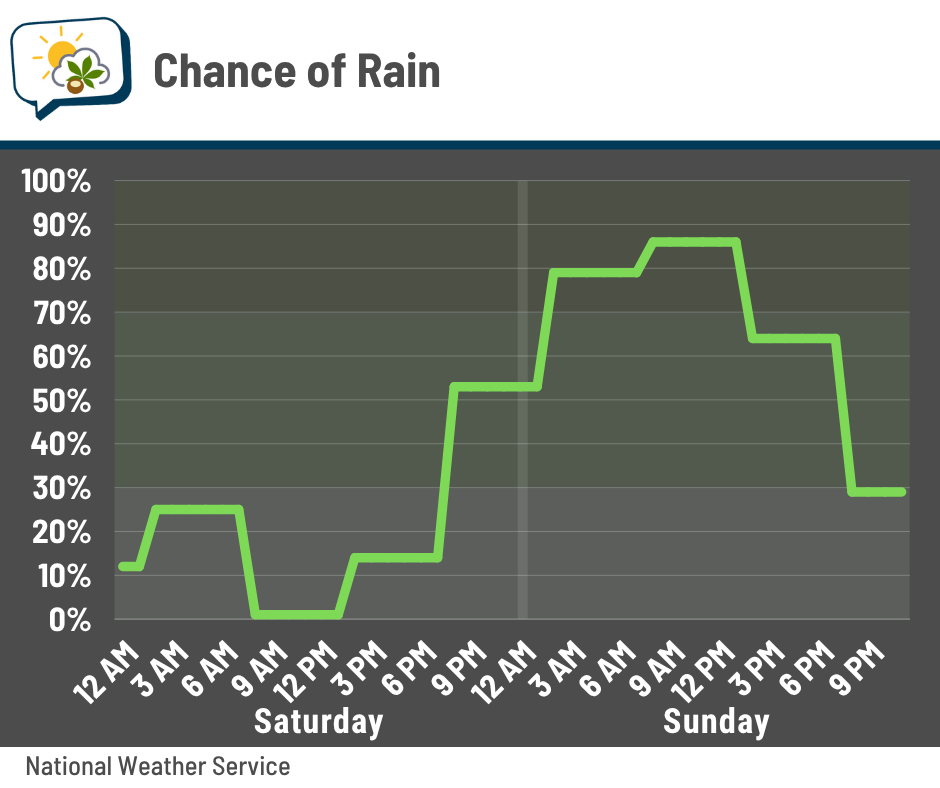
As far as how much rain to expect… well, this is an area I don’t have a lot of confidence. The average from the National Blend of Models, along with official forecasts, call for over an inch.
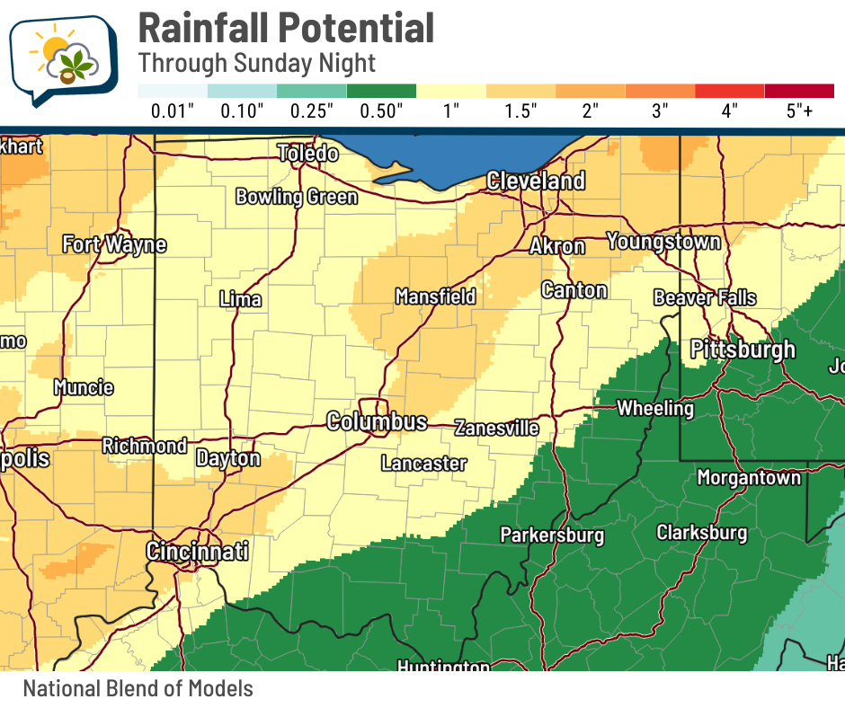
That said, some guidance comes in a fair bit under that. I think at least a half-inch is very likely and an inch is possible. But an inch-and-a-half, I’m skeptical about. I won’t totally discount it, but I think that’ll be a stretch.
A cold front pushes through Sunday morning, so temperatures will slowly fall through the 60s most of the day. Combine that with rain — or even if it’s not actively raining, the dampness — and wind, and you have a pretty gnarly day.
Sustained winds will be blowing along at 15–25 mph with gusts over 30 mph. They should be strongest in the afternoon and early evening.
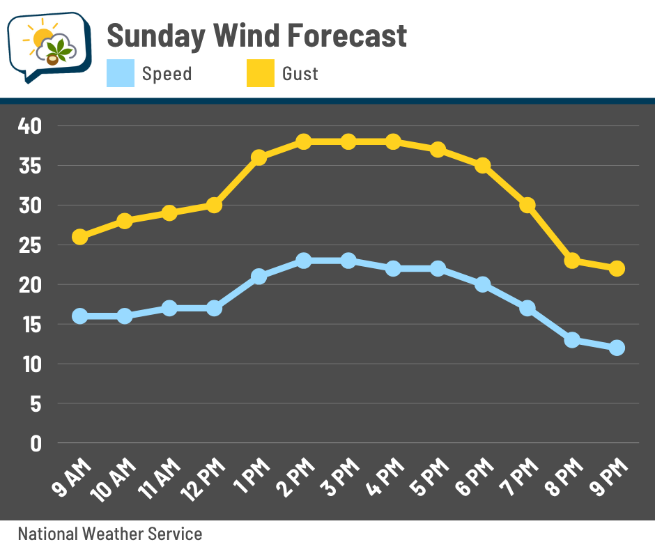
If any storms can develop, they could produce locally higher gusts. Strong storms are unlikely because of a lack of unstable, or “energetic” air, but other ingredients will be present in the otherwise marginal environment.
⤵️ Seasonably cool next week
Highs early next week should be locked in the mid-60s. Another weather system passes on Tuesday, which brings a chance of showers and a reinforcing push of cooler air.
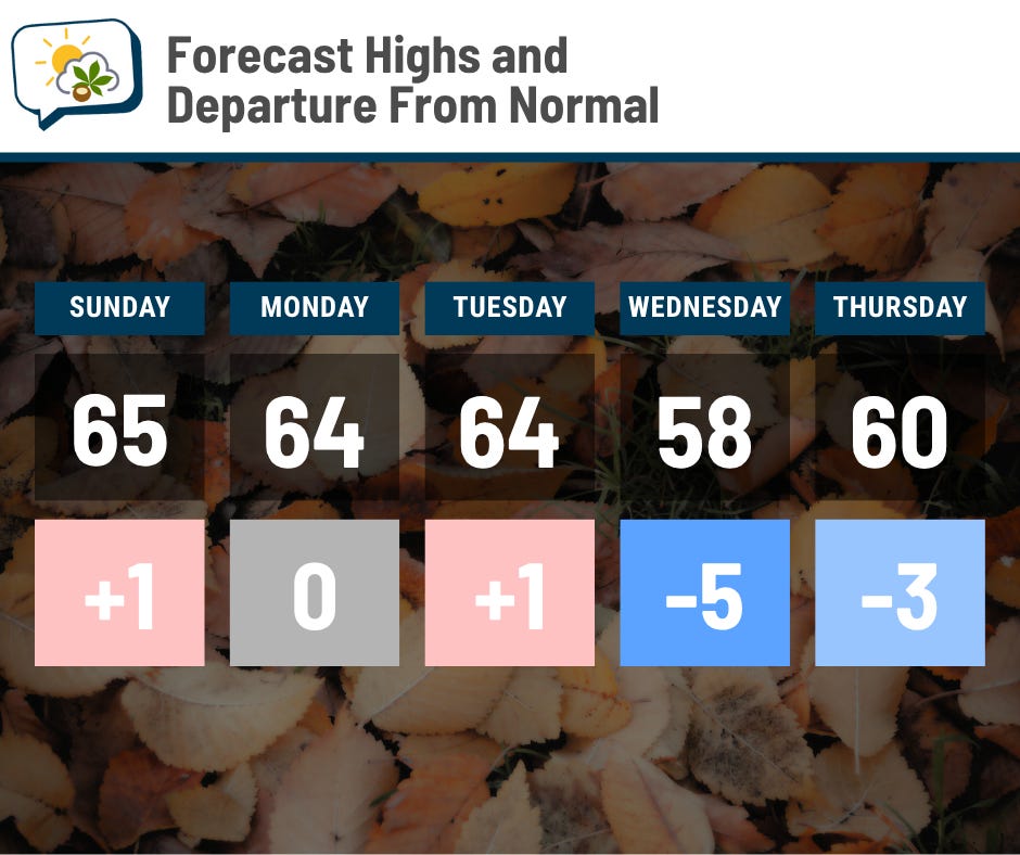
The coolest air of the season arrives in its wake; Wednesday might not make it out of the 50s. As you can imagine, morning lows will probably be chilly, too. We have several opportunities for frost later next week.
📊 Today’s almanac
Normal low/high: 44 / 65
Record low/high: 26 (1977) / 83 (1968)
Sunrise/set: 7:44 a.m. / 6:49 p.m.
💧 Drought conditions improve
This week’s Drought Monitor incorporated last Tuesday’s rain, and even though it was dry for the following week, our drought situation got better.
Here’s the map of the change from last week’s update to this week’s:
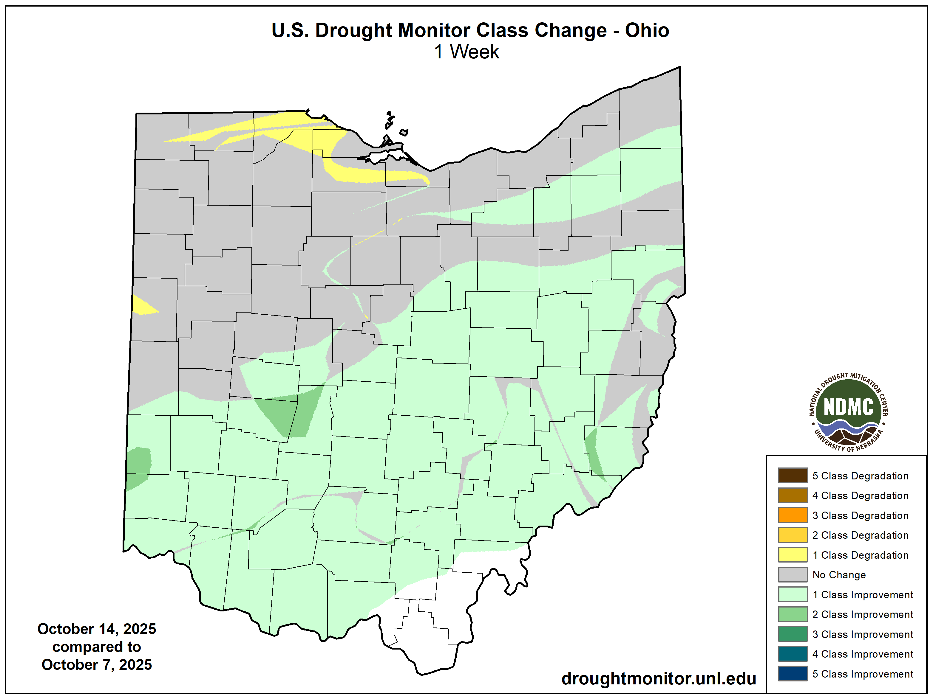
A large part of Ohio saw drought conditions improve by one category, with some pockets even jumping two categories. In fact, the amount of the state in moderate drought or worse was halved from the previous week, going from 73% to 37%.
Columbus is now in “abnormally dry” conditions and out of actual drought.
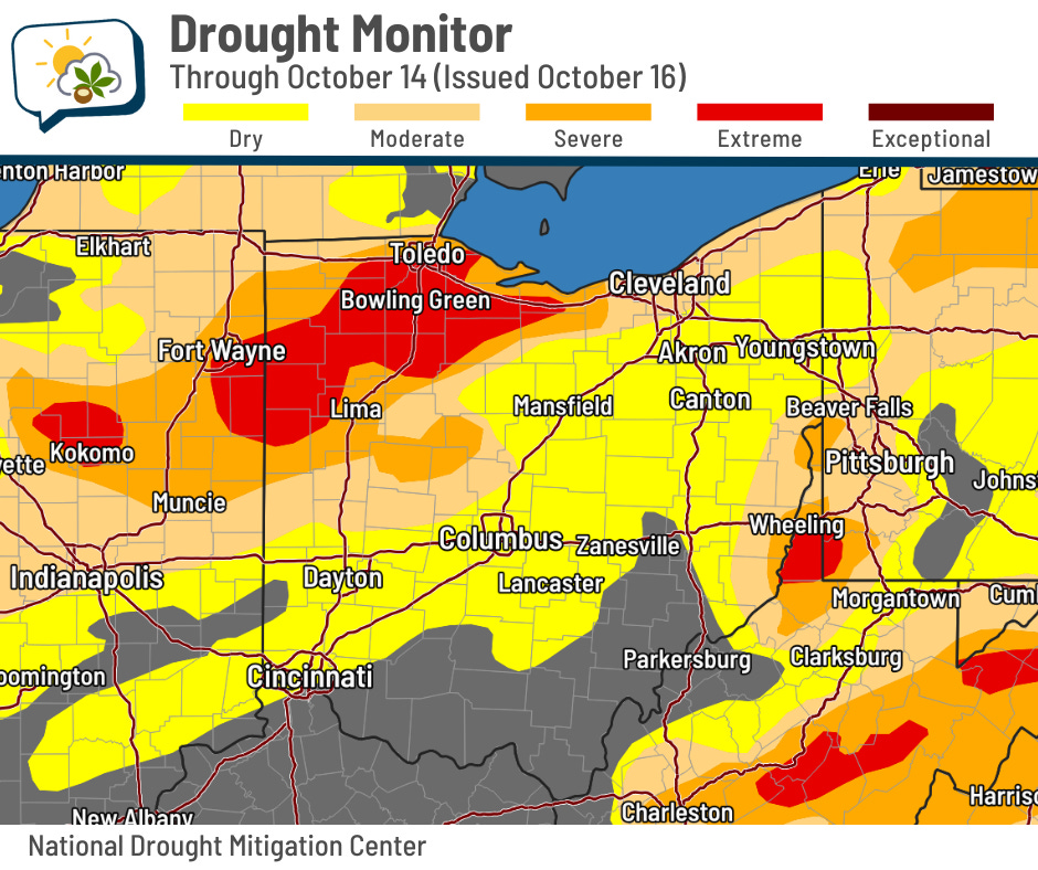
Northwest Ohio remains in extreme drought.
🌭 For the weather weenies
-
Drought lowering Mississippi River levels again, disrupting shipping (AccuWeather)
-
For private flood insurance companies, the government shutdown is good for business (NPR)
-
Warming worries of a once-doubtful climate scientist (Sustain What)