➡️ Yesterday’s high was the coolest since the end of May. Highs in the 50s later this week will be the first since May 22 (high of 57) and possibly the coolest since mid-April — six months ago.
The 614cast
Today’s tl;dr
🌦️ Brief rain early, then partly sunny and breezy with showers again in the evening. High in the mid-60s.

Forecast highlights
2️⃣ Couple bouts of showers
One band of rain is passing by first thing this morning and wastes no time kicking out of here. After it’s passed, we should have a lull for much of the day with some sunshine coming through. Another batch of rain is possible this evening, probably between 6 and 9.
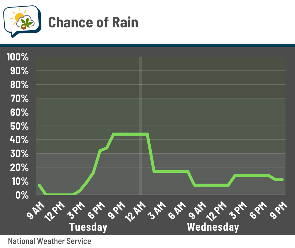
There’s not a lot of energy with this system, but you might hear a rumble of thunder from the evening activity.
Rain chances are pretty low tomorrow, but not zero. The bulk of the showers stays in northern Ohio, but some of them could try to graze our area.
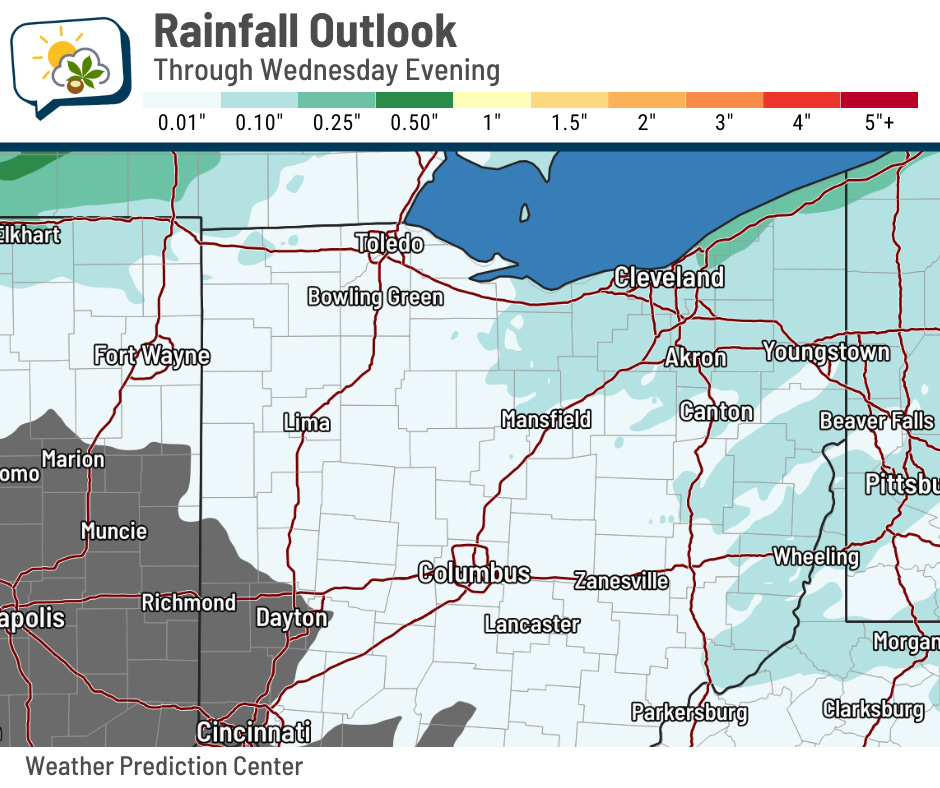
Since this system doesn’t have much moisture and the rounds of rain won’t last very long, rainfall amounts will be pretty light. We should generally be under a tenth of an inch, unless you get lucky. Relatively higher amounts will be to our north where showery weather is more prevalent.
🍃 Cool breezes
Today’s the warmest day of the week with highs in the mid-60s, followed by highs in the 50s. In any case, it’ll feel cooler thanks to the fall breezes.
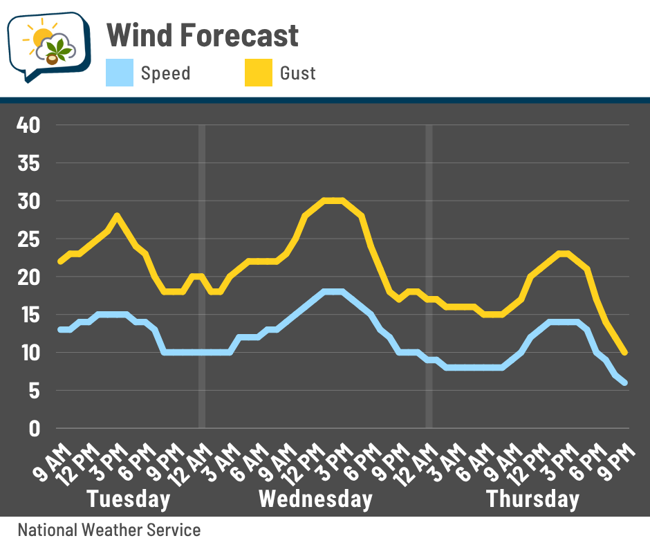
Sustained winds will be around 10–15 mph with gusts topping 20 mph each day. Wednesday looks like the windiest with gusts around 30 mph, perhaps a bit higher. That’s not unlike what we had on Sunday.
We will definitely feel an extra little chill in the air, especially Wednesday and Thursday.
📊 Today’s almanac
Normal low/high: 43 / 63
Record low/high: 17 (1952) / 83 (1953)
Sunrise/set: 7:49 a.m. / 6:43 p.m.
❄️ NOAA releases its winter outlook
NOAA’s Climate Prediction Center (CPC) updated its winter outlook last week.
Locally, there’s no strong leaning any direction for temperatures; it’s currently a one-in-three shot each for above, near, or below-normal temperatures.
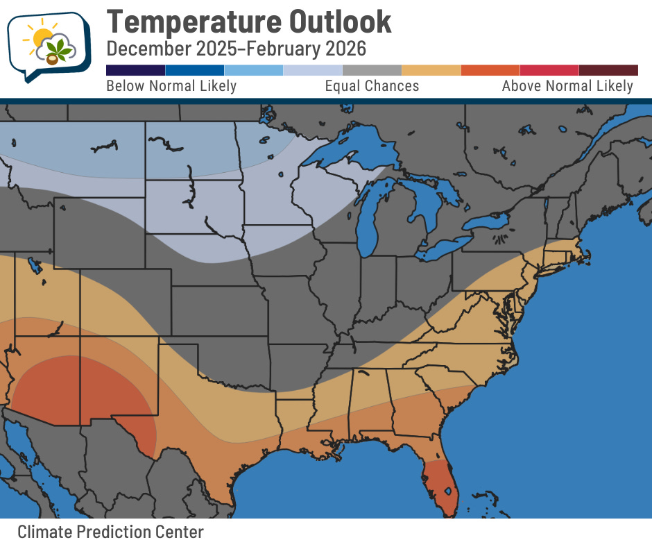
The southern U.S., along with parts of the East Coast, are favored to be warmer than average. Meanwhile, the Upper Midwest toward the northern Rockies leans toward being cooler than average.
Precipitation, on the other hand, is favored to be above normal in our region. CPC has us in a 45% chance of winter ending wetter than average, compared to a 33% chance of near-normal precipitation and a 22% chance of being drier than average.
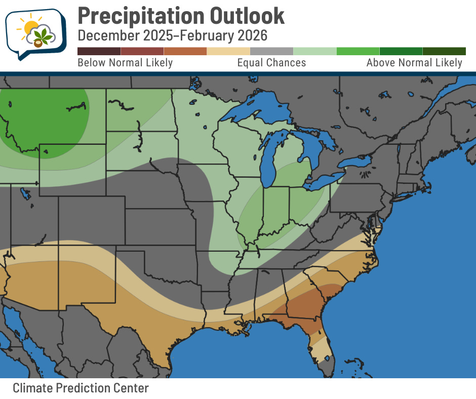
Keep in mind that this doesn’t necessarily mean more snow. That depends on what temperatures are like when stuff’s actually falling from the sky, not the broad trend over three months.
CPC’s forecast is driven in part by the expectation of a weak, short-lived La Niña pattern this winter. La Niña is when ocean surface temperatures in a particular area of the equatorial Pacific Ocean are cooler than usual. This is tied to broader weather patterns that drive what we can experience here. In general, La Niña winters tend to be wetter in our region.

The map above is a broad generalization of what is typical, not a guarantee. You might notice that the CPC outlooks align with it fairly closely, though. They’re also watching other factors. There’s the potential for a “wavier” jet stream and weaker polar vortex (yes, it’s a real thing) working together to push intrusions of arctic air into the central and/or eastern U.S. … but those cold air outbreaks can just as easily spill into Europe and Asia.
You can read their detailed discussion here.
🌭 For the weather weenies
-
Lava visible in nighttime satellite imagery (Cooperative Institute for Research in the Atmosphere/Bluesky)
-
Illinois wants climate education in schools. Now teachers need to figure out how to make it happen (Inside Climate News)