Catching you up on developments since Friday’s newsletter…
🌀 Hurricane Melissa, located in the Caribbean, rapidly intensified over the weekend. It’s expected to be the strongest hurricane on record to directly strike the island and will have catastrophic, long-lasting impacts. You can follow the National Hurricane Center’s updates here. Colorado State’s Center for Research in the Atmosphere has been regularly posting eye-popping satellite loops on their Bluesky.
This is a loop from Sunday morning when it was a Category 4 storm with estimated top sustained winds of 140 mph.
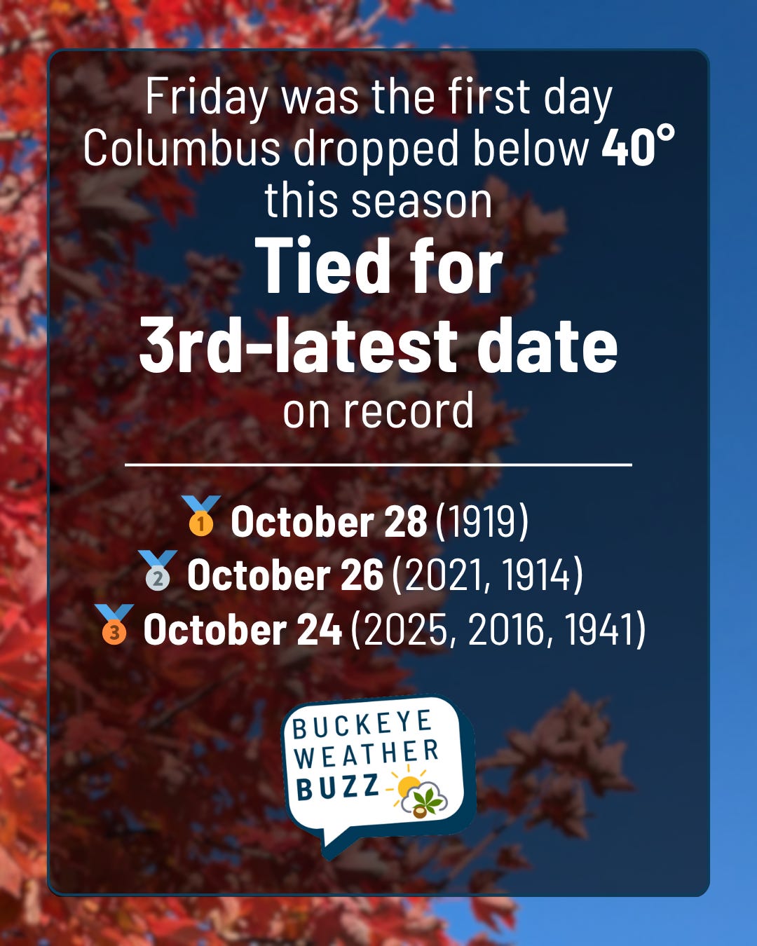
🥶 CMH fell to 34° both Friday and Saturday morning, by far the coldest it’s been so far this season.
The 614cast
Today’s tl;dr
🌤️ Sunshine with passing high clouds, high in the lower 60s.

Forecast highlights
🏔️ Today’s the peak of the week
Yesterday was a gorgeous fall day… the sunshine felt warm, but there was enough of a breeze to provide a crispness to the air.
Today’s going to be pretty similar, albeit with some high, thin clouds passing over. Highs will still make a run just past 60. It’s downhill from here in the temperature department, though.
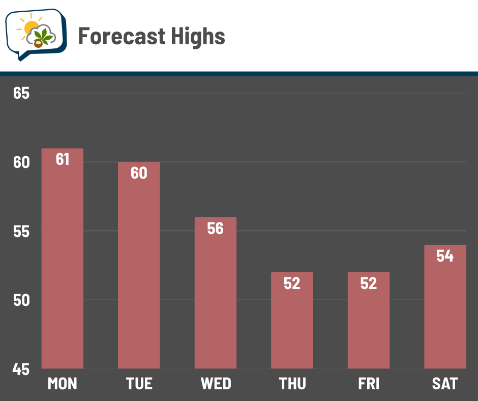
Okay, so tomorrow should still be near 60, which is not a noticeable difference… after that, temperatures tumble some. Thursday’s lower 50s might even be a little optimistic.
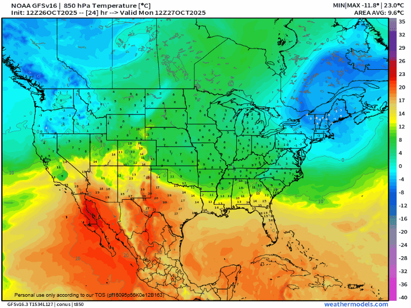
A pocket of cooler air aloft will rotate into the region later this week as a weather system pulls through. After it passes, we should have some recovery back up closer to seasonal averages.
💧 Wetter starting Wednesday
That weather system that draws in cooler air will also bring extensive clouds and rain later this week.
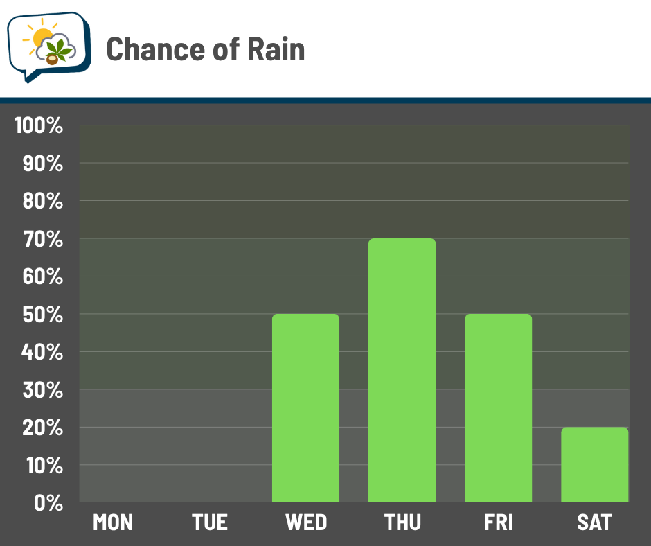
Wednesday’s rain chance may wait until later in the day… details are still TBD for that. But Thursday is not looking very good amongst virtually all guidance right now. It appears a shield of fairly steady rain may be moving through, making for a rather unpleasant day. For many — including where we live — trick-or-treating is Thursday evening. (Find your local trick-or-treat info here.) Since that’s still a few days away, things could shift… but I’m not very optimistic right now. 😬
Some showers remain possible on Friday, probably favoring early in the day, as that system pulls away.
📊 Today’s almanac
Normal low/high: 41 / 61
Record low/high: 20 (1962) / 81 (1963)
Sunrise/set: 7:55 a.m. / 6:35 p.m.
🌡️ 70s aren’t necessarily done for good
This might be hard to believe, but the weekend before this past one, we hit 82 and 72. Since then, the warmest high was 65 and there aren’t any 70-degree highs in the near future. Are they gone until next spring?
Maybe, but don’t bet on it yet.
There’s a huuuuge spread in the last date of the last 70-degree high. The earliest on record was October 3, in both 1972 and 1925. The latest was December 10, 1971.
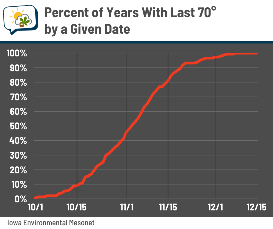
Half of years have their final 70-degree day after November 3 (or before it, if you’re glass half-empty). So, if we still have one after a week from now, that’s really not strange at all. But only 25% of years had their last 70-degree day after November 12… so if we haven’t done it again by then, we’re on borrowed time.
Columbus’ last 70-degree day was in November in seven of the past 10 years.