🗳️ It’s Election Day! Local elections really ought to have higher turnout than they do, since local issues are of such importance to our day-to-day life. If you haven’t voted yet, check here to see where your polling place is and get your ballot in!

The 614cast
Today’s tl;dr
⛅ Partly cloudy and less windy, high in the upper 50s.

Forecast highlights
👍 A few more respectable days…
… until the bottom drops out early next week.
Highs are still on track to be near or above average the rest of the week — even on Friday, which will be cloudy and eventually rainy.
Below is the European forecast model of temperature anomalies about a mile up, which serves as a nice way to get a sense of airmass trends here. We have a couple bouts of relatively mild air that swing through tomorrow and Friday (highs in the 60s); otherwise, it’s fairly close to average.
Until the end of the loop. 😱
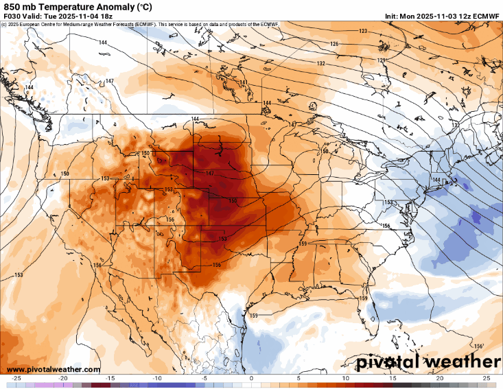
There’s strong agreement among guidance that things will turn decidedly chilly early next week. Just how chilly is up in the air, but there’s reason to believe we might struggle to get past 40 for a high on Monday.
So, enjoy the decent temperatures while we have them.
A couple other notes:
-
Cloudiness today will be mid to high level clouds, so we may still get some brightness filtering through even during the more overcast periods.
-
Today’s less windy, but winds are up there again tomorrow (sustained at 10–20 mph, gusting past 30) and Friday.
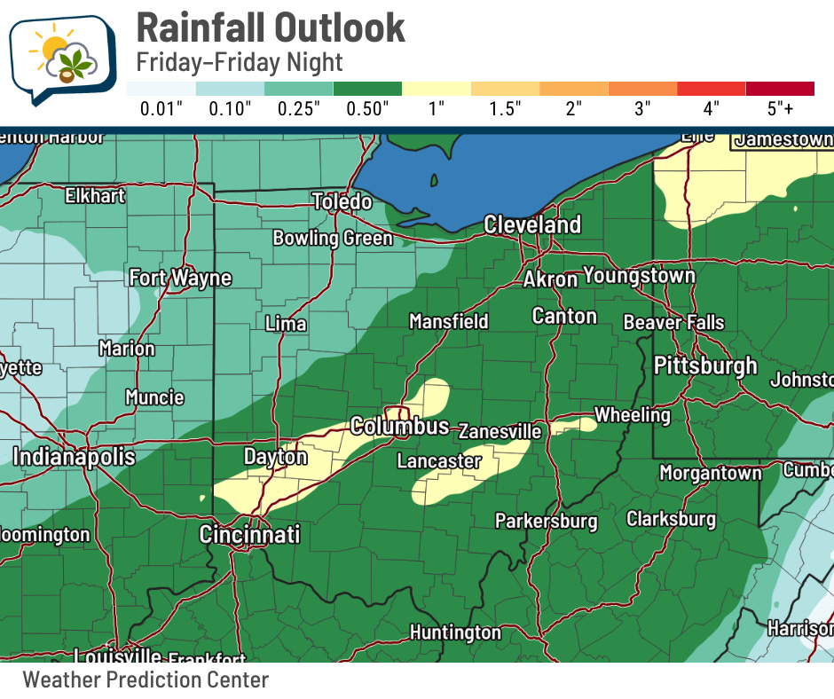
🌧️ Turning wet — and maybe a little wintry
It still looks like the weak system moving across the Great Lakes tomorrow should not affect us with any sprinkles or light rain. Friday, on the other hand, still looks wet. In fact, I’m just going with a 100% chance of rain already. If that system ended up not giving us rain, it would be a colossal shock.
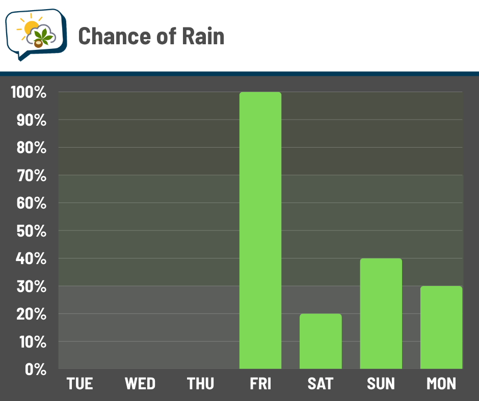
A half-inch to inch of rain on Friday looks like a very solid bet.
That system kicks out pretty quickly with only a meager shot at lingering light rain on Saturday.
Another disturbance may bring light precipitation Sunday–Monday… note that I use the word “precipitation” and not “rain.” If there’s enough moisture around, temperatures might be cold enough to support some wet snowflakes. No guarantees on that, but it’s a non-zero chance.
📊 Today’s almanac
Normal low/high: 38 / 57
Record low/high: 18 (1991) / 78 (1987)
Sunrise/set: 7:04 a.m. / 5:25 p.m.
🦫 November brings the Beaver Moon
The next full moon is upon is! It’s technically fullest tomorrow morning at 8:19 a.m., after it’s slipped below our horizon. But no worries; it’ll appear full both tonight and tomorrow morning. Clouds will be thinning later this evening, and we’ll have a clearer sky tomorrow night.
The common name for this full moon is the Beaver Moon. At this time of year, beavers transition to their winter life, which was also a time when trappers would pursue them for their pelts.
Some of the Native American names also included “Freezing Over Moon,” “Leaf Fall Moon,” and “First Snow Moon.”
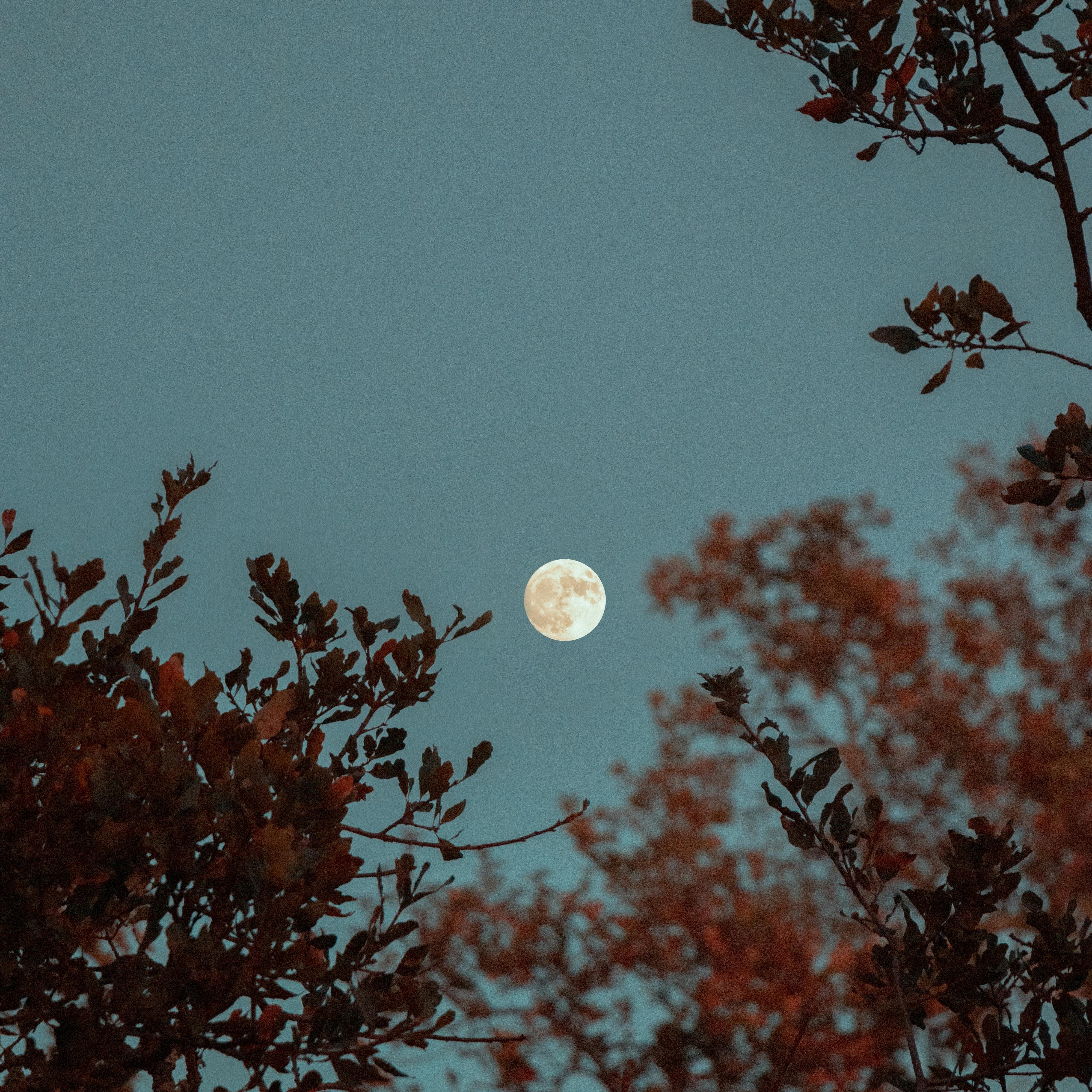
This is also the biggest moon of 2025: it’ll be at its closest point to Earth for the year at 5:30 p.m., according to Space.com. It’ll be 221,726 miles away. Even though it’s closest, don’t expect it to loom super large in the sky… you won’t really be able to tell a difference from other full moon.
While you’re out looking at the full moon, look up and to the right and you should see Saturn. The Big Dipper will also be rotating low on the northern horizon.
🌭 For the weather weenies
-
Solar farms can bloom with life, not just energy (Yale Climate Connections)
-
Researchers gain new insights into rare but costly windstorms (University of Oklahoma)
-
What happens if property insurers are allowed to exclude wildfires from coverage? (Moving Day)