The 614cast
Today’s tl;dr
🌧️ Windy with occasional showers and perhaps a thunderstorm, high around 60.

Forecast highlights
☔ Windy, a little wet, warmish
Regarding the rain, today will not be a soaking, sopping wet day. The nature of the rain looks to be showery and intermittent, but we have a decent chance anytime from later in the morning through late afternoon.
Here’s one high-resolution forecast model’s radar prediction. It starts at 7 a.m., then pauses at noon, 3 p.m., and 6 p.m., ending at 11 p.m.
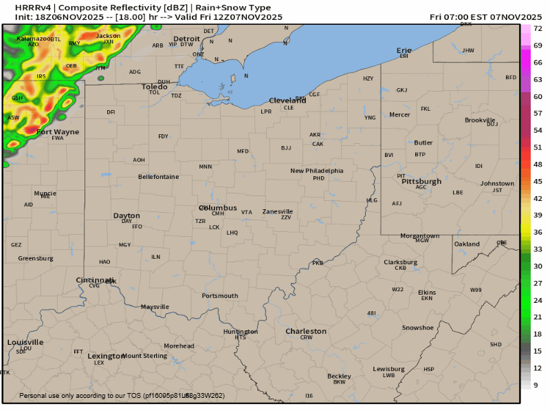
As you can sense from the map above, chances ramp up through the morning and drop off later in the afternoon, with activity largely out by evening. Another system (the one that dumps in the cold air) brings some spotty light rain then light snow later in the weekend into Monday… I’m still skeptical of much sticking.
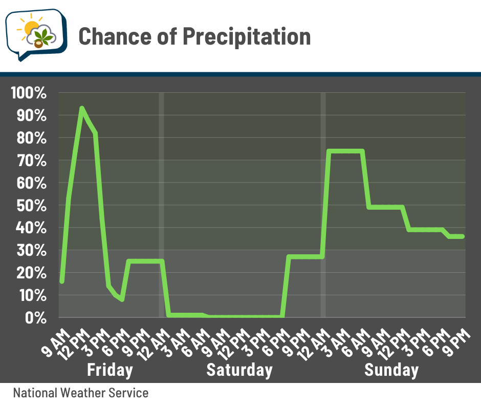
Rainfall amounts for today continue trending downward. 🙄 I’m not disappointed, though, since we’re out of drought and it’s November, so we don’t need rain so much. Plus, not getting drenched all day is nice.
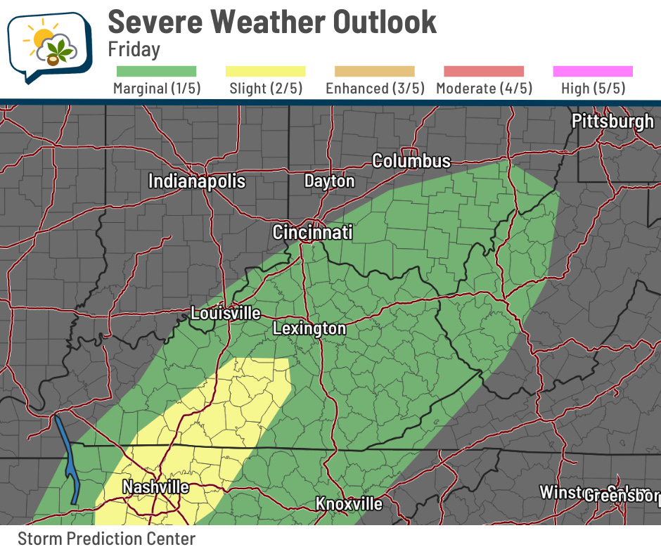
Regarding the storm chance, there’s a window in the afternoon when there might be enough meager energy for a storm or two, which could enhance already gusty winds. The Storm Prediction Center’s outlook yesterday afternoon had the marginal risk (level 1/5) of a severe storm a little farther southeast than the day before. (Here’s today’s latest outlook.)
Winds today will be from the southwest at 10–20 mph, gusting to around 30 mph. That’s close to what we had on Tuesday.
❄️ Upcoming chill will sting, but is brief
After a high around 60 both today and tomorrow, the bottom drops out for a few days. Sunday’s high in the upper 40s should happen early, with fairly steady or slowly falling temperatures most of the day.
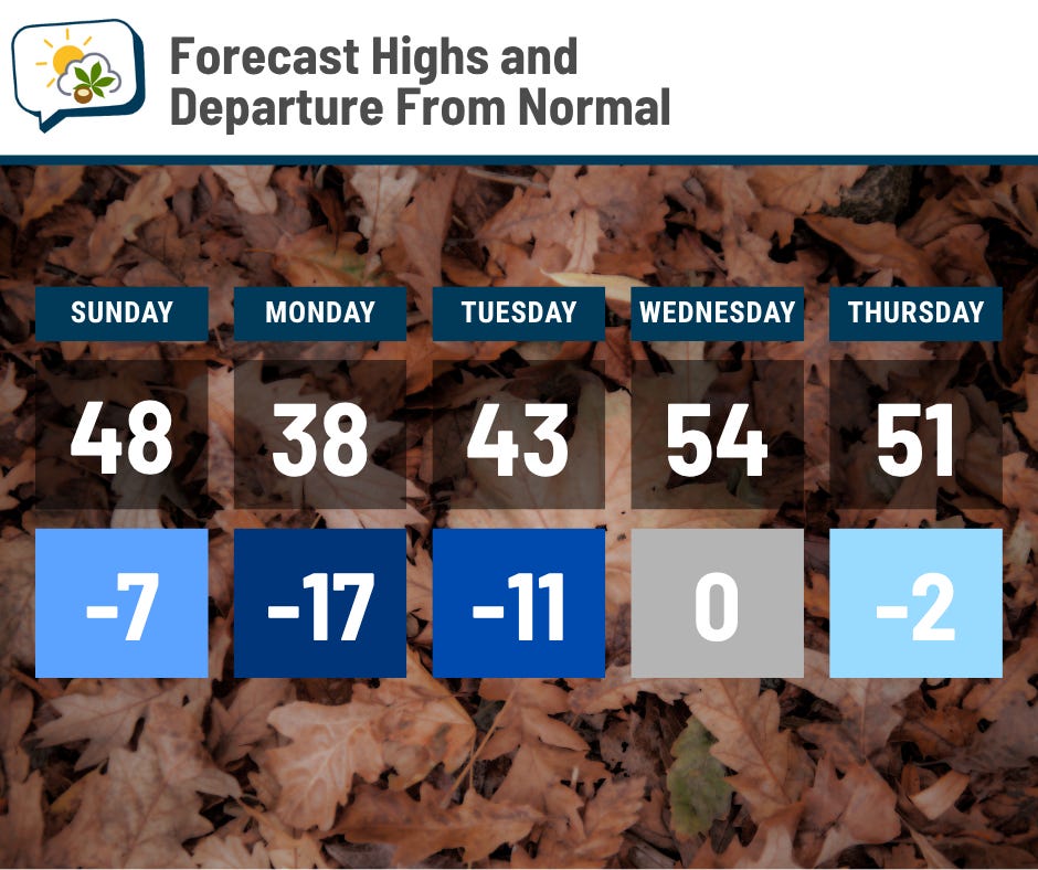
Monday’s going to be downright cold. A high of 38 — which is 17 degrees below average — will be accompanied by enough wind to keep feels-like temperatures in the 20s. It’ll be more typical of early January than early November.
But we’ll bounce back fairly quickly! Highs are already back around average on Wednesday.
To give you a sense of the breadth of this brief blast of cold air, check out this map of lows Tuesday morning.
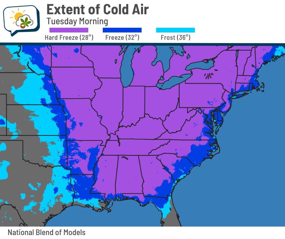
A hard freeze (28 degrees or colder) is expected to reach all the way to about the Gulf Coast. Record lows will be challenged across parts of the Southeast.
Locally, we’ll fall to the mid-20s that morning.
📊 Today’s almanac
Normal low/high: 37 / 56
Record low/high: 20 (1971) / 78 (1938)
Sunrise/set: 7:08 a.m. / 5:22 p.m.
🧊 First hard freeze
We’ll probably fall into the upper 20s Monday morning; 28 is considered a hard freeze.
The earliest on record in Columbus is October 11, 1964. The latest is November 30, 1902. It so happens that last year’s was the second-latest on record on November 29.
The average date of the first hard freeze for the 1991–2020 climate period is November 8, so this year will be very close to that mark.
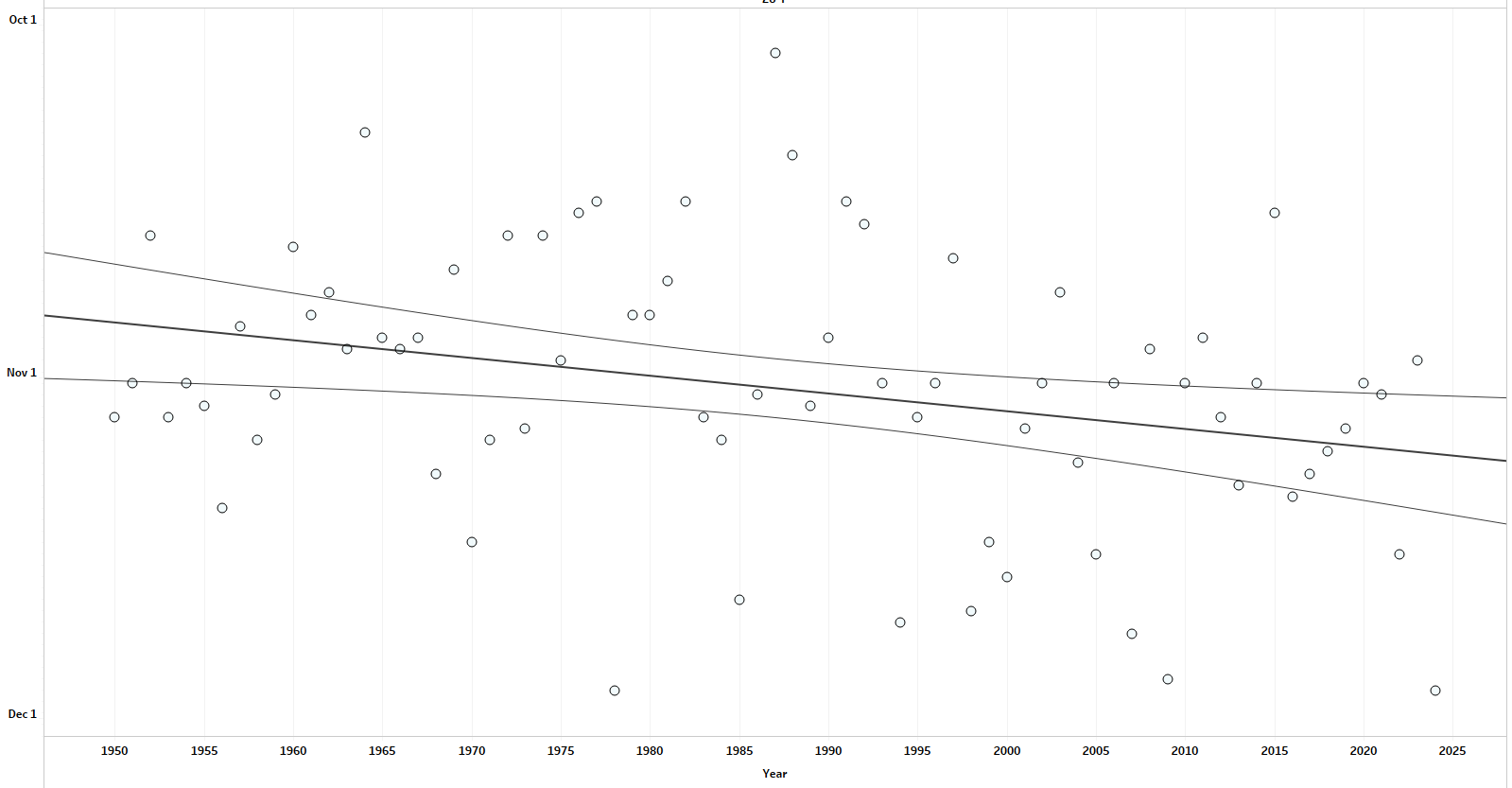
Data since 1950 show that the date of the first hard freeze has been trending later.
If you haven’t taken care of winterizing outdoor water stuff, tomorrow will be a good day to do that. Drain and disconnect garden hoses and flush your irrigation system, if you have one.
🌭 For the weather weenies
-
Fishermen missing in Vietnam as Philippines mourns dead from Typhoon Kalmaegi (Associated Press)
-
Columbus leaders brace for heating assistance impacts amid ongoing federal shutdown (WSYX-TV)