Surprise! I decided to send the Monday morning newsletter out this evening since there’s a bit of snow and stuff happening to kick off the new workweek. (You’ve probably heard. 😜) BTW, my very earliest subscribers may recall that I originally sent these in the evening before switching to mornings. But if people feel strongly that I should switch it back, I’d certainly consider it!
The 614cast
Monday’s tl;dr
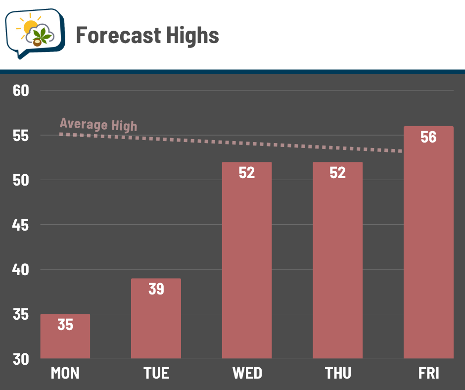
🌨️ Windy with occasional snow showers, high in the middle 30s.
Forecast highlights
🥶 Cold, periods of snow
The first couple snow events of the season are often a pain because there’s a lot of monkey wrenches that can get thrown into the forecast. So, let’s start with the one thing that we will absolutely deal with on Monday: cold.
Temperatures will really struggle to do much and top out only in the mid-30s, nearly 20 degrees below average. A wind out of the north or northwest at 10–15 mph, gusting to around 20 mph, will keep wind chills in the 20s throughout the day.

Heavy coat, hat, gloves… you’ll want it all.
Okay, now the snow. This is tricky, because it’ll be somewhat spotty and short-lived in nature, instead of a band of consistent snow moving through over the course of several hours like we have with most weather systems.
Timing: As of this evening, it appears the best timing is probably overnight through Monday morning, then a lull for afternoon before odds pick up some going into Monday night. In fact, we might actually get a brief breaking of the clouds late Monday.
Amounts: I expect generally around an inch or less, but exactly how much could vary a fair bit over short distances depending on how “bursty” any of the snow showers are. Forecast guidance seems to be favoring west of us for the early round of snow, so if you travel toward the Dayton area, for example, take that into consideration.
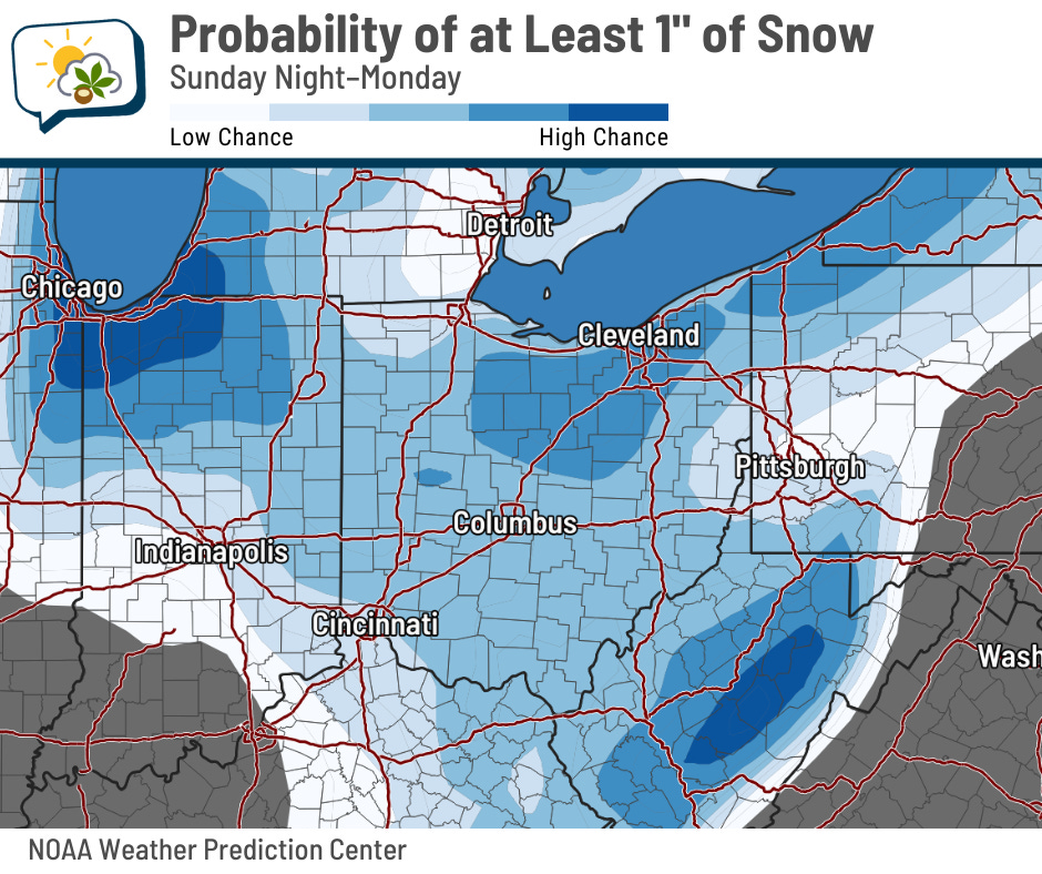
Below is the map of the Weather Prediction Center’s odds of getting at least an inch of snow from tonight through Monday. In the Columbus vicinity, it’s around a 60–70% chance… but that’s in total, and there’ll be melting to contend with. There’ll probably be less than that on the ground at any given time.
You can see that the highest odds are up closer to the lake. Some spots that direction could get a few inches, with the favored locations east of Cleveland going even higher.
Impacts: Most accumulation will be on grassy and elevated surfaces, mostly from any snow showers that can get going enough so their rate of snow can overcome the rate of melting. Since temperatures have been relatively warm recently, the ground is, too; soil temperatures this weekend were hovering around 50 degrees.
Be mindful of slick conditions on bridges and overpasses, since they will be more prone to snow sticking. (If you’re wondering why this happens, check out the section at the bottom of this newsletter.)
Long story short: Plan on manageable but slower conditions. Leave extra space between you and other vehicles, and if the road looks wet, assume it’s slippery and adjust accordingly. And as with any snow event, remember that things can change, so be flexible just in case that does happen.
📈 Warming back up soon
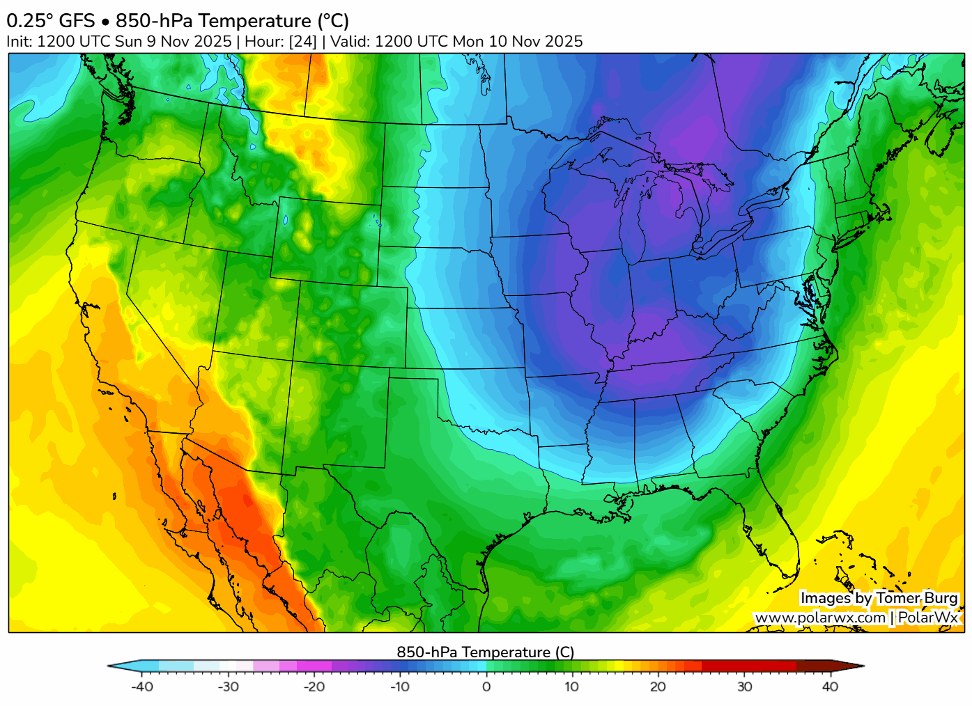
This unusually strong blast of cold air — enough to challenge dozens of record cool lows and highs across the Southeast Monday and Tuesday — will not last long.
The blob of blue exits stage right already on Tuesday, with moderating temperatures midweek before milder air aloft tries to shove in to end the week.
What does this mean for us? The next couple of days will be chilly, to be sure, but highs quickly rebound back into the 50s for the second half of the week.
📊 Monday’s almanac
Normal low/high: 37 / 55
Record low/high: 19 (1957) / 78 (2020)
Sunrise/set: 7:11 a.m. / 5:19 p.m.
⚠️ “Bridge ices before road”
You’ve seen the signs.
… no, not that one. This one.
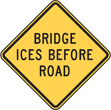
But why do bridges and overpasses freeze up before other roads? They’re all experiencing the same conditions, right?
Almost.
Roads lose heat only from the top, since they have ground underneath. And that ground can be relatively warm, so a bit of heat can radiate up to the pavement and keep it warmer than it might otherwise be. Meanwhile, bridges are surrounded by air on all sides, so they’ll lose heat in every direction. And if there’s wind, it’ll wick away heat so that the bridge temperature is near the air temperature even more efficiently.
Another aspect is the materials themselves. Roads are often paved with asphalt, which takes longer for its temperature to change — it’s a poor conductor of heat. Bridges are made of steel and concrete, which are better conductors of heat (especially the metal), so a bridge’s temperature changes more readily.
You can see the difference from this photo from the Mississippi Department of Transportation. The overpass they’re on still has snow covering some of the lanes, but if you look farther up the highway, more of the pavement is clear.

🌭 For the weather weenies
-
Where ODOT clears roads and where it doesn’t (Ohio DOT/Instagram)
-
Common moon mistakes (MinutePhysics/YouTube)