🛰️ Last night, NOAA’s Space Weather Prediction Center issued a Severe Geomagnetic Storm Watch. And the storm already produced aurora (northern lights) last night relatively far south! We had clouds around but maybe some of you got lucky and saw something.
Here’s a photo my sister took from back home in northwest Illinois:
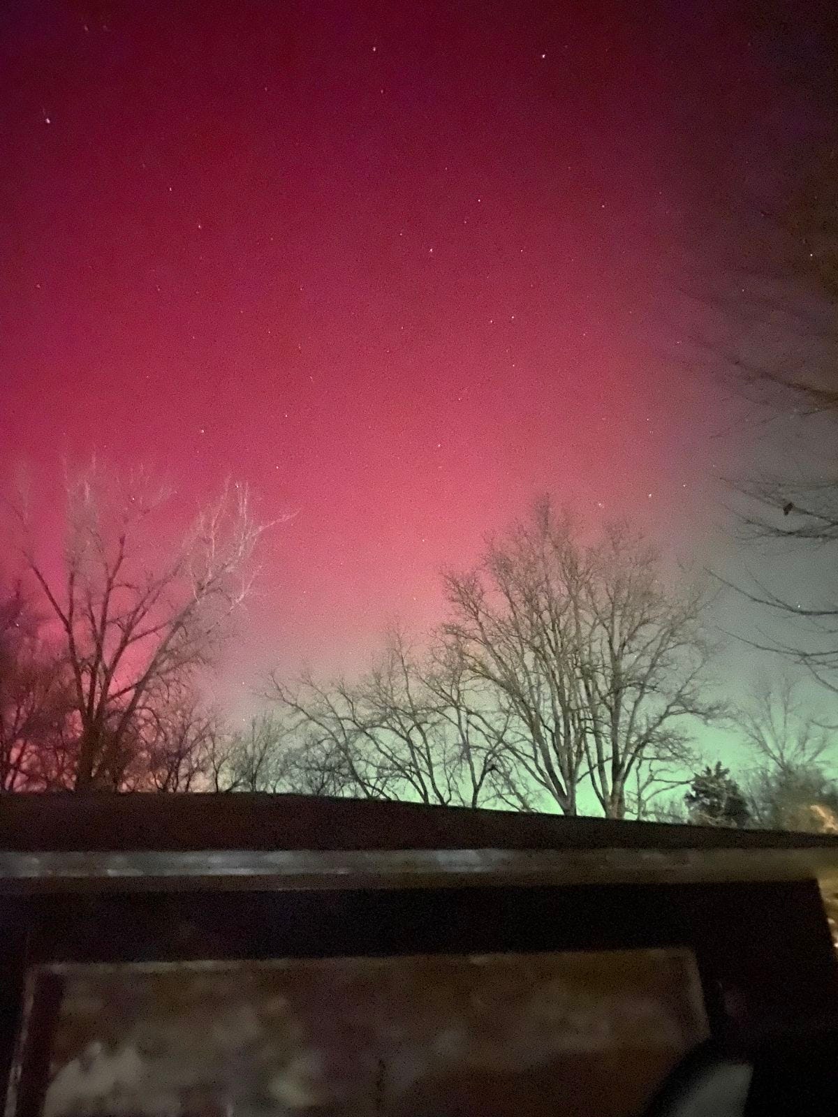
The geomagnetic storm could lead to increased potential for aurora to appear farther south than usual again tonight. BUT! Space weather is very tricky, even more than weather here on Earth. I always advise not getting your hopes up, and understand that even in good aurora situations, you need some luck.
Here are a couple of pages you can follow:
The 614cast
Today’s tl;dr
⛅ Morning clouds then afternoon sun, still a bit windy, high near 50.
Forecast highlights
❌ Dry until at least the weekend
Even though the snow the other day wasn’t that much, we still deserve the breather. And we still have at least a few more days of dry weather. The system that comes through this weekend is looking pretty meager as far as rainfall.
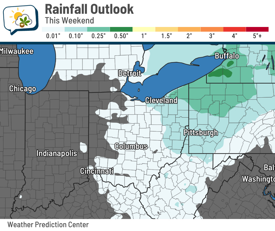
Forecast guidance is coming in pretty light on amounts… I think the highest I saw was, like, a tenth of an inch. Others keep us completely dry. Regardless, it looks like if we get anything, it’ll be more of a nuisance than anything.
Timing currently is mostly in the Saturday night to early Sunday timeframe.
🌡️ Moderating temperatures
After a couple of pretty cold days, we are on the rebound! Today’s still going to be chillier than average, but it’ll still be noticeably warmer… a nearly 15-degree jump from yesterday. That said, the wind will still be similar to the past couple days, 10–15 mph gusting around 20–25 mph.
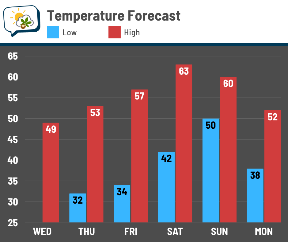
We keep rising straight into the weekend, peaking in the lower 60s Saturday. Sunday looks to be around 60, although that might come down into the 50s… but still respectable, regardless. If you do outdoor Christmas decorations and haven’t put them up yet, this weekend is certainly worth considering.
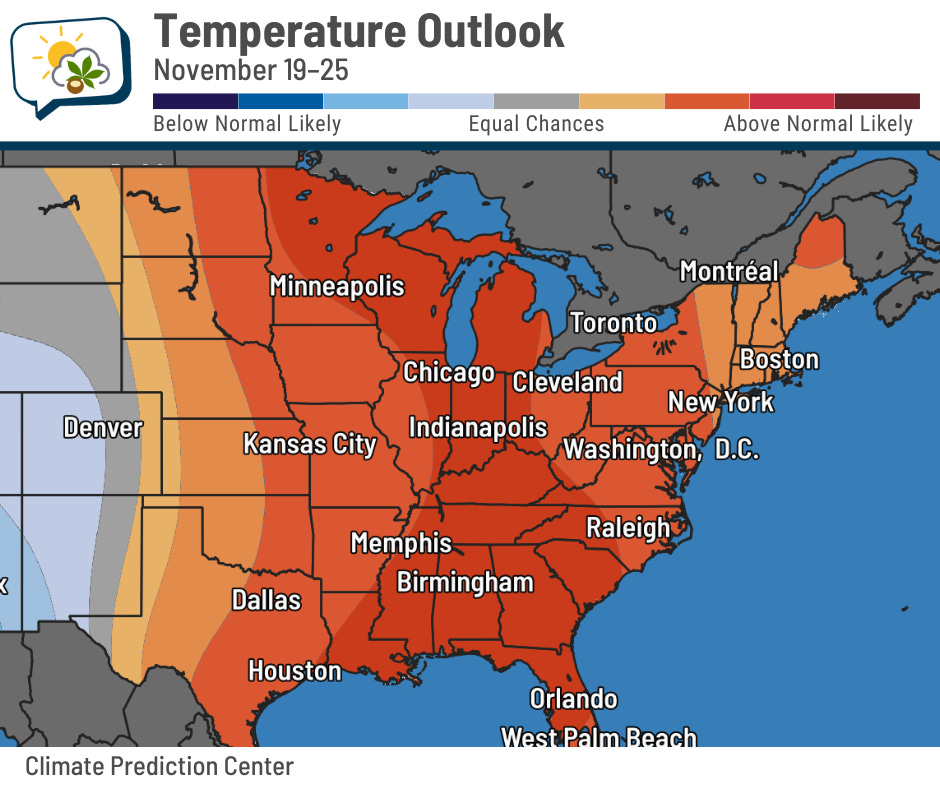
Temperatures ought to stay warmer than average as we roll closer to the first few days of Thanksgiving week. NOAA’s Climate Prediction Center has good odds of temperatures being above average, overall, from the 19th through 25th.
📊 Today’s almanac
Normal low/high: 36 / 54
Record low/high: 15 (2019) / 75 (1949)
Sunrise/set: 7:14 a.m. / 5:17 p.m.
🚗 Under pressure
This guy show up for you yet?
The dreaded tire pressure light… a sign of winter cold. As temperature drops, so does pressure (remember the ideal gas law from high school chemistry?), and your car’s tires aren’t immune to that.
As a rule of thumb, air pressure decreases by 1 to 2 PSI (pounds per square inch) for every 10 degree drop in temperature. That’s not a big deal with the typical variations in our weather, but when it’s consistently colder, your tires will then be consistently underinflated.
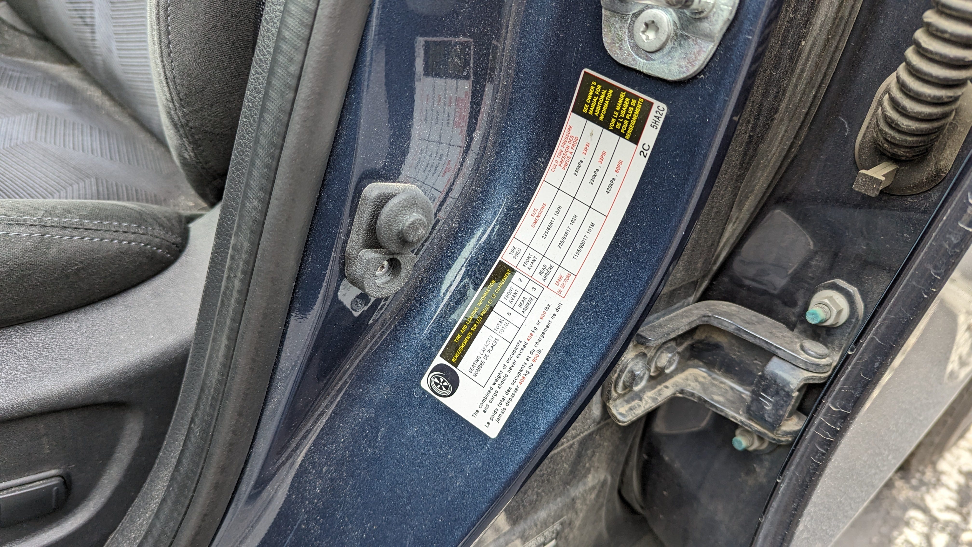
If you don’t know what your tires’ pressure should be — and why would you know that? — check the driver door frame, because you’ll probably find a sticker there with that information.
Underinflated tires are problematic. Yes, you get slightly lower fuel economy, but the big issue is safety. Traction is worse, increasing stopping distance and the risk of skidding… not what you want to deal with when roads can already be slippery. And being underinflated puts more wear on the tires, making these issues get worse even faster.
🌭 For the weather weenies
-
Miami sets first record low since 2014, after dozens of record highs (Philippe Papin/Bluesky)
-
Satellite loop of melting snow in the Smokies (CIRA/Bluesky)
-
Snowfall extinction (Weather with a Twist)