The 614cast
Today’s tl;dr
☀️ Sunny and much less windy, high in the upper 40s.

Forecast highlights
🌧️ Sun today, then more active
Yesterday was definitely one of those “if you’re in the sun and it wasn’t so windy” sorts of days.

The good news about today is that high pressure is much closer to us, which means we get to keep the sunshine and add in a much lighter wind. Yes, there’ll be a little breeze at times, but we’re talking gusts up to, like, 15 mph. Not 30 mph like yesterday. Relatively speaking, you’ll hardly even notice.
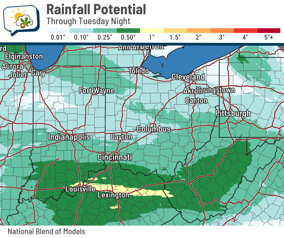
Soak in today’s weather, because Tuesday will be a much grayer day. A system passing to our south will toss occasional showers our direction. Temperatures aloft should be too warm to support snow, so I don’t anticipate wet flakes mixing in early Tuesday. Surface temperatures should also be just warm enough for us to avoid a brief period of ice at first, too. But I’ll keep an eye on any 11th hour changes.
As far as rainfall amounts go, we should come away with less than a quarter-inch. Higher amounts fall down toward the Ohio River.
We catch a short-lived break before the next weather system pushes into the region. Here’s the European forecast model from Thursday morning to Saturday morning.
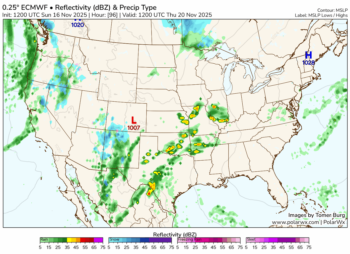
This late-week system has been trending slower. The daytime hours on Thursday might be dry, with rain moving in Thursday night and continuing Friday. If you have plans for Thursday evening, I’d still recommend planning on the potential for rain at this moment, just in case.
🌡️ Week starts cool but turns milder
Even with sunshine, today’s going to come up a bit short of mid-November averages. Tomorrow’s the coolest day of the week, though, with highs only in the mid-40s.
But then things change with that late-week system…
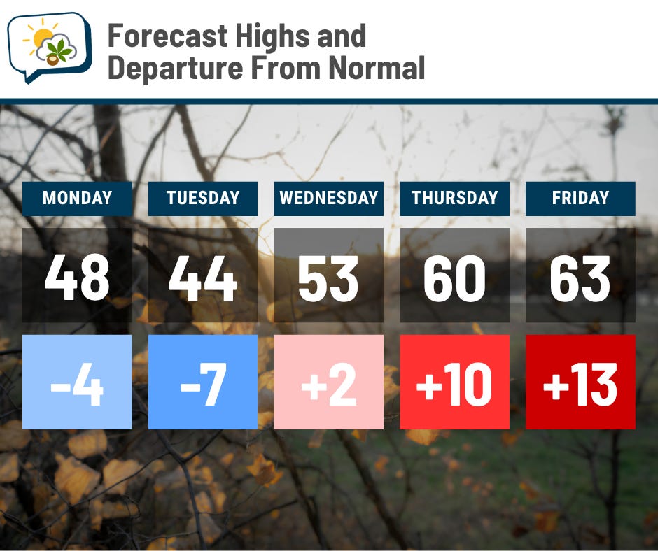
Southwest flow will shove mild temperatures our way, despite more clouds and even some rain. Looks like 60+ is in the cards to finish the week.
📊 Today’s almanac
Normal low/high: 35 / 52
Record low/high: 13 (1959) / 76 (1958)
Sunrise/set: 7:19 a.m. / 5:13 p.m.
❄️ Winter Safety Awareness Week
This week is Winter Safety Awareness Week in Ohio. We’ve already gotten our first little taste of winter weather, and there’s plenty more we’ll face in the coming months.’
Winter can bring a variety of weather hazards: snow, blizzards, ice, wind, cold, even flooding from ice jams or snowmelt or heavy rain on frozen ground.
The Ohio Emergency Management Agency makes some simple, straightforward recommendations on how you can be ready for winter weather. Sure, we go through winter stuff every year, but it never hurts to review them, especially if you need to make an adjustment based on changes in your situation or even if you’ve simply forgotten about some aspect of good preparedness.
🌭 For the weather weenies
-
Clean up begins in village hit by Storm Claudia floods (Sky News/YouTube)