💧 Most of the metro got between a third and a half-inch of rain yesterday. CMH officially tallied 0.55” as of 8:30 p.m.
The 614cast
Today’s tl;dr
🌥️ Generally more clouds than sun, high around 50.

Forecast highlights
🤔 Late-week rain still has details to iron out
Woof. The system that tracks across the region later this week isn’t particularly clear-cut. The saying “all models are wrong, but some models are useful” sure is the case.
What’s reasonably high confidence is that the bulk of the rain holds off until Thursday night. What’s not high confidence is just how long it’ll take for rain to get here. The difference between the main American model and the European model is stark.
Here’s a comparison for late morning–midday Friday. The European model still doesn’t have rain here yet at that time! It delays until late Friday.
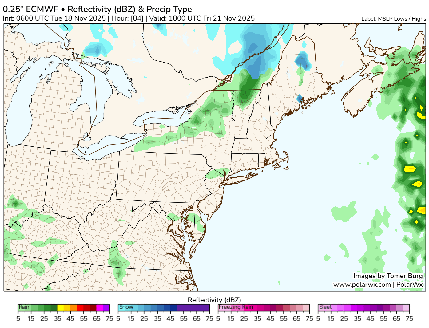
The European model is pretty reliable, but I’m suspicious of how dry it is. We’ll have a decent plume of moisture coming in ahead of a cold front, and having diddly squat with that is… curious. Not impossible, but at this point, it would surprise me if that’s what comes to pass.
One implication is rainfall amounts… if the European is right, we’d likely have far less than what other stuff is showing.
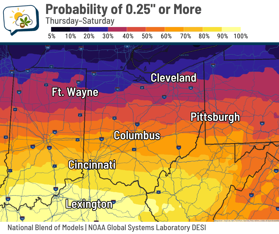
When there are these kinds of questions, I like to look at probabilities and see how they compare to other solutions to see what might be an outlier. In this case, here’s the National Blend of Models’ odds of getting a quarter-inch and a half-inch rain.
One theme is clear: Farther south has higher odds of getting a given amount. The I-70 corridor has about a 60% chance of getting at least a quarter-inch… not super high odds, but respectable. That would suggest the European model is an outlier; not necessarily wrong, to be sure, but still an outlier.
The National Weather Service doesn’t fully buy a mostly dry scenario, either. Their current chance of rain forecast picks up Thursday evening, peaking overnight with another peak later Friday.
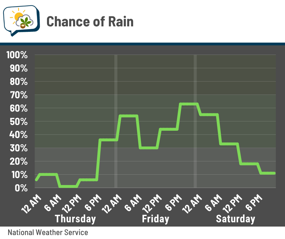
Long story short, I’m feeling good about Thursday being dry, and expect at least occasional rain Friday into Saturday morning.
👆 Rising warmer than average
Even with quite a bit of cloudiness most of the next several days, along with some rain, temperatures will actually be near to above average.
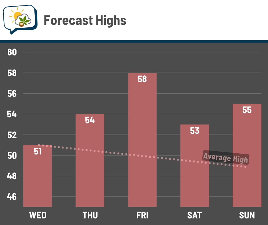
Sadly, it appears 60 degrees will be just out of reach after it looked like we might get there. Even so, we’re talking temperatures that are several degrees above average on Friday.
📊 Today’s almanac
Normal low/high: 34 / 51
Record low/high: -3 (1880) / 73 (1985)
Sunrise/set: 7:21 a.m. / 5:12 p.m.
🥶 What the heck was happening in 1880?
Did you notice today’s record low? Yeah, three below zero. It’s an outlier, bookended by record lows of 10 (also set in 1880) and 11 (set in 1914).
Turns out that 1914 record low was the only one not from 1880 between November 18 and 23. Five out of six days! Four of the six days are also still the record cold highs.
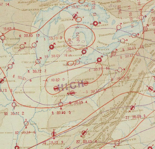
Here’s the War Department weather map for the morning of November 19, 1880.
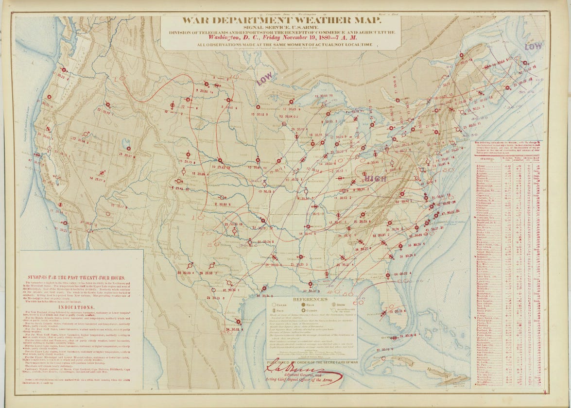
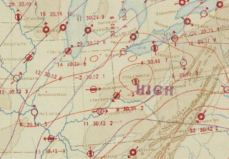
A high pressure (about 30.46”, which is fairly strong) is centered right over Ohio, which is a recipe for clear skies and calm winds.
To get so cold so early in the season, even with perfectly placed high pressure, would almost certainly require a fresh snowpack. Unfortunately, snowfall data only begins in 1884 in Columbus, but we can make some reasonable inferences from the monthly weather data.
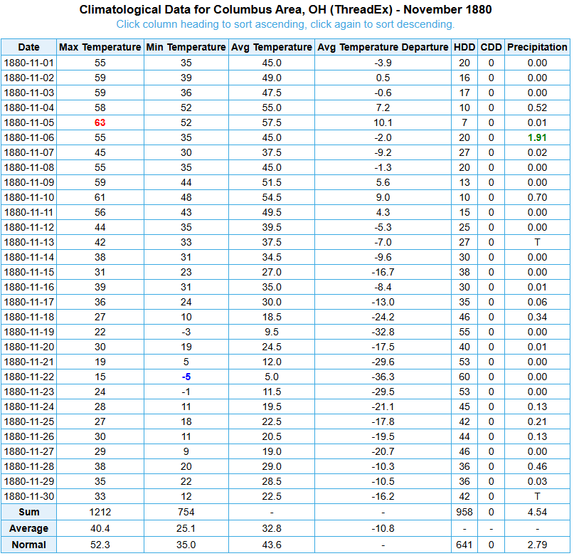
0.40” of precipitation was recorded on the 17th and 18th, and temperatures were mostly below freezing, so I’m going to assume that much or all of that fell as snow. That’d support the idea of a fresh snowpack of at least a few inches helping reinforce the cold weather that this high pressure system brought. (Interestingly, the coldest weather in the U.S. was here that morning.)
Let’s jump ahead to the 22nd, when the low fell to -5.
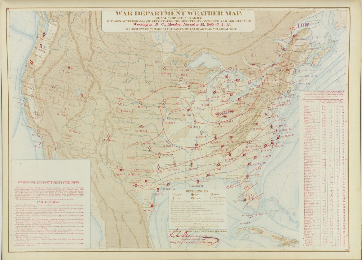
Lookie there, another high pressure! This one was even stronger, clocking in at 30.85” and among the highest on record for November (and for any month, for that matter).
While the month started with seasonable weather, the exceptionally powerful cold spell that lasted the entire second half of the month weighed the average temperature more than 10 degrees below normal. That is an astonishing departure. It still ranks as the coldest November in Columbus.
🌭 For the weather weenies
-
DeepMind releases a new weather forecasting model for more accurate predictions (Engadget)
-
Increasing risk of mass human heat mortality if historical weather patterns recur (Nature Climate Change)
-
Ohio Committee for Severe Weather Awareness opens poster contest for submissions (OCSWA)