📺 Programming note: This newsletter is taking the rest of the week off for Thanksgiving. I hope you have an enjoyable holiday — see you Monday morning!
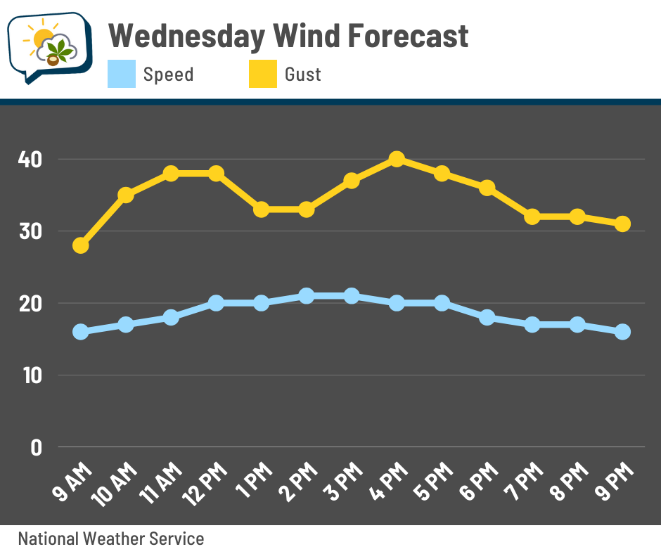
⚠️ A Wind Advisory is in effect today from 10 a.m. to 10 p.m. for gusts over 40 mph.
The 614cast
Today’s tl;dr
💨 Mainly cloudy and very windy. Falling temperatures through the 40s; 30s by late afternoon.

Forecast highlights
🥶 Brrrrisk!
The much-anticipated cold front shoves through around daybreak. We should see a little line of short-lived showers along it, possibly followed by a brief window of sun mid-morning. If we do get any cloud breaks, don’t be fooled… they’ll fill right back in.
The cold air pouring into the region could wring out a few flurries this afternoon or evening. Temperatures will steadily fall through the day, eventually dipping into the 30s later this afternoon.
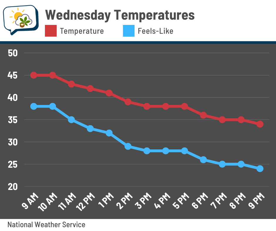
Winds will be stiff out of the west around 15 to 20 mph with gusts of at least 40 mph, especially in the afternoon. If you’ll be driving on north-south roads, be extra careful and leave more space between you and other vehicles.
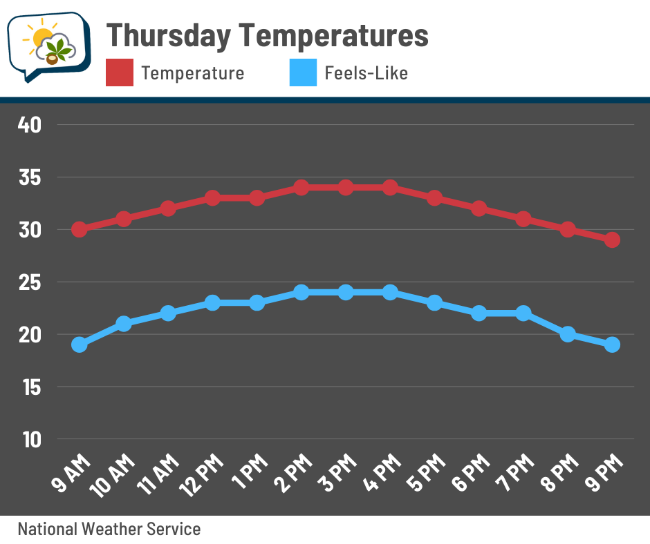
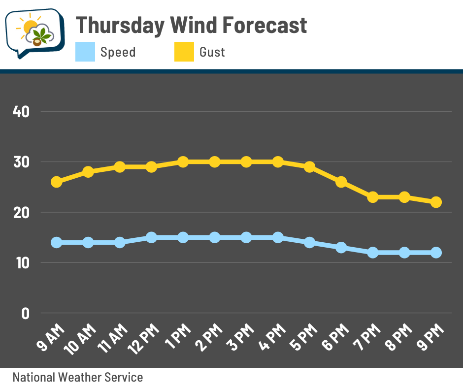
Thanksgiving will be even colder with highs in the mid-30s and wind chills staying in the 20s. The wind won’t be quite as strong, but gusts around 30 mph are still awfully blustery.
👀 Watching the weekend
A weather system will be tracking across the Midwest and Great Lakes this weekend, causing noteworthy travel impacts to our west. Here’s the European model’s forecast radar Saturday afternoon.
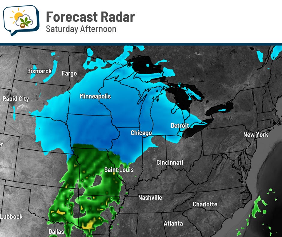
Snow will be widespread across parts of Illinois, Iowa, Wisconsin, Minnesota, and possibly Michigan. Darker blues indicate heavier snow. Driving conditions will be not too great in those areas.
That system continues heading northeast into Sunday. As it looks now, I expect precipitation here to start as light snow then change to rain. The bulk of the precipitation should begin either overnight Saturday or early Sunday.
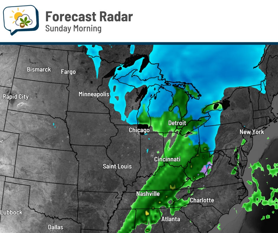
Temperatures should support primarily rain here. If the initial snow accumulates, it’ll likely be minor and melt not long after.
Since snow is likely in the Chicago area on Saturday, I would expect impacts to flights, especially later in the day when it picks up more.
Stay up on the latest forecasts from the National Weather Service if you’re traveling this weekend.
📊 Today’s almanac
Normal low/high: 32 / 48
Record low/high: 7 (1950) / 70 (1896)
Sunrise/set: 7:29 a.m. / 5:08 p.m.
🦃 Thanksgiving weather history
The official date of Thanksgiving has varied somewhat over the years, but has been the fourth Thursday of November starting in 1942. That makes checking records a little trickier, but I believe the following is accurate based on checking dates from the Midwest Regional Climate Center’s holiday weather info and discarding years that aren’t correct.
-
Warmest high: 70° (1896)
-
Coolest high: 12° (1930)
-
Coldest low: 3° (1930)
-
Most precipitation: 1.76” (2010)
-
Most snow: 1.0” (1950)
🌭 For the weather weenies
-
Massive wildfire liabilities push utilities to use AI to stop blazes (Bloomberg)
-
He has one job at Amazon: to expertly study weather every day, 365 days a year (Bagable)
-
2025 Atlantic hurricane season marked by striking contrasts (NOAA)