Columbus officially recorded 4.5” of snow at John Glenn International. Here are some other local reports:
-
Commercial Point: 4.0”
-
Delaware: 3.6”
-
Grandview Heights: 4.5”
-
Grove City: 4.0”
-
Hilliard: 4.6”
-
Marysville: 3.1”
-
Newark: 5.0”
-
Pickerington: 4.5”
-
Powell: 4.8”
-
Sunbury: 4.0”
-
West Jefferson: 4.3”
-
Worthington: 4.5”
The 614cast
Today’s tl;dr
⛅ Turning partly cloudy, high in the mid-30s.

Forecast highlights
❄️ Maybe a skiff of snow tonight
We should hopefully get some sun to poke through this afternoon, but clouds fill right back in tonight as a cold front approaches. It’ll bring a chance of light snow late tonight into early Thursday.
This is the forecast radar from one of the high-resolution models from midnight through 10 a.m. As you can see, there’s not much going on with this system, unlike the one that ended yesterday morning.
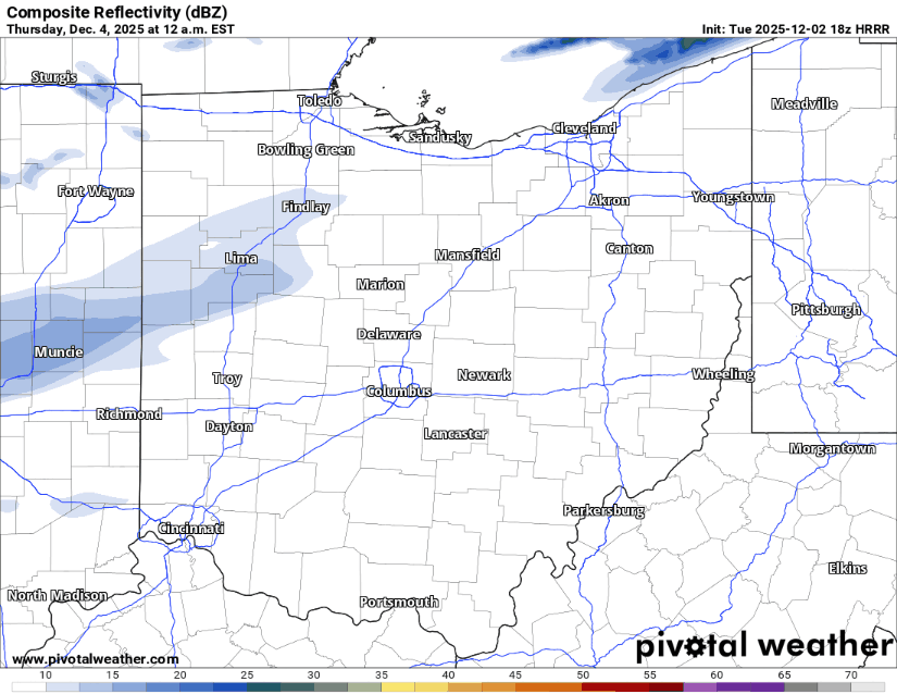
In fact, the National Blend of Models has pretty meager odds of getting at least a half-inch of snow… somewhere in the 10–20% range.
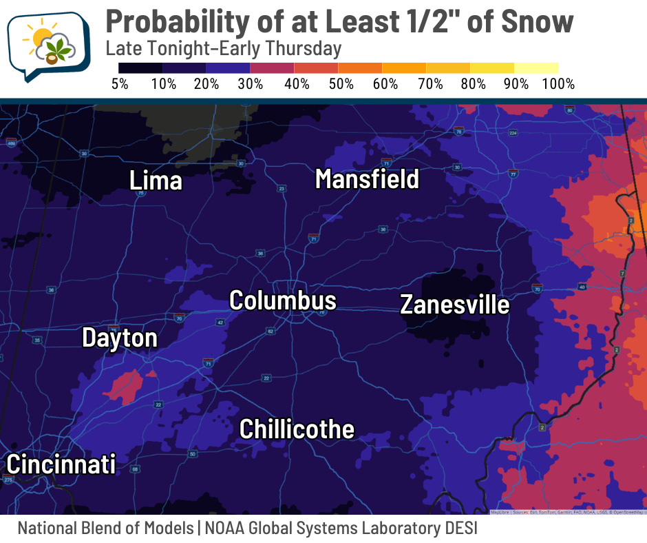
Even so, I’d plan on some patchy slick spots for the morning drive tomorrow.
🫠 Not much melting
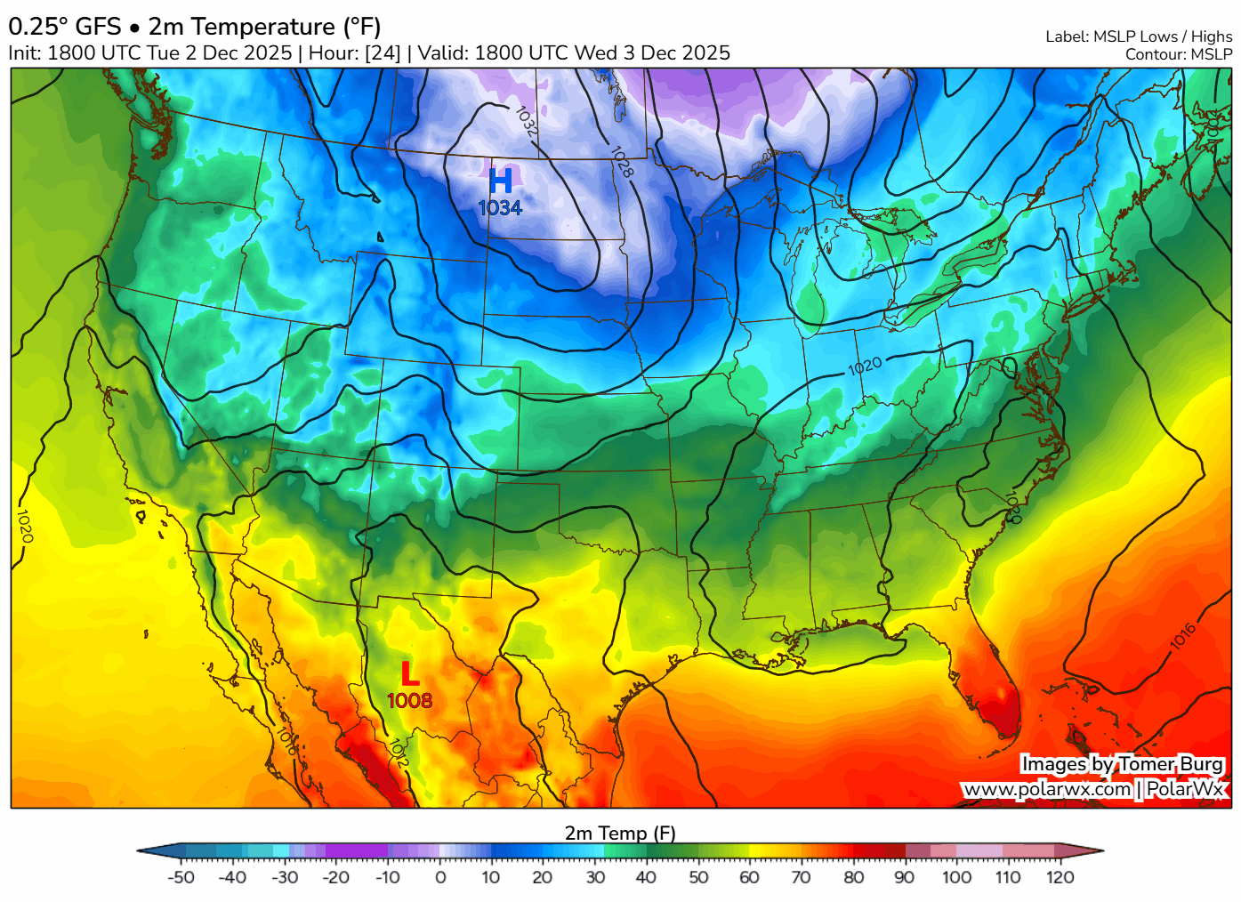
The cold front will hit by around daybreak tomorrow, and temperatures won’t move much from there. It looks like we’ll be pretty well locked in the upper 20s most of the day with wind chills near 20.
Canadian high pressure slides in behind this, which is noted at the beginning of this loop with the blue H in the Northern Plains and Upper Midwest. Underneath that high pressure, some areas will drop below zero and break record lows. But even after that high pressure departs, we have a really hard time getting warmer air to return over the next week.
Our coldest time will be Friday morning. Lows could dip into the single digits… the National Weather Service forecast undercuts most forecast model guidance, but with some fresh snow on the ground, these numbers are doable if the wind slacks and we get any kind of clearing.
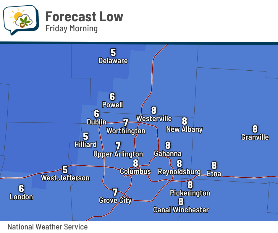
By the way, Friday’s record low is 8, set in 1976. Even if we don’t get quite this cold on Friday, we ought to still wind up in near-record territory.
📊 Today’s almanac
Normal low/high: 30 / 45
Record low/high: 0 (1966) / 76 (1982)
Sunrise/set: 7:36 a.m. / 5:06 p.m.
☃️ Winter normals
Plenty of climatological previews and reviews so far this week… one more to round it out! Climatological winter runs from December 1 to February 28.
-
December
-
Normal high and low drop from 46/31 to 38/24
-
Normal precipitation (rain+melted snow) is 3.13”
-
Normal snowfall is 5.1”
-
Lose 12 minutes of daylight through 12/21, then gain back 3 minutes
-
-
January
-
Normal high and low start at 38/24, dip to 37/21, rise back to 38/22
-
Normal precipitation is 3.00”
-
Normal snowfall is 9.5”
-
Gain 45 minutes of daylight
-
-
February
-
Normal high and low rise from 38/22 to 45/27
-
Normal precipitation is 2.41”
-
Normal snowfall is 7.6”
-
Gain 1 hour, 5 minutes of daylight
-
🌭 For the weather weenies
-
Why this year won’t be the warmest on record (Eco Nana)