The 614cast
Today’s tl;dr
⛅ Turning partly sunny, nearly steady temperature in the upper 20s.

Forecast highlights
🥶 Have I mentioned it’s cold?
I have a Christmas wreath that hangs above our front porch. The wind knocked it down last week and I haven’t put it back up yet because we were out of town, it was cold when we got back, then it snowed and was cold, and now it’s still cold. I shouldn’t complain; it’s one wreath and won’t take long. It sure beats having to do the entirety of our outdoor decorations, which we put up the day after Thanksgiving when I was growing up. My younger days had some cold fingers.
Anyway. Temperatures won’t move much today since the cold front producing some bits of light snow will also pass through early on. There’ll be enough of a breeze throughout the day to make it feel pretty brisk, producing wind chills mostly in the teens.
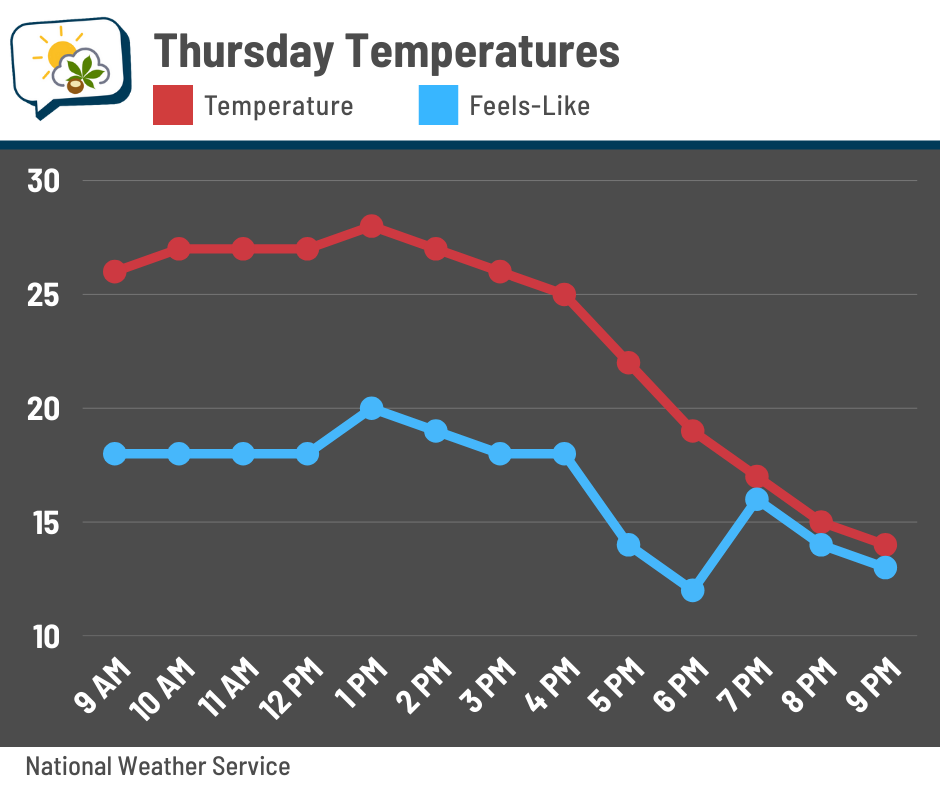
We’ll probably fall off to around 10 or so tonight.
If you’re hoping for a pattern change that gets us warmer soon, don’t hold your breath. Time to get ✨nerdy✨ with why that’s the case…
Let’s go halfway up the atmosphere. This is one place to find ridges (the flow arcs north) and troughs (the flow dips south). This particular forecast model map also includes colors that indicate how anomalous the thickness of that bottom half of the atmosphere is. Oranges/reds are greater thickness than usual (more “ridge-y” than average), while blues/purples are smaller thickness than usual (more “trough-y” than average).
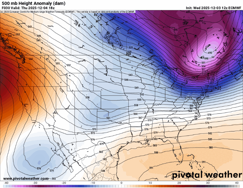
These mid-level ridges typically bring relatively warm air, while the troughs bring relatively cool air.
Now let’s come back down to the ground. This is the model’s prediction of how far temperatures will be from average. And would you look at that: temps in the West where the ridge is are expected to be warmer than average, while that downstream trough has colder than average temperatures.
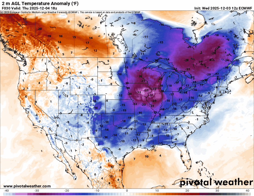
You’ll notice that ridge-trough pattern is pretty persistent throughout this loop, which runs through next Thursday evening. Yes, the details will change, but the general gist across much of the forecast guidance agrees with this. We have a ways to go before temperatures moderate.
Since you stuck with me through all that, I reward you with this tidbit: This will be the first time since 2010 in which the first week of December won’t hit 40. This has happened only seven times on record: 2010, 2005, 2000, 1915, 1910, 1903, and 1893.
📊 Today’s almanac
Normal low/high: 30 / 45
Record low/high: 3 (1966) / 68 (1982)
Sunrise/set: 7:37 a.m. / 5:06 p.m.
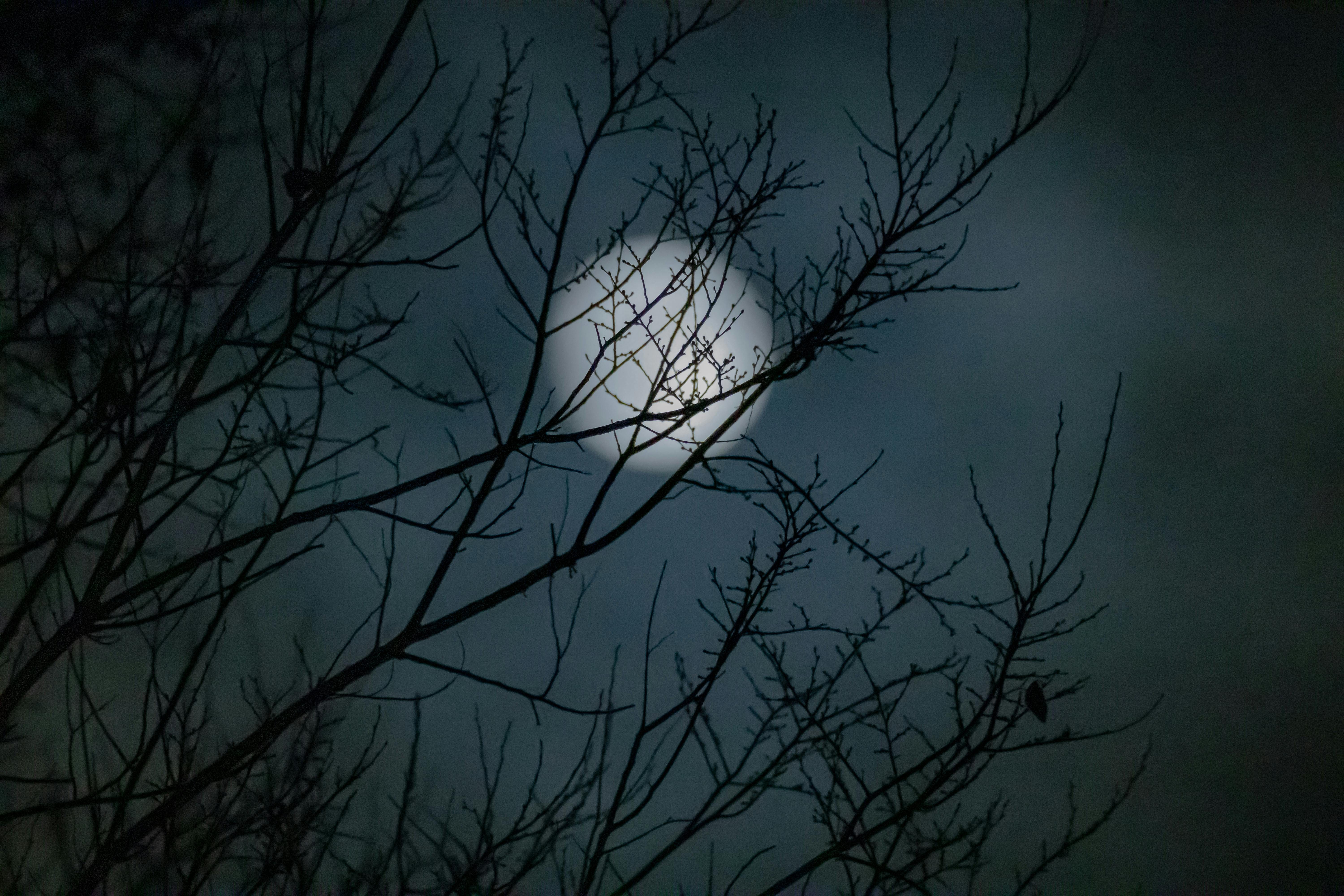
🌕 Full Cold Moon
This month’s moon is fullest tonight at 6:14 p.m. I think we’ll actually have enough breaks in the clouds yet this evening that you’ll be able to see it. If you care about supermoons, this also is one of those (just like the past couple of full moons), although you won’t really be able to tell that it’s any larger than other full moons. It can appear slightly brighter, though, and if we’re clear enough, that effect may be enhanced by the reflection off the snow.
Another name for this moon is Moon Before Yule, which is much more fun to say. And a couple of the Native American names include Long Night Moon and Big Winter Moon.
You might be able to glimpse Jupiter to the lower-left of the moon; it rises above the horizon around 8 p.m.
🌭 For the weather weenies
-
Phoenix Dust Storm (PHX-DUST) Scale: A cooperatively developed dust storm scale for Phoenix, Arizona (Bulletin of the American Meteorological Society)
-
BalancedWx Special: Camp Mystic reveals new flash flood safety plans (BalancedWx)