Today’s edition is short and late… didn’t have time yesterday to work on it. 😬
The 614cast
Today’s tl;dr
⛅ Partly cloudy, high in the lower 30s.

Forecast highlights
🤷 Fairly uneventful the next several days
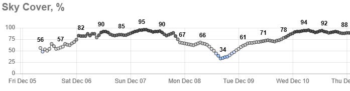
Our weather’s going to be fairly dull for a while… which is fine, although I could take more sunshine. Here’s the National Weather Service’s cloud coverage forecast through next Wednesday night. This weekend looks pretty gray, with the most sunshine currently forecast for Monday afternoon.
One quick-moving system could bring us light snow or even a light rain/snow mix on Sunday. Another one the middle of next week could draw in warm enough air that we see a rain chance more than a snow chance… perhaps we’ll even hit 40 next Wednesday!
However, the overall pattern still strongly leans cold. Here’s the Climate Prediction Center’s outlook for the 10th through 14th (next Wednesday through the following Sunday).
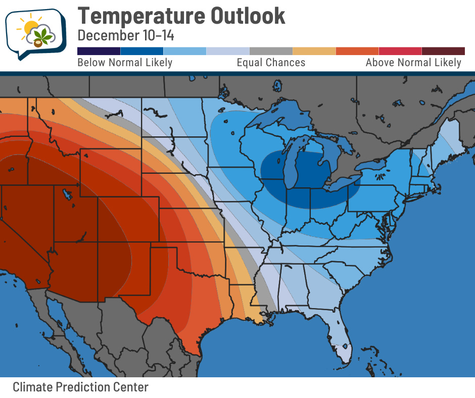
No big defrosting times in the near future…
📊 Today’s almanac
Normal low/high: 30 / 45
Record low/high: 8 (1976) / 70 (2001)
Sunrise/set: 7:38 a.m. / 5:06 p.m.