📺 Programming note: Based on how things went last week, I’m going to scale back to a twice-weekly newsletter for now. I think I’ll typically send them on Sunday evenings (previewing the week ahead) and Wednesday evenings. I intend to have extra editions if there’s something significant in between and I have time to write something. I’ll also be tweaking the format of the newsletter a bit since it won’t be daily.
Now, onto the weather!
We managed to reach 40 at CMH on Sunday, soooo this will not be the first time since 2010 failing to hit 40 in the first week of December. That said, we haven’t had an above-average high since November 26.
The 614cast
Monday’s tl;dr
⛅ Partly cloudy, high near 30.

Forecast highlights
☁️ Occasionally unsettled weather
Today’s going to be reasonably decent, all things considered. A weak disturbance tomorrow could bring flurries, but the main system comes in Wednesday. Precipitation with that one should be primarily rain showers, but we could get a little snow as the system departs and cooler air wraps back in.
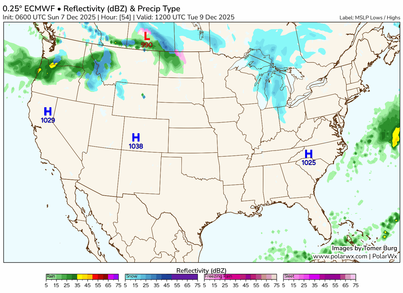
This loop of the European model starts Tuesday morning, pauses Wednesday morning, and ends Friday night.
Rainfall amounts on Wednesday won’t be much, maybe a tenth or so.
Light snow chances continue Thursday and Friday. Some guidance indicates the potential for minor accumulation, but it’s a ways out and I don’t have much concern about it at this point.
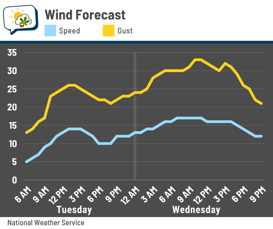
The wind will also be a thing with the midweek system. Here’s the forecast wind speed and gust Tuesday and Wednesday. Blustery conditions peak on Wednesday as gusts should top 30 mph. Even though that’ll be our warmest day this week, the wind will make it feel more brisk, especially since there’ll be some dampness.
🥶 Cold blast hits next weekend
The theme of “below average temperatures” rolls on this week. Today’s high around 30 will be some 14 degrees short of average, although we’ll improve to reaching about normal on Wednesday.
And then things drop again.
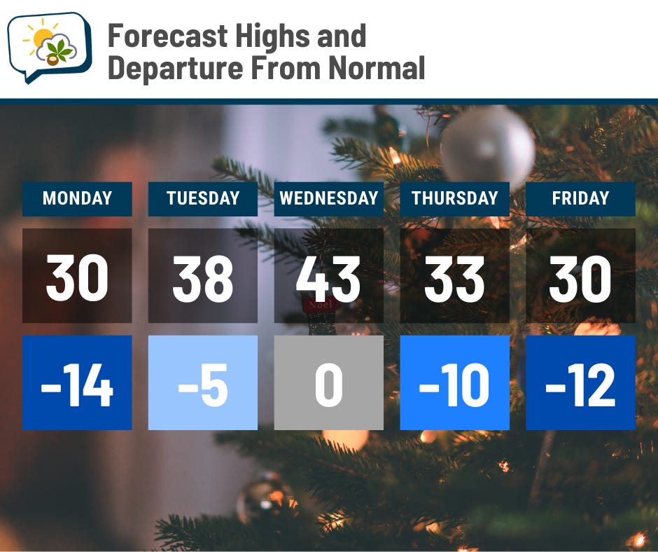
Friday’s just a taste of what’s to come. The chill coming in behind that cold front is even more pronounced this weekend.
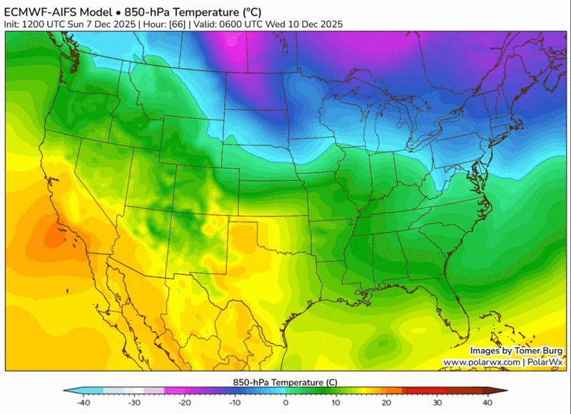
Here’s a check of temperatures aloft from the AI flavor of the European model. We’ll start Tuesday night, when relatively mild air sneaks in ahead of the shower-producing system. Cooler air comes in behind it, but you can see purples and pinks lurking farther northwest that dive our way for the weekend.
Highs might struggle to hit 20 both days, based on early indications. Just how long that cold blast lasts is uncertain, although trends suggest we’ll at least remain cooler than average into next week.
📊 Monday’s almanac
Normal low/high: 29 / 44
Record low/high: -4 (1882) / 69 (1966)
Sunrise/set: 7:41 a.m. / 5:06 p.m. (This is very slightly later than Sunday’s sunset!)
🎿 Snowy start for some
Columbus has picked up 6.5” of snow so far this season, about four-and-a-half inches more than average. It’s the most through December 7 since 2013, when we already had 9.8”.
Here’s how things look around the rest of the region:
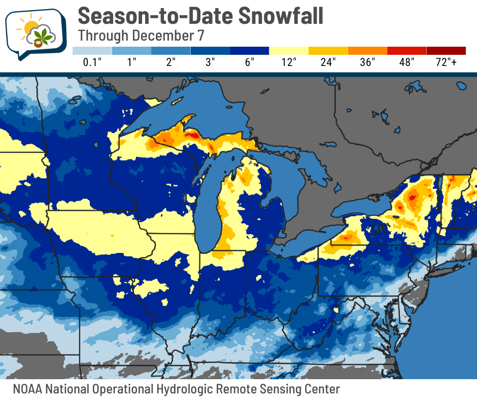
Surprisingly, we’ve had more snow than northwestern Minnesota!
Meanwhile, a couple of noteworthy weather systems have impacted parts of the Midwest, giving a decent swath of well over a foot already. You can also see the places downwind of the Great Lakes that get their typical higher amounts.
As you might imagine, season-to-date snowfall in many areas of the Midwest is above average.

🌭 For the weather weenies
-
When trade routes shift, so do clouds: Researchers uncover ripple effects of new global shipping regulations (Florida State University)