The 614cast
Monday’s tl;dr
🌥️ Partly cloudy, high in the lower 40s.

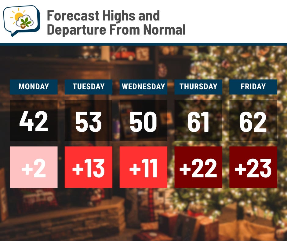
Forecast highlights
🕵️ Where did winter go?
The first half of the month featured below-average temperatures on all but one day. Since the 15th, things have improved in that department.

And now the dial is turning up even more. Highs ought to get more than 20 degrees above normal later this week.
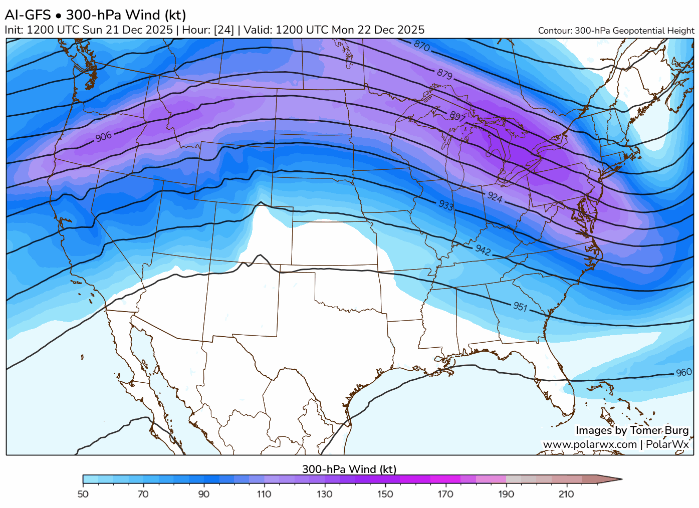
A big ol’ ridge of high pressure aloft is taking over. As you may recall, these upper-level ridges often lead to warmer temperatures.
The animation below shows the forecast position of the jet stream through next weekend. (The dark blues and purples indicate faster wind speeds.) The jet stream is the fast-moving ribbon of air high aloft. As you can see, we’re on the south side of this ridge throughout the week, although it does possibly buckle a bit next weekend.
And dew points actually rise above 50 on Christmas and Friday, which means it’ll feel kind of humid for late December!
There’s a large spread in forecast temperatures the weekend after Christmas, as models are disagreeing on that little kink in the jet stream. We might have a shot of colder air sometime around the 29th, but we’re generally looking at relatively mild temperatures. Here’s the NOAA Climate Prediction Center’s outlook as we finish the month and head into the first days of January:
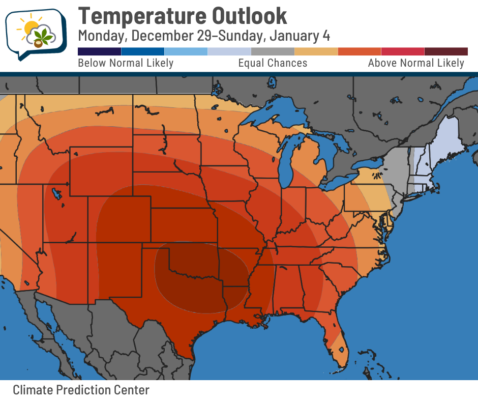
Much of the Lower 48 has better-than-even odds of being relatively mild, thanks to persistent ridging in the jet stream.
🤏 Minor rain chances
Will we have occasional rain showers this week? Probably. But none of them look like they’ll amount to much.
The forecast map shows some weak, fast-moving impulses gliding along the flow:
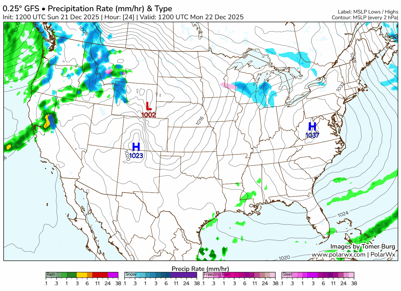
However, guidance is in pretty good agreement at the moment that most of those chances may very well happen more during the night.
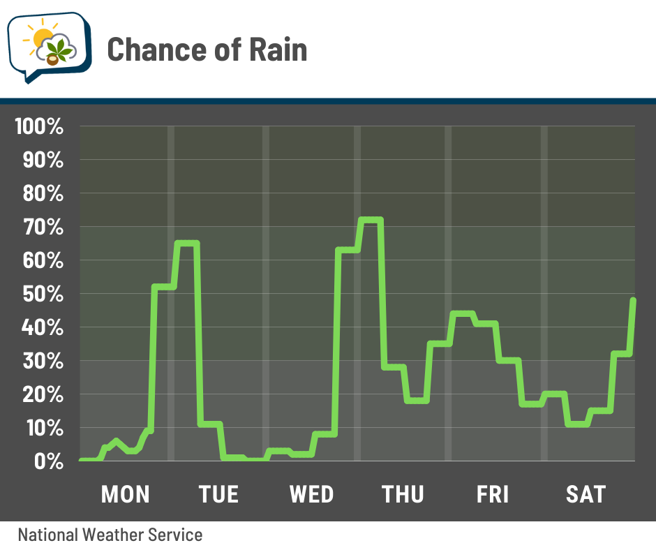
Timing could shift, as these things can be a bit tricky to pin down very far in advance. Regardless, I don’t see them being much more than a nuisance at most.
📊 Monday’s almanac
Normal low/high: 26 / 40
Record low/high: -17 (1989) / 68 (2013)
Sunrise/set: 7:50 a.m. / 5:10 p.m.
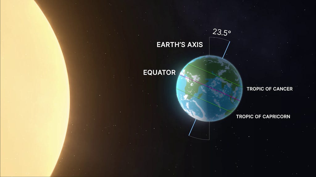
⛄ Winter has officially begun
The winter solstice happened Sunday morning at 10:03 a.m. At that moment, the sun’s most direct rays were at the Tropic of Capricorn in the Southern Hemisphere, their southernmost point of the year.
Sunday was our shortest day of the year with 9 hours, 19 minutes, and 55 seconds of daylight. Monday will be a few seconds longer, and we’ll keep adding on until June 21. That day will have about 5 hours and 40 minutes more daylight.
While we’ve now had our shortest day of the year, we aren’t in the average coldest part of the year yet. Here, it lags about a month behind. Just like when you heat or cool water, it takes time for the temperature to change.
🌭 For the weather weenies
-
When a “forecast miss” prevents tens of millions in losses (G2 Weather Intelligence)
-
Hurricane Melissa at Ground Zero (iCyclone/YouTube)