🎄 My midweek missive normally comes on Wednesday, but since I’ll be going right from work to Christmas Eve activities, I’m sending it a day early.
Wishing you all the happiest of holidays, no matter what you celebrate!
The 614cast
Wednesday’s tl;dr
🌥️ Mostly cloudy, high in the lower to middle 40s.
Forecast highlights
🔁 Post-Christmas switcheroo
So, the general theme over the next several days is the same, but the details have changed a bit… but the forecast after this weekend is starkly different than before.
First off, the fronts associated with the next couple of disturbances often set up south of us, so it may not get quite as warm as originally thought. But, it’ll still mild for late December. We should still surpass 50 on Christmas Day.
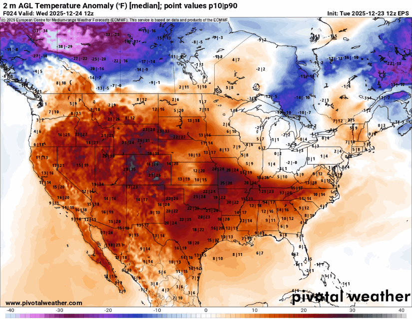
Check out the temperature anomaly map below; don’t worry about the numbers, just look at the colors. You can see lots of red over much of the country through the weekend, indicating warmer-than-average temperatures.
Remember my last update when I shared the temperature outlook for around the new year? I mentioned that there was a spread in the forecast… well, guidance has swung to the low end of that spread.
I’m not a big fan of that huge drop from Sunday to Monday. 😬
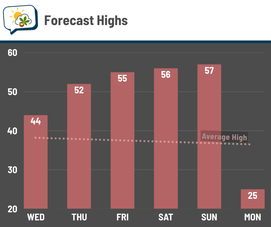
There’s more uncertainty on the exact temperatures than I’d like, but the gist is the relevant thing here: mild into the weekend, then considerably colder.
🌧️ A few shower chances
A few weak disturbances are still set to slide by the region over the next several days. It currently looks like Wednesday night, Friday, and Sunday are the times with highest shower chances.
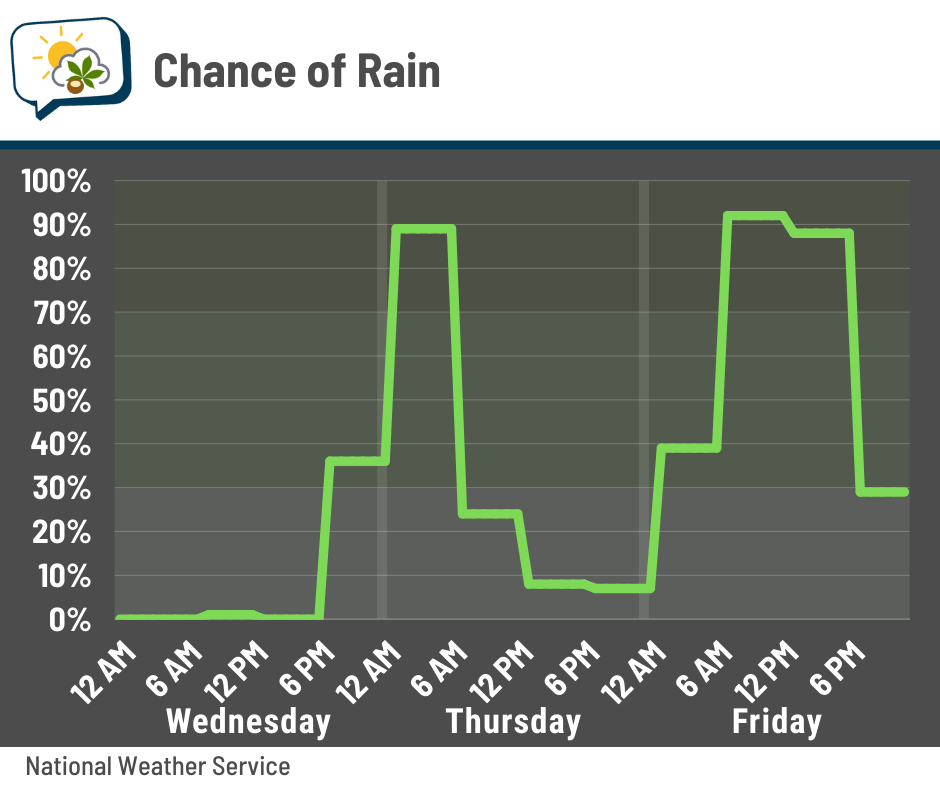
That first rain chance is still mainly a nighttime event, so no biggie there. The second one has shifted toward the daytime hours Friday. Shouldn’t be a heavy rain, but if you’ll be out and about, plan on wet roads and having an umbrella or putting your coat hood up. Sunday’s timing is a bit uncertain, as it’ll depend on when the front blasts through.
📊 Wednesday’s almanac
Normal low/high: 26 / 39
Record low/high: -12 (1983) / 66 (1889)
Sunrise/set: 7:51 a.m. / 5:11 p.m.
🎅 Christmas weather history
-
Warmest high: 64° in 1893
-
Coldest low: -12° in 1983
-
Coldest high: 1° in 1983
-
Wettest: 0.82” in 2021
-
Snowiest: 7.0” in 1890
-
Greatest snow depth: 9.0” in 1960
-
Years with at least 1” snow depth (“White Christmas”): 20
Most data begin in 1878; however, snow depth data only go back to 1948.
🌭 For the weather weenies
-
Rare ‘high risk’ flood threat for Southern California as atmospheric rivers target the state through Friday (The Weather Channel)
-
Camp Mystic’s reopening plans in Texas has drawn outrage, but some families want to return (Associated Press)
-
Appeals court rules in favor of upstream homeowners in Hurricane Harvey flooding case (Houston Public Media)