The 614cast
Monday’s tl;dr
⛅ Partly sunny, breezy at times, high around 40.

Forecast highlights
📉 Midweek system brings rain to snow
Our next weathermaker approaches Tuesday, bringing a chance of spotty showers late. That will change over to light snow on Wednesday, although the timing of the changeover is still in question.
Most of the precipitation should be on Wednesday as a second disturbance dives in.
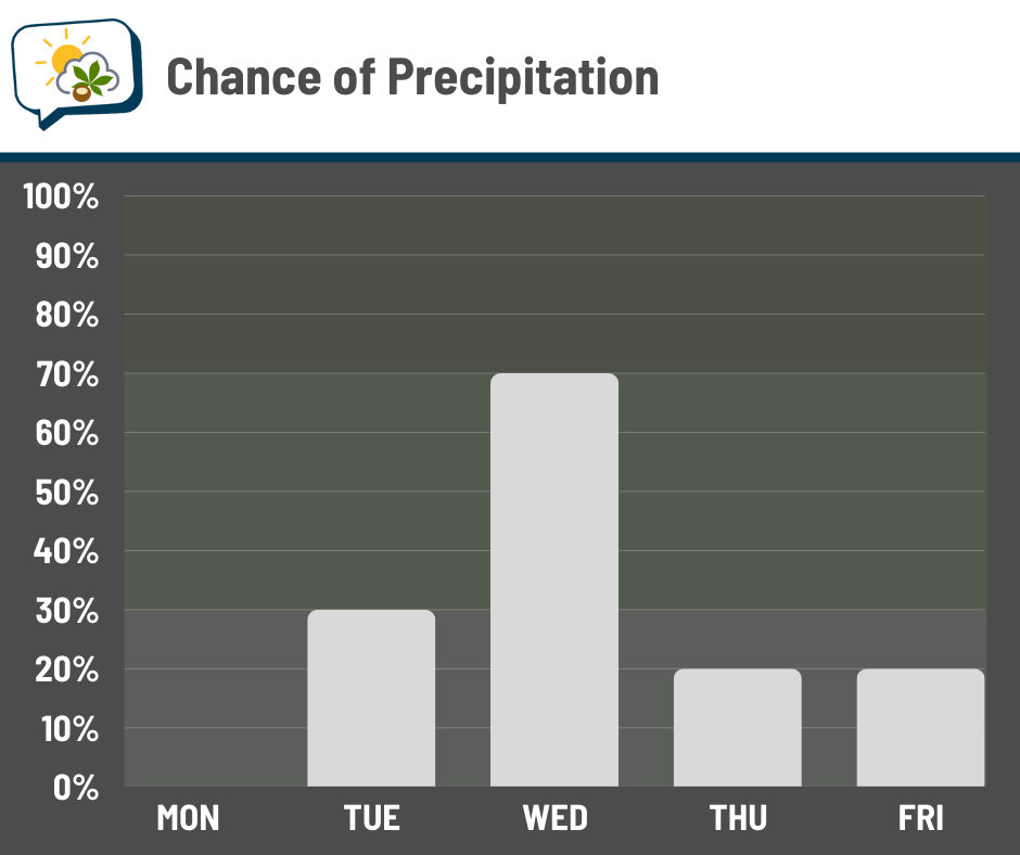
Even though chances are higher then, activity will still be intermittent. Snow amounts currently look minor, probably under an inch based on present indications.
Another weak disturbance may affect us to end the week.
⤵️ 40s briefly return before another chill
The week begins with temperatures that are a bit warmer than average. However, colder air comes in behind the midweek disturbance. We’ll go from 40s to 20s/30s for highs as a pattern change takes over for a little while.
Let’s look a ways up the atmosphere, about 18,000 feet. This shows how the “thickness” of the lower half of the atmosphere compares to average. Higher thicknesses, noted in orange/red, suggest warm temperatures; lower thicknesses, noted in blue/purple, suggest chilly temperatures.
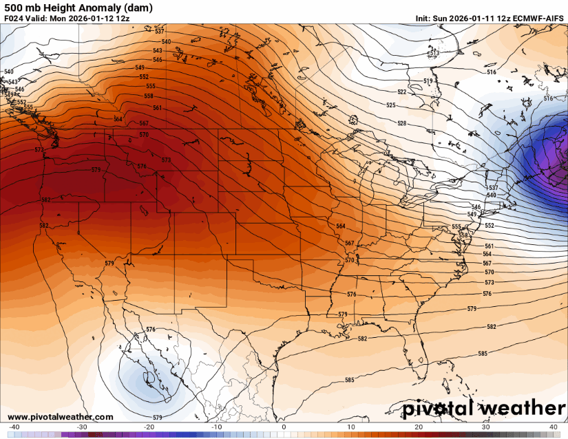
You’ll see the much lower thicknesses — with plenty of blue and purple — take over the eastern U.S. after midweek. That coincides with our cooldown! This model run goes through the middle of next week, and it takes until that point for the pattern to show signs of shifting away from the chill again.
The Climate Prediction Center’s temperature outlook from next weekend through early next week likewise shows our region having pretty good odds of cooler-than-average temperatures.
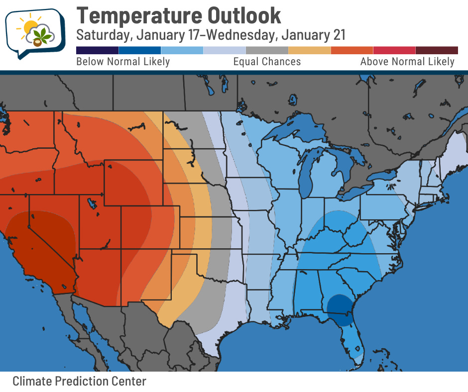
The western U.S. will be the inverse.
📊 Monday’s almanac
Normal low/high: 22 / 37
Record low/high: -13 (1918) / 67 (2017)
Sunrise/set: 7:52 a.m. / 5:28 p.m.
🚨 2025’s billion-dollar disasters
NOAA no longer produces its list of billion-dollar weather and climate disasters (although past data remain available), but Climate Central has taken up the job.
They found last year had 23 disasters that cost at least a billion dollars apiece, the third-highest number on record (since 1980). And that’s without any landfalling hurricanes in the U.S. this season!
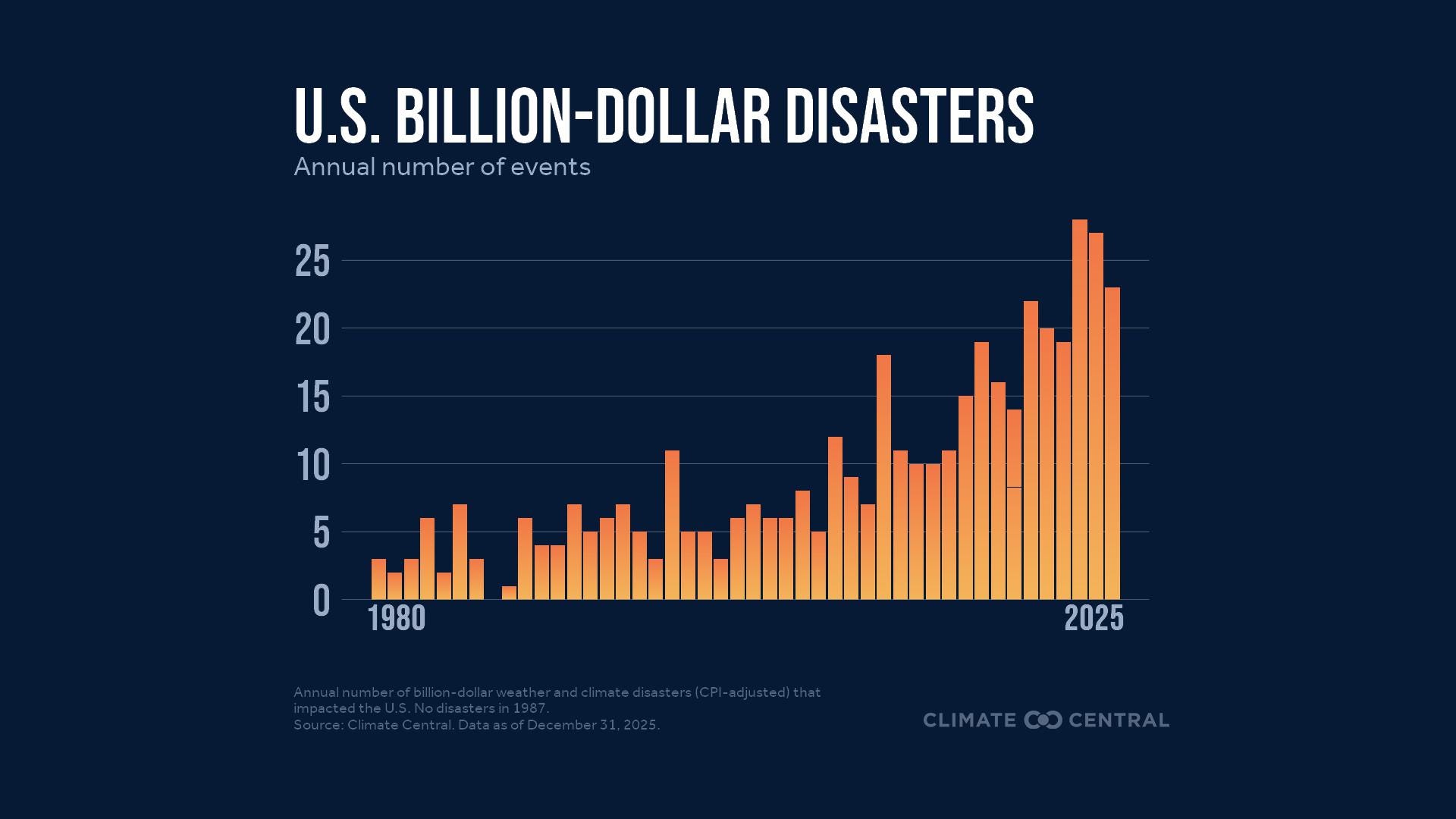
Damages were an estimated $115 billion in total. More than half of that came from the January 2025 wildfires in the Los Angeles area.
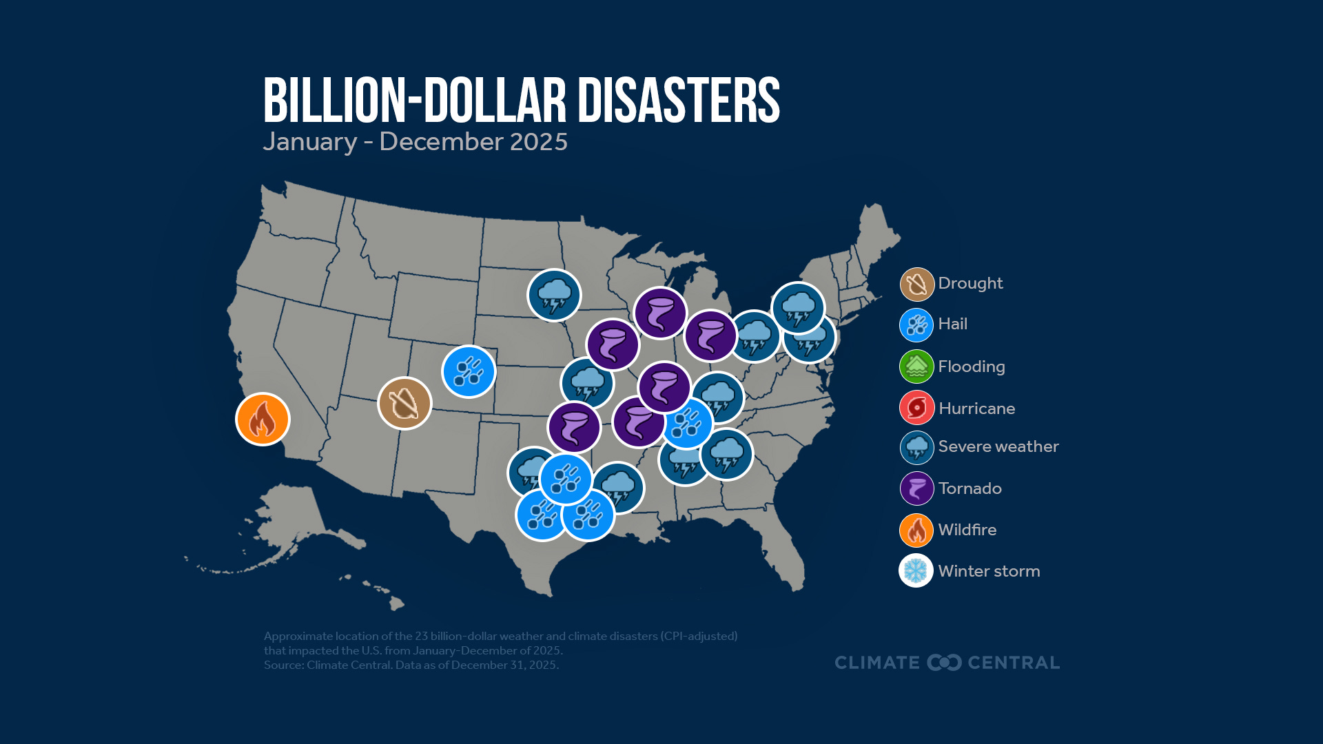
21 of the remaining 22 billion-dollar disasters were related to severe thunderstorms, including five hail-related events.
I’ll note that these billion-dollar disaster reports do adjust for inflation.
You can read their full report here.
🌭 For the weather weenies
-
Measuring tornado strength from space (Weather with a Twist)
-
A simulation of being dropped randomly in the ocean every day for 5 years (Reddit)