⏰ I’m setting my alarm prettttty early this Sunday. I’ll be filling in on weather duties for 10TV (WBNS) for that day’s morning newscast. It runs from 6–9 a.m., so tune in if you want to see how well (or poorly 🤣) I handle sleep deprivation on live TV.
The 614cast
Thursday’s tl;dr
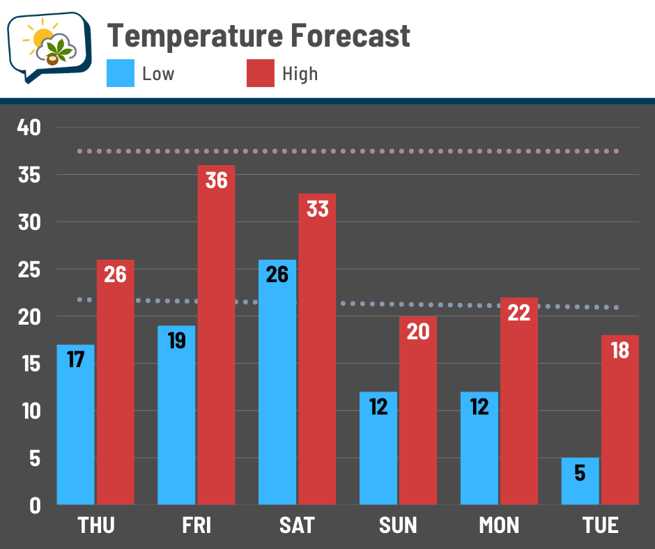
⛅ Partial clearing, high in the mid-20s.

Forecast highlights
🥶 From chilly to cold
A week ago, we were talking about mild — even record-breaking — temperatures. Today… it’s all about the cold.
We have a quick cold shot for Thursday behind the system that brought the light rain and snow showers on Wednesday. After briefly coming back up, arctic air surges south into the Great Lakes later this weekend into next week.
Anytime you see big blobs of blue and purple on a temperature anomaly map (this one for temperatures about a mile above our heads), you know it’s gonna be cooooold.
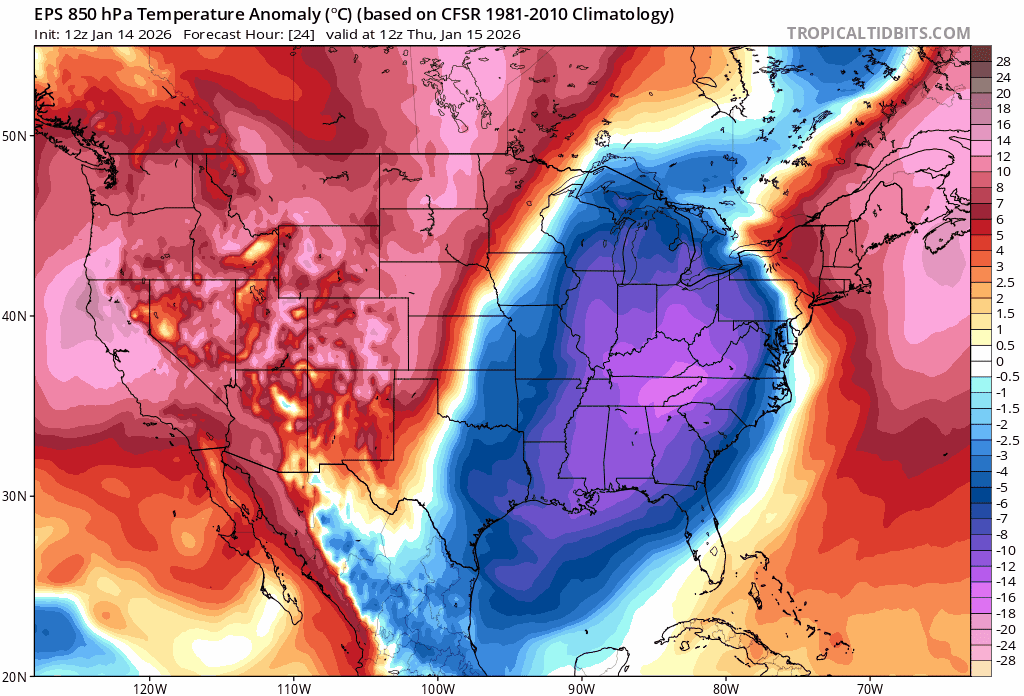
Just how cold? Highs struggle to reach where our normal lows are for a few days early next week.
Wind chills early next week will be in the single digits and may drop below zero Tuesday morning.
Winds will still be brisk more often than not over the next week.
❄️ Week ends with snow chances
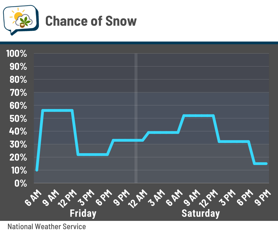
There’s an off-chance of a few straggler flurries early Thursday, but the main focus on snow will be Friday and Saturday.
Snow showers may return as early as daybreak-ish Friday, although I think they’ll be battling some dry air at first. In any case, occasional light snow continues into Saturday.
We’ll have some melting happening in between the periods of activity, so what actually accumulates will be less than the “total” snow when all is said and done.
Not that we’re going to get much, anyway. Here’s the National Blend of Models’ probability of getting at least an inch… a little less than 50/50 here. Odds are higher up north.
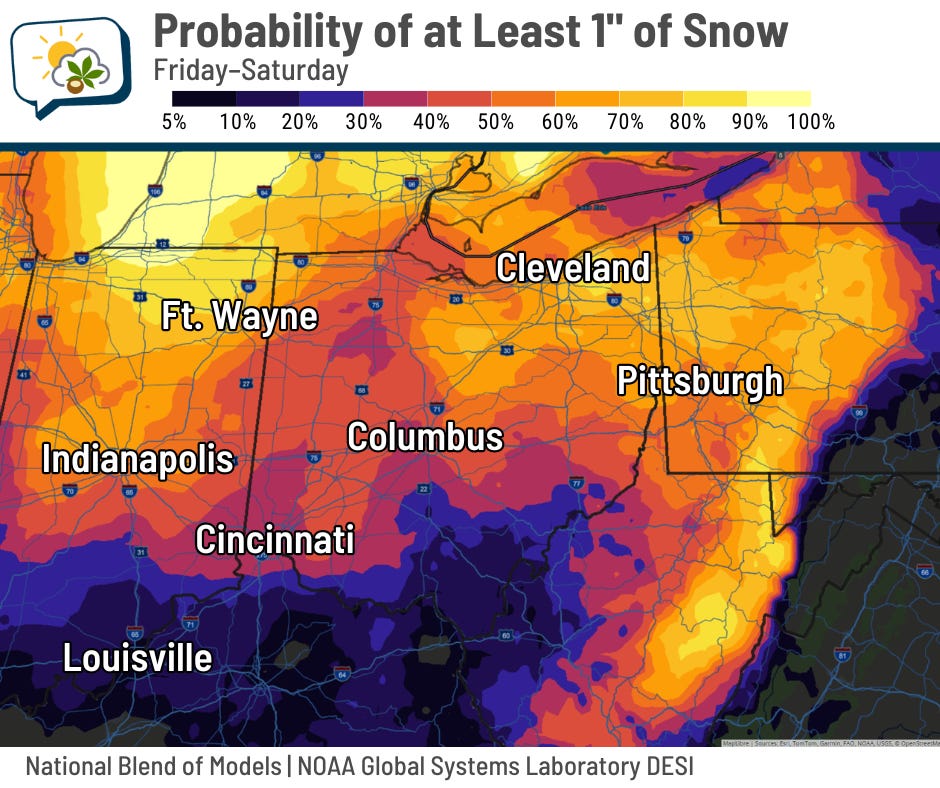
And the probability of getting at least 2” is quite small.
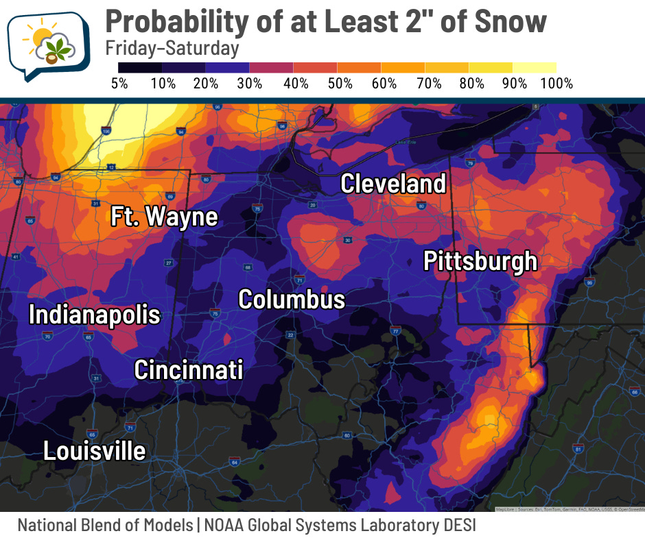
Sure, we could certainly have brief periods in which streets, sidewalks, and parking lots get a tad slick. But by and large, this appears to be more of a nuisance than anything impactful.
📊 Thursday’s almanac
Normal low/high: 22 / 37
Record low/high: -12 (1893) / 64 (1932)
Sunrise/set: 7:51 a.m. / 5:31 p.m.
☁️ Why is winter cloudy?
Last Wednesday’s newsletter debunked a claim that it’s “not uncommon to go weeks at a time without a sunny day this time of year.” It does feel that way sometimes, and it’s because winter is indeed cloudier.
We can blame temperature inversions for that.
A temperature inversion happens when warmer air sits atop cooler air. Typically, the reverse is true; warmer air is near the surface, rises upward, and cools. That also allows the air to mix around.
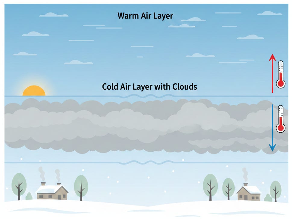
But when the warmer air is on top, there’s little to no mixing. Moisture gets trapped and clouds stick around. And it’s not like we can expect the sun to do as much as it does in the summer, because the sun angle is so much lower and doesn’t provide the same amount of energy and warmth.
Temperature inversions can trap more than just moisture. They can also do it to pollutants… including smells. It comes up on the Columbus subreddit from time to time.
🌭 For the weather weenies
-
A January Atlantic hurricane? It happened, 10 years ago (AccuWeather)
-
ODOT snowplows now visible on Waze navigation app during winter operations (10TV)
-
Drivers retreat as powerful waves hit Italian coast (Associated Press/Instagram)