Officially, the Columbus storm total snowfall through 7 p.m. was 12.1” and is noted as “storm total.” The National Weather Service says it’s the 5th-highest two-day snowfall event on record. 11.9” fell just on Sunday, which is the 3rd-highest calendar day snowfall on record.
To see all the snowfall reports since 3 p.m. Sunday, head over here. The National Weather Service in Wilmington decided to pause putting out additional reports until the last snow band ends, so if it looks oddly blank, check again later as they publish more.
The 614cast
Monday’s tl;dr
🌥️ Mostly cloudy, passing flurries/light snow possible. High in the mid-teens.

Forecast highlights
🥶 Cold, cold, cold
I’m trying to mentally prepare for the possibility of no school all week due to the cold. I’m not saying it will happen, but in my mind, there’s a non-zero chance of it.
Here’s why.
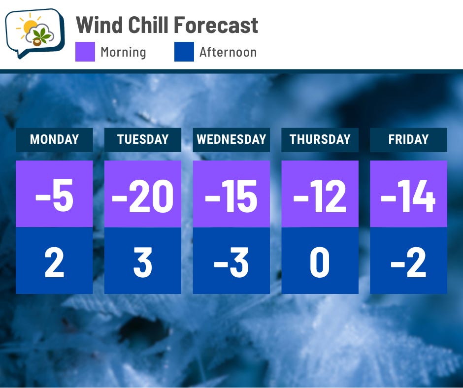
Schools have already called off Monday, of course. And wind chills will be well below zero every following morning this week. And afternoon wind chills won’t feel much better.
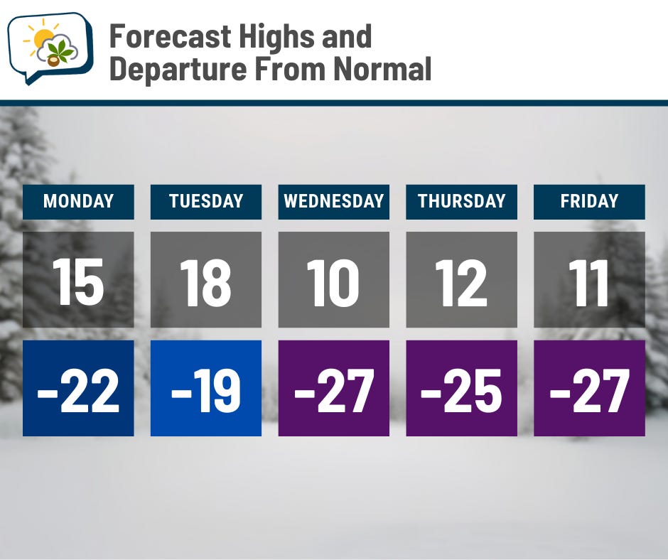
Highs should be stuck in the teens all week, way below average. Morning lows dip below zero, too; record lows are in play at the end of the week.
With such cold temperatures, any snow that’s walked and driven on will get compacted into ice, and it’s going to be really, really hard to get rid of that. This snow (and whatever’s turned into ice) is not melting anytime soon. Guidance doesn’t indicate much hope for approaching the freezing mark until maybe later next week. So, like, a week-and-a-half if we’re lucky (and I’m not holding my breath).
We won’t have especially blustery winds this week, but it doesn’t take much to really make a difference when it’s this cold.
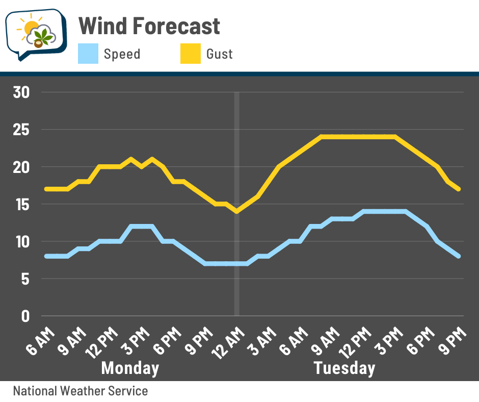
Open areas could have some blowing and drifting the next couple of days.
😮💨 No more (notable) snow for a while
Whew. We’ve earned a break. We have a chance of occasional light snow or flurries on Monday as another disturbance works through, but any accumulations will be negligible compared to what we just went through.
A couple additional weak disturbances also pass by later this week, and each could produce some flakes, but there are no signs of anything really accumulating with those, either.
Here’s the forecast of 6-hour snowfall amounts from the National Blend of Models the rest of the week.
📊 Monday’s almanac
Normal low/high: 21 / 37
Record low/high: -9 (1948) / 70 (1950)
Sunrise/set: 7:45 a.m. / 5:44 p.m.
⛄ Winter precipitation types
While we got buried in snow, other parts of the country dealt with freezing rain and sleet.
This page has helpful visuals to explain why the different precipitation types happen.