We were one degree shy of tying the record high of 66° on Wednesday. It was the warmest day since January 9, when we also hit 65°.
The 614cast
Thursday’s tl;dr
⛈️ More clouds than sun with showers/storms developing later, high in the lower 60s.

Forecast highlights
⚡ Low-end severe risk accompanies rain
You may be aware that parts of Ohio, including us, are in a severe weather risk later Thursday. Whether we get that here really depends on if there’ll still be enough energy for robust storms. There’s plenty of shear — winds changing direction and speed with height — but the big question is whether their timing will overlap here.
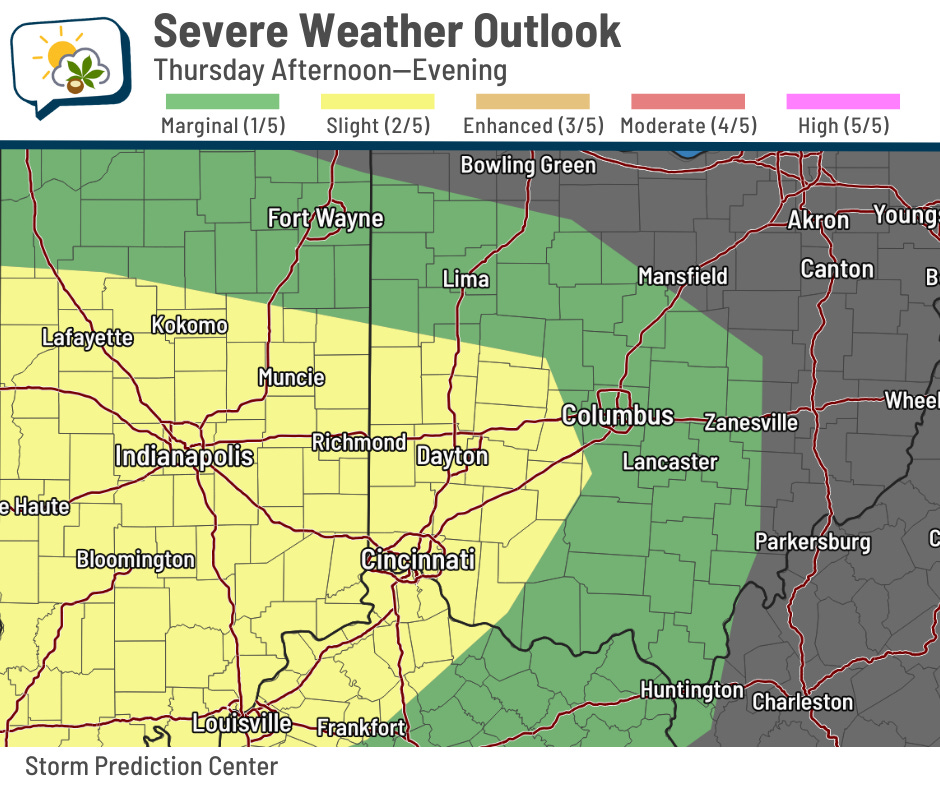
If storms can maintain their strength, gusty winds would be the main threat. Hail and a brief, weak tornado aren’t out of the realm of possibility.
Higher odds of severe storms exist to our west and southwest, where storms will be happening somewhat earlier in the day, so they’ll have more energy to tap into.
Here’s the afternoon run of one of the high-resolution models, showing forecast radar on Thursday. It briefly pauses at 9 p.m. Thursday evening.
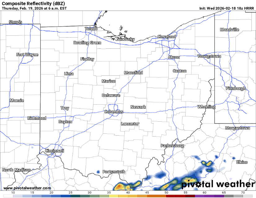
If this has the timing right, we’ll have most of the rain/storm activity in the late evening.
There are some indications that a narrow band of heavy rain could occur with localized amounts over an inch. However, that’s one of those “won’t know until it gets close” situations, but it’s something to bear in mind, especially with the soggy ground from the recent snowmelt and rain.
📉 Mild for now, colder again soon
We have one more day in the 60s, then the cold front responsible for Thursday evening’s rain/storms comes through. Temperatures probably won’t move much on Friday, but hey, they’re still in the 50s.
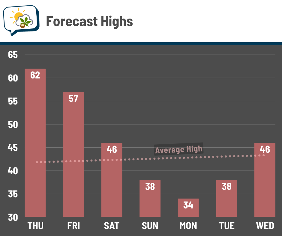
We continue tumbling through the weekend, with highs only in the 30s early next week. That puts us back below average, but not by a ton, thankfully. Some nuisance light snow is possible Sunday and Monday as the chilly air carves in.
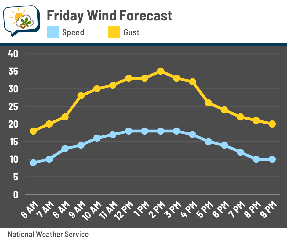
I’ll also add that winds will be stiff on Friday in the wake of the cold front. Gusts will top 30 mph from late-morning into most of the afternoon.
📊 Thursday’s almanac
Normal low/high: 25 / 42
Record low/high: -6 (1936) / 70 (1939)
Sunrise/set: 7:19 a.m. / 6:12 p.m.
☀️ Winter warmth
It may not seem like it, but the number of mild days this winter is actually pretty close to average.
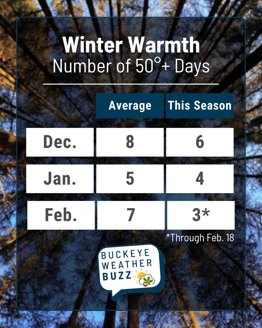
December and January came up just a touch short of the 1991–2020 monthly averages for the number of days hitting at least 50°, but they were still within a typical range.
And while February still has some to go, we’ll tack on two more days Thursday and Friday, bringing the number this month to 5, with a little more time late next week to see if we can get a couple more in.
🌭 For the weather weenies
-
New computer simulations reveal the Earth system in unprecedented detail (NSF NCAR/UCAR)
-
Global warming forced scientists to change the way they look at El Niño (CNN)
-
Trump’s climate supercomputer plans threaten U.S. insurance market: Actuaries (Chris Bianchi/Bluesky)