As I write this, a blockbuster nor’easter is moving up the East Coast and will produce blizzard conditions, heavy snow, and coastal flooding in parts of that region. This page will be collecting cool satellite imagery from the event.
The 614cast
Monday’s tl;dr
☁️ Mainly cloudy, chance of occasional flurries, high in the lower 30s.
Forecast highlights
📈 Week starts chilly but gradually improves
The first round of fake spring is behind us. It was nice while it lasted, wasn’t it?
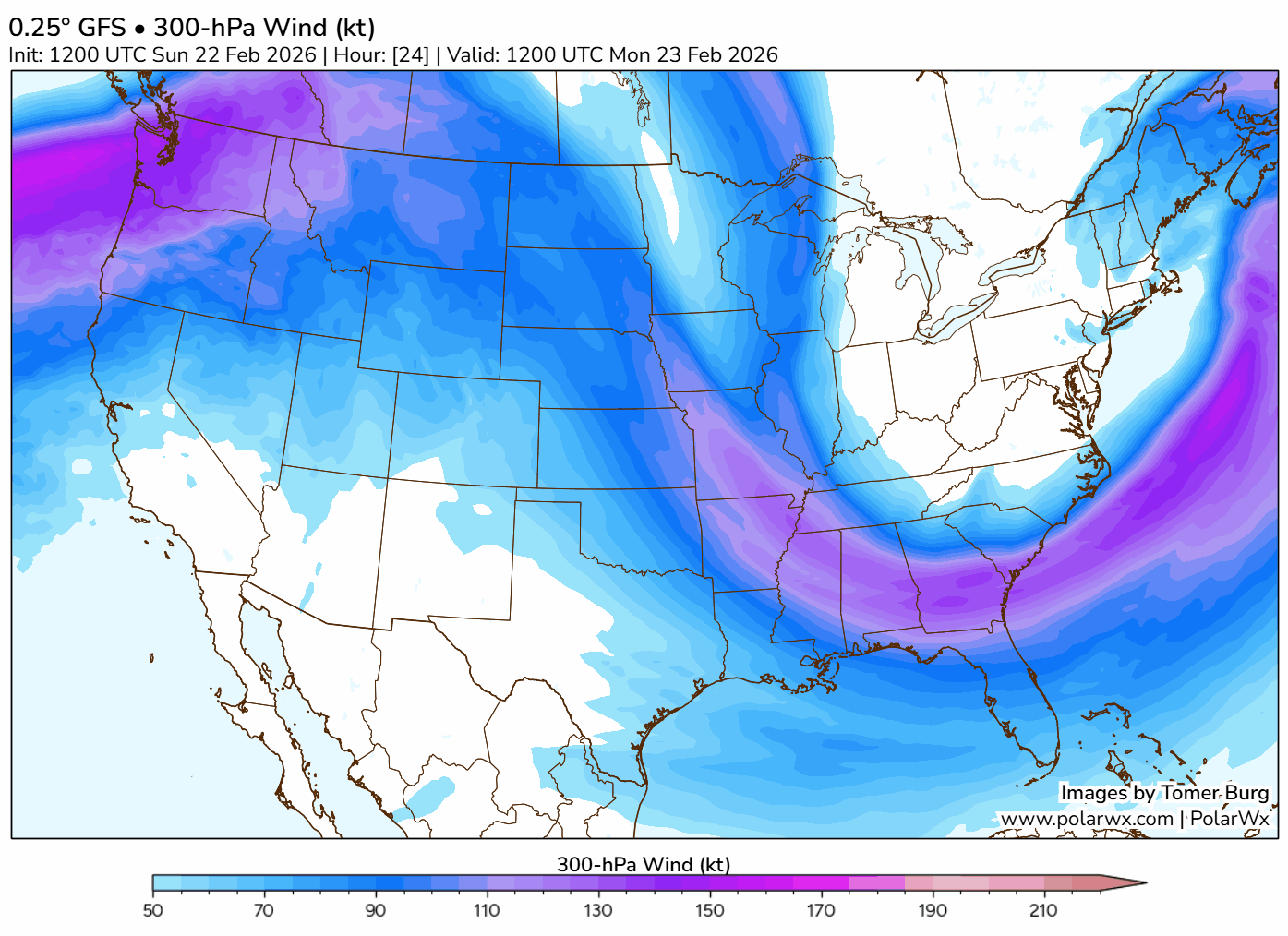
The pattern of the jet stream — that river of fast-moving air about 30,000 feet up — is from the northwest for now. However, it’ll flatten out as the week goes on, becoming more “zonal” (more of a straight west-to-east flow). That’ll allow our temperatures to moderate, going from Canadian origin to milder Pacific air.
You’ll see that reflected in the forecast highs this week.
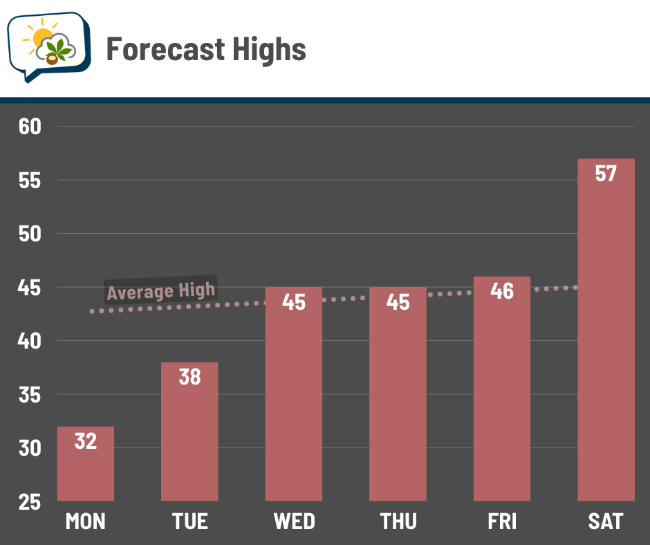
I’ll add that there’s some spread in the reasonable range of expected highs midweek, especially Thursday. The track of a weather system that day will play into how warm we get. More on that system below…
🤔 Midweek messiness
Lingering clouds on Monday could squeeze out the occasional flurry, but my attention is on two disturbances this week. The first is a quick-hitter that brings a chance of light snow Tuesday night or early Wednesday morning. Should be no biggie. The second one comes Thursday and will be more of a thing for us.
Its eventual track is uncertain (no surprise), but we’re close enough to the rain/snow line that where it goes will make a difference in what we get. Temperatures here at the ground and aloft will depend on the track of that system.
Current guidance favors a path that’s northerly enough for us to have predominantly rain, and that’s where the “American” forecast model puts things. The European model has a shallower system that passes farther south and is therefore cooler, supporting more of a wet snow.
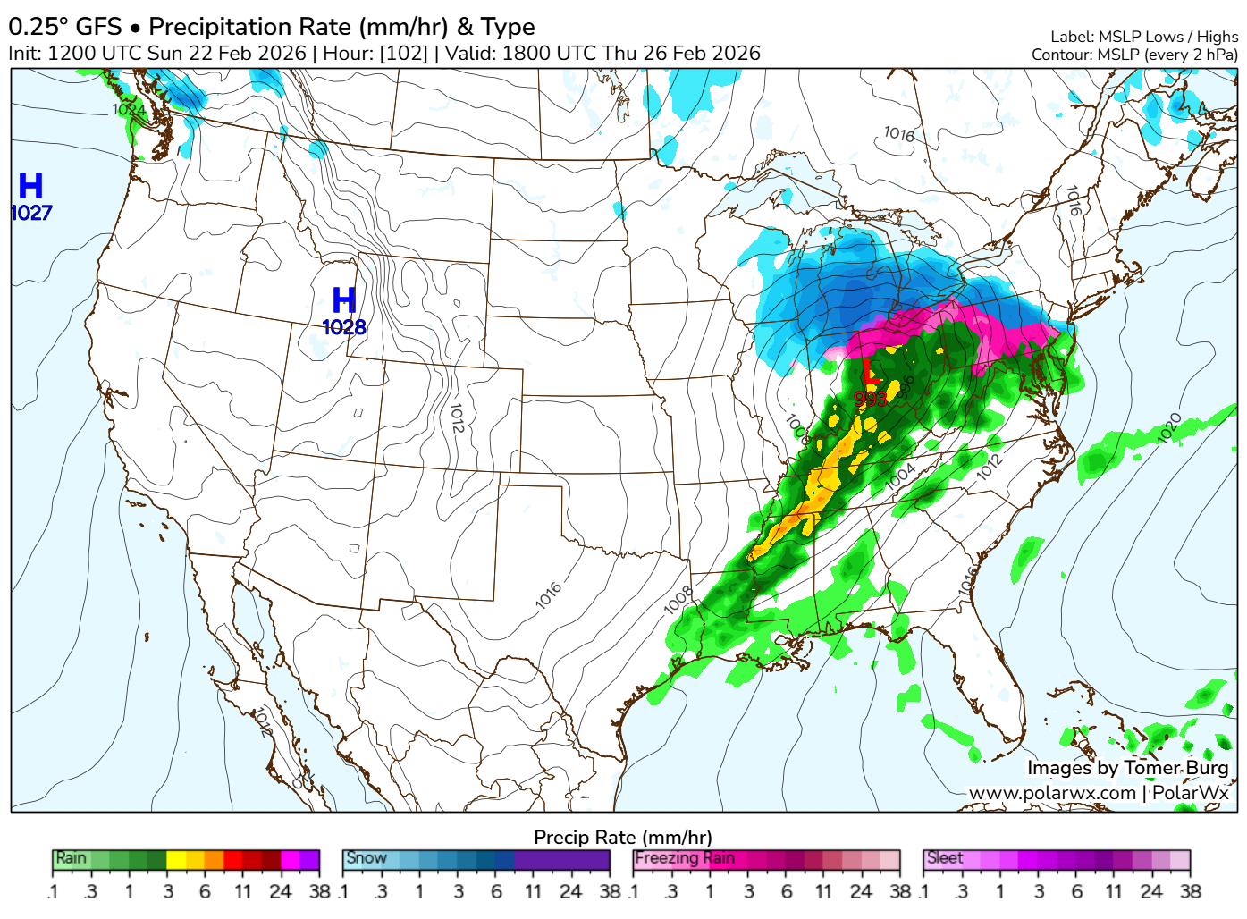
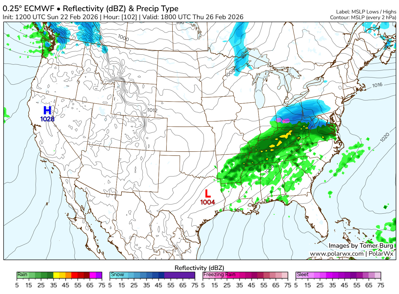
It seems to me that, even if it does end up taking the more southerly route, temperatures would still be warm enough that snow would be pretty wet and require some healthy snowfall rates to accumulate much. I’m somewhat skeptical of that scenario, although it’s hardly impossible, so it’d be wise to stay updated throughout the week as things become clearer.
🌬️ On the breezy side
This week looks a tad brisk more often than not. Sustained winds around 15 mph and gusts near 25 mph on Monday will keep wind chills in the teens to around 20.
You’ll notice most days this week will be somewhat breezy. Nothing extreme, but enough to make it feel cooler, for sure.
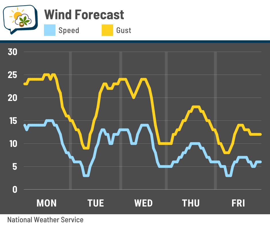
Winds back off late this week.
📊 Monday’s almanac
Normal low/high: 26 / 43
Record low/high: -4 (1885) / 73 (2023)
Sunrise/set: 7:13 a.m. / 6:17 p.m.
⚡ February thunderstorms
Somebody on the Columbus subreddit was wondering last Thursday if it was weird we were getting a thunderstorm in February.
So, I checked. 🤣
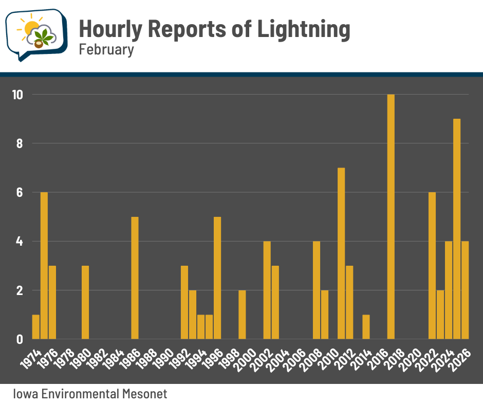
In addition to the routine weather observations (temperature, wind, etc.) taken every hour at CMH, they also will add a note for certain kinds of weather, like thunderstorms. Last week’s storminess had four hourly reports of a thunderstorm. But last February had nine hourly reports that included a thunderstorm!
We’ve now had five years in a row with a February thunderstorm. There are certainly gaps where some years didn’t have thunder, but it’s not at all unusual for thunderstorms to happen this early in the year.
🌭 For the weather weenies
-
Northeast blizzard live updates (The Weather Channel)
-
Scientists change how El Niño is labeled to keep up with spike in temperature (Associated Press)
-
NASA delays astronaut moon mission again after new rocket problem (Associated Press)
-
Measuring the size of eruptions (Sketchplanations)