The 614cast
Monday’s tl;dr
⛅ Cloudy in the morning with a chance of light snow, then partly cloudy. High in the mid-40s.

Forecast highlights
☔ Wet weather pattern
There’s plenty of rain to talk about, but first things first.
If you don’t want any more snow, you’ve been lucking out lately. Yet another system that initially looked like it would bring us some accumulation is passing to our south and coming in weaker.
Here’s the National Blend of Models’ probability of getting at least an inch of snow early Monday. The highest chances — and I use the word “highest” loosely — are to our south and west. And even there, they’re generally less than three-in-one odds.
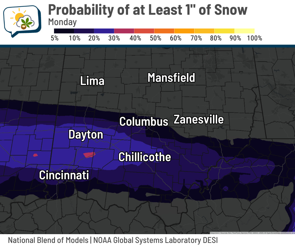
Long story short, don’t be surprised if we have light snow to start off the day, but don’t expect it to amount to much. And if anything does stick, it’ll melt pretty quickly.
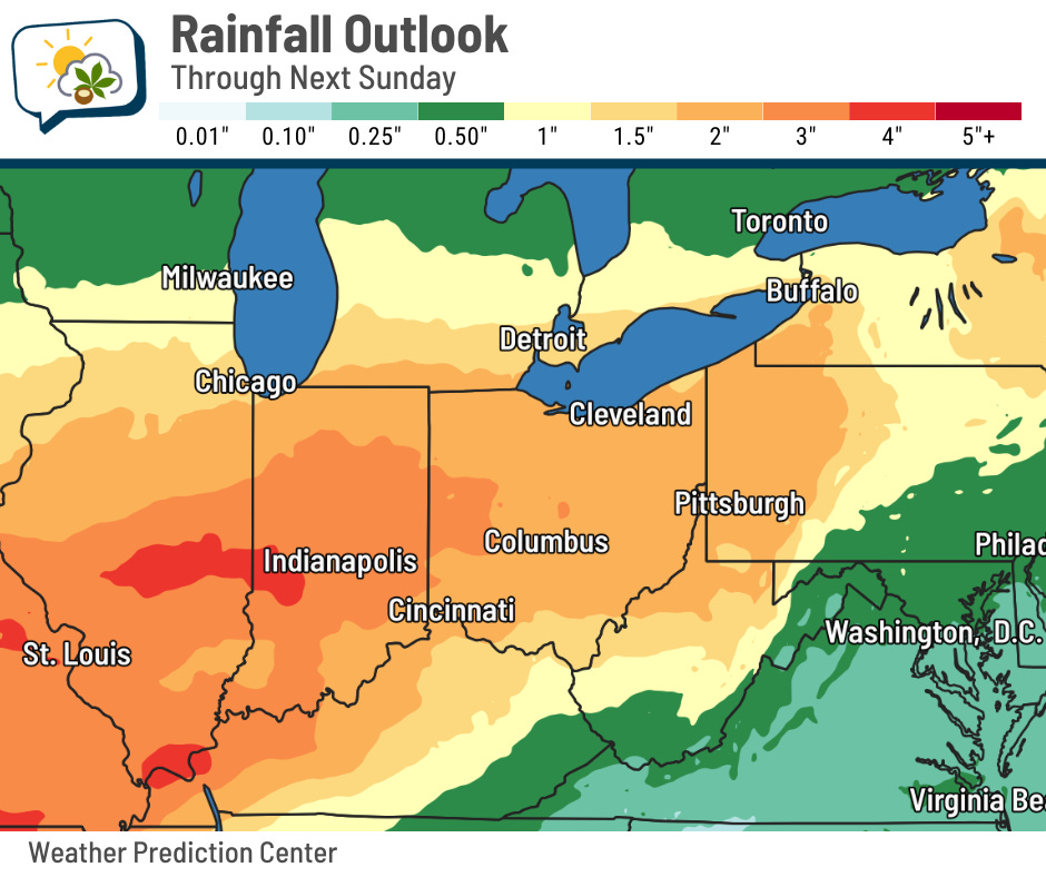
Okay, on to the rain. For a while, all guidance has shown a pattern that would support a lengthy period of unsettled, wet weather. Those predictions are unchanged. Through the end of next weekend, we could very easily be looking at rainfall amounts over a couple of inches. I wouldn’t be shocked if some parts of central Ohio have over three inches by then.
The upper-level pattern will allow several disturbances to push through, and they’ll be tapping into plenty of moisture. Below is an animation of “precipitable water.” The idea is that it’s the amount of water you’d get if you could wring out all the moisture in the atmosphere above a given spot. It doesn’t give you a rainfall prediction, but it does indicate how moisture-laden the air is. And it’s quite a bit for this time of year.
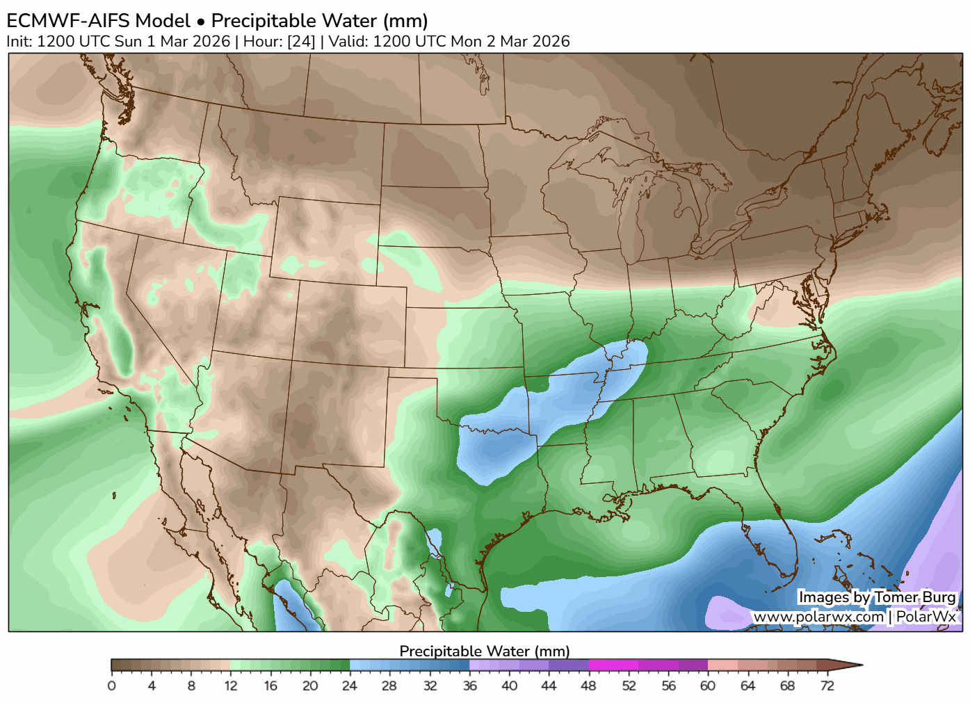
You can see the streamer of moisture pointed right up the the Mississippi Valley into the Great Lakes and Ohio Valley.
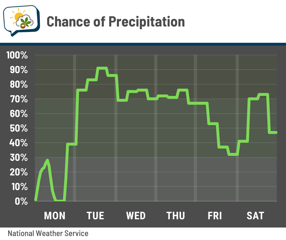
All this will foster a high chance of rain starting Tuesday and lasting right into the weekend (and perhaps beyond). No, it will not be constantly raining that entire time with no breaks, but there will certainly be frequent and lengthy bouts of rain.
Suffice it to say, streams will be running high later this week, and open fields will be awfully soggy at best. I think the farms not far from our house will look like they have a bunch of little shallow ponds in them, given how easily water ponds here.
As far as severe weather goes, those odds look very limited at this point. I was looking at the machine-learning severe weather probabilities that Colorado State University generates, and its predictions don’t have much to write home about for us. Of course, I’ll keep an eye on that.
🌡️ Spring-feeling warmth
The southwest flow that’s fueling this week’s rain is also opening up warmer air. Check out the temperatures later this week. It currently looks like we’ll reach 70° more than once, and morning lows will be above the normal highs.
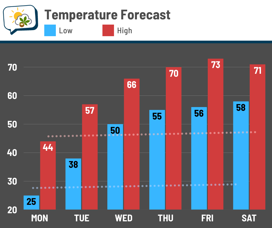
Readings could be higher, but I’m playing the conservative route for now.
📊 Monday’s almanac
Normal low/high: 28 / 45
Record low/high: 0 (1980) / 73 (1992)
Sunrise/set: 7:03 a.m. / 6:25 p.m.
🌷 Climatological spring is here
March 1 marks the first day of climatological spring, which runs until May 31. Since the start and end date of astronomical seasons vary a bit, climatological seasons use static dates that align with calendar months.
And boy, do things change over the next three months.
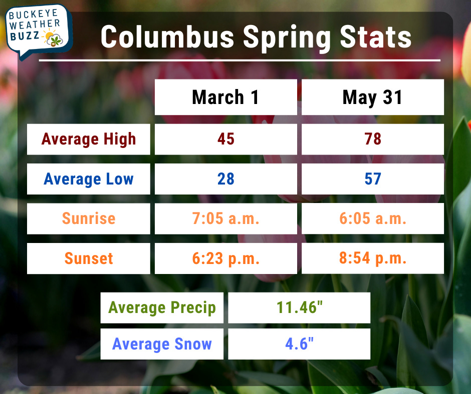
The average high goes up by a whopping 33 degrees! We also gain three-and-a-half hours of daylight. (Don’t forget, daylight saving time starts next Sunday; clocks go forward an hour.)
🌭 For the weather weenies
-
New Gulf study uncovers what happens underneath a hurricane (Chron)
-
How ancient Scottish rocks throw ‘snowball Earth’ theory up in the air (The Guardian)