Wednesday’s official snow depth was still 7”, the 10th straight day with at least that much. That’s now a tie for third-longest stretch with that much snow on the ground, matching January 19–28, 1985. Second place is 12 days, from February 10–21, 2010. First place is a big yikes: 32 days, from January 10–February 10, 1977.
The 614cast
Thursday’s tl;dr
🌥️ Turning mostly cloudy, high in the lower 20s.

Forecast highlights
🌨️ Workweek ends with some snow
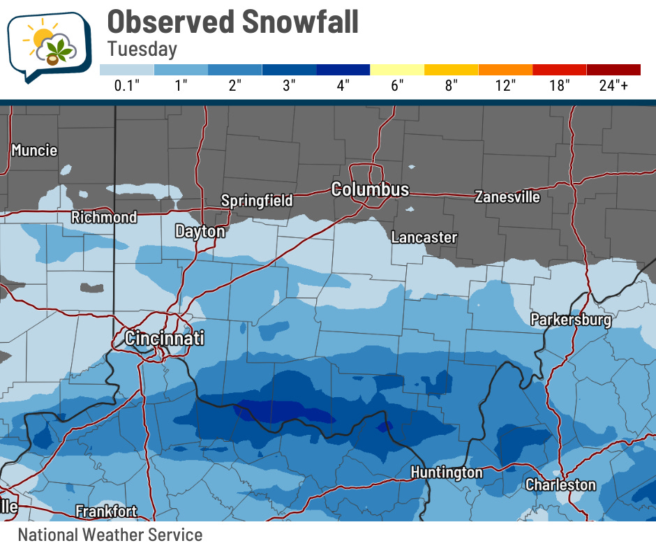
Tuesday’s snowmaker passed to our south, but not by much. Far southern Ohio picked up a few inches!
Friday’s little clipper system has a better chance of bringing some minor accumulations here. In fact, you can see most of the eastern half of the state has pretty good odds of getting at least an inch.
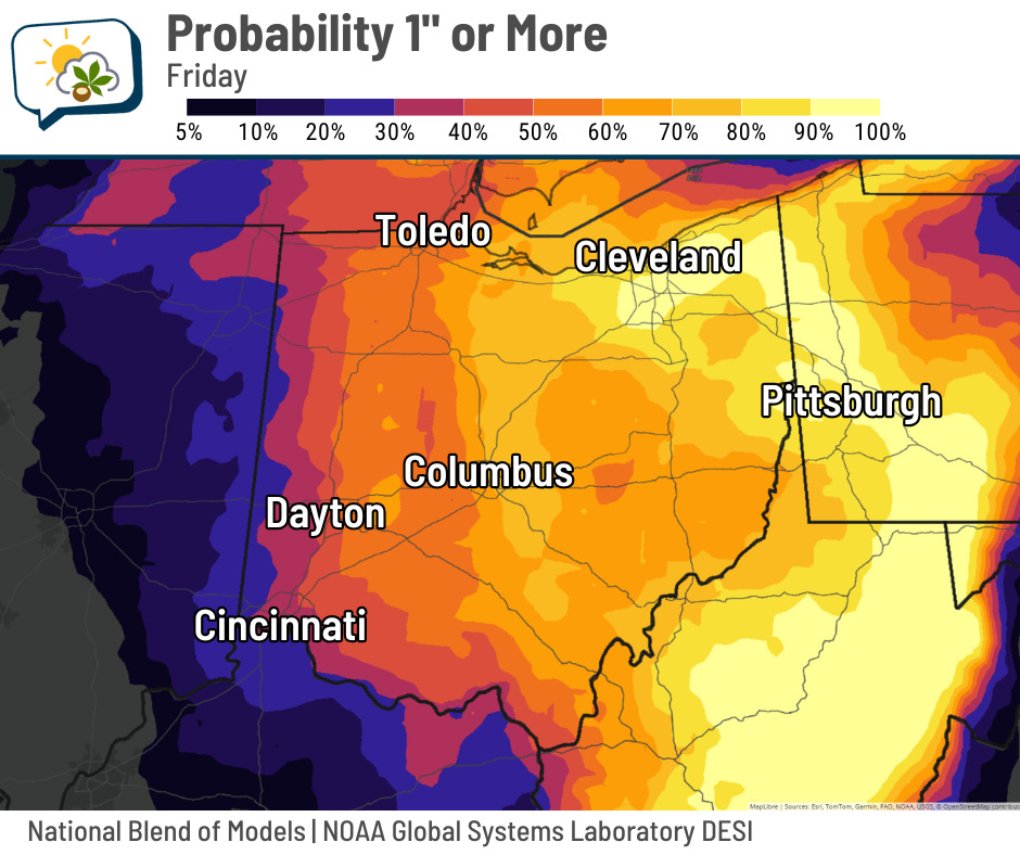
I think we’ll generally pick up between 1–2”, with most on the low side of that.
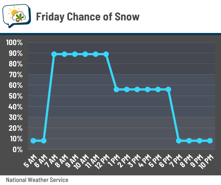
Snow chances quickly increase Friday morning and remain elevated into the afternoon. It seems that lingering snow in the late afternoon or early evening might be more “burst-y” in nature. If that happens, those snow showers would briefly reduce visibility, thanks in part to blustery winds gusting over 20 mph.
🎢 Arctic dip, then a thaw
A pattern change is coming… but there are some ups and downs to deal with until then.
Thursday: Chilly. Friday: Respectable. Saturday:

Wind chills will be below zero Saturday morning through early afternoon. But at least there’ll be some sunshine, I guess?
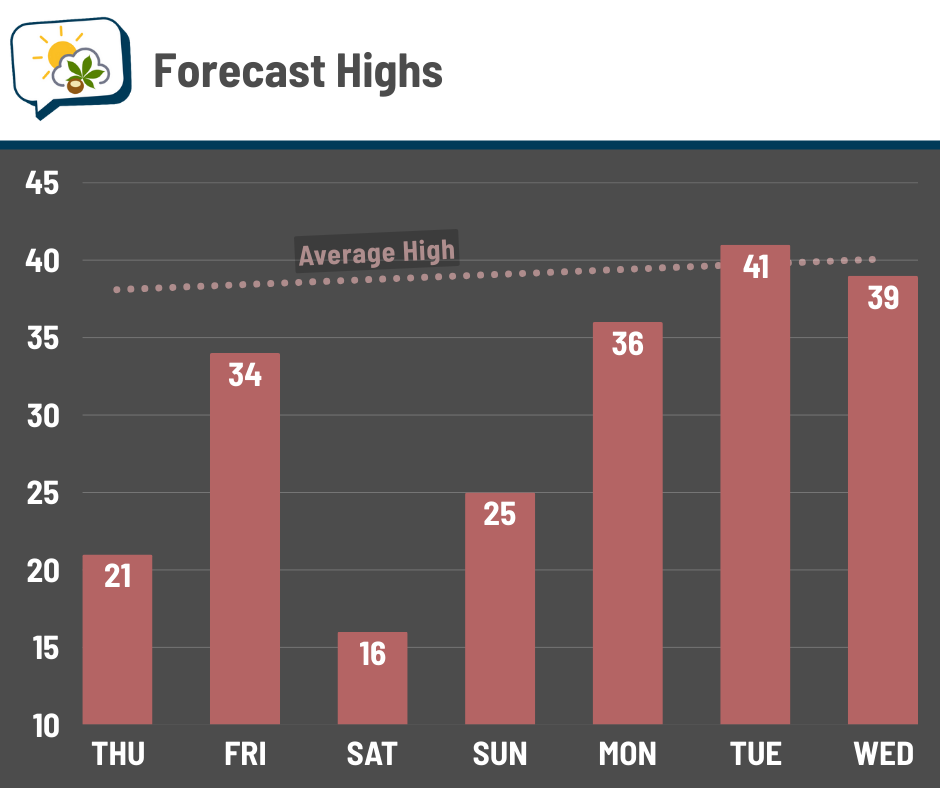
Then we are onward and upward! If you cross your fingers and toes, we just might hit 40° already on Tuesday. Wouldn’t that be swell?
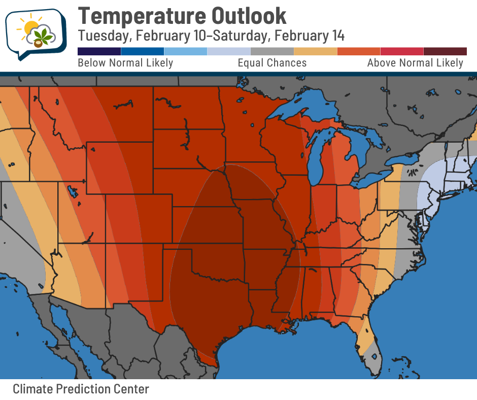
I’m happy to report that the pattern that has kept us in the chill for entirely too long will finally shift next week. The western U.S. has been in an unusually large ridge, giving them warm and dry conditions… while we’ve been in a trough, keeping us cold.
That ridge spreads east next week. It’ll flatten as it does so, but it’ll still put us in better shape than we have been.
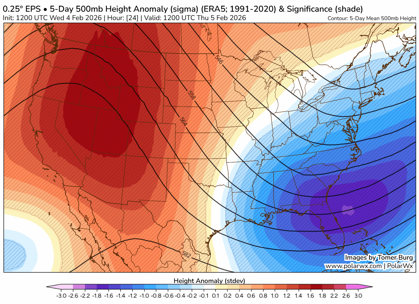
While it’s not going to be toasty, odds favor temperatures being generally warmer than average much of next week (and probably beyond that).
📊 Thursday’s almanac
Normal low/high: 22 / 38
Record low/high: -10 (1918) / 64 (1986)
Sunrise/set: 7:36 a.m. / 5:56 p.m.
🌞 National Weatherperson’s Day
February 5 is National Weatherperson’s Day, which I swear I did not make up. It commemorates the birthdate of John Jeffries in 1744.
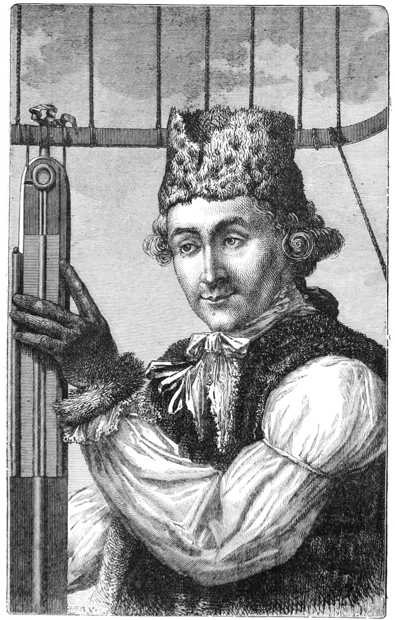
He’s considered to be one of America’s first weather observers, taking weather observations in Boston for a couple of years starting in 1774.
Like many scientists of his day, Jeffries had wide-ranging abilities and interests. He was also a medical doctor and military surgeon, and crossed the English Channel by balloon with inventor Jean-Pierre Blanchard in 1785 (they were the first people to do so).
Jeffries also ballooned over London the year before, and “carried with him a reliable barometer, a thermometer of special make, a hygrometer, an electrometer, a mariner’s compass, and seven small bottles for obtaining samples of air at different heights.”1
While meteorologists on TV and online are the most visible, they make up just a fraction of the field. Others range from those in the National Weather Service who make routine forecasts and issue weather alerts, to those who develop computer forecast models, to those who provide specialized forecasts for utility companies or other businesses… and everything in between.
🌭 For the weather weenies
-
Fact check: Climate change is not making extreme cold more common (The Climate Brink)
-
Time lapse of ‘snow waves’ (Mark Sudduth/Facebook)
💬 Follow me on social
https://www.celebrateboston.com/biography/john-jeffries.htm